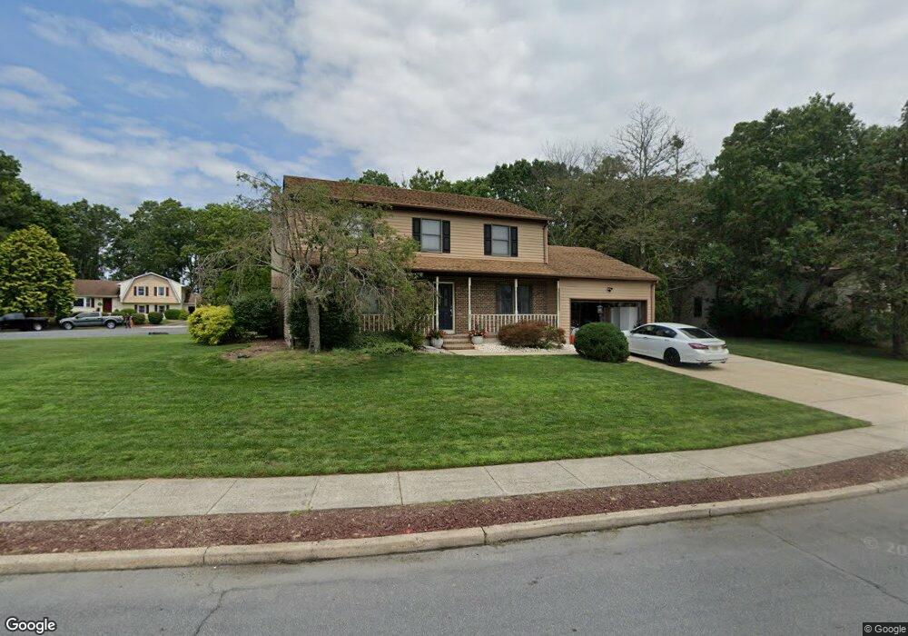
573 Brentwood Rd Forked River, NJ 08731
Lacey Township NeighborhoodEstimated Value: $588,000 - $676,000
4
Beds
3
Baths
2,344
Sq Ft
$264/Sq Ft
Est. Value
About This Home
This home is located at 573 Brentwood Rd, Forked River, NJ 08731 and is currently estimated at $619,661, approximately $264 per square foot. 573 Brentwood Rd is a home located in Ocean County with nearby schools including Lacey Township High School.
Ownership History
Date
Name
Owned For
Owner Type
Purchase Details
Closed on
Jan 11, 2018
Sold by
Ocean County Tax Collector
Bought by
Us Bank Na
Current Estimated Value
Purchase Details
Closed on
Jan 31, 2003
Purchase Details
Closed on
May 17, 1999
Sold by
Crescenzo Teresa and Crescenzo Giovanni
Bought by
Czaplinski Mark and Sonnenlitter Kristine
Home Financials for this Owner
Home Financials are based on the most recent Mortgage that was taken out on this home.
Original Mortgage
$171,500
Interest Rate
6.9%
Purchase Details
Closed on
Jun 30, 1995
Sold by
Gss&P Dev
Bought by
Cresenzo Giovanni and Cresenzo Teresa
Home Financials for this Owner
Home Financials are based on the most recent Mortgage that was taken out on this home.
Original Mortgage
$48,000
Interest Rate
7.02%
Create a Home Valuation Report for This Property
The Home Valuation Report is an in-depth analysis detailing your home's value as well as a comparison with similar homes in the area
Home Values in the Area
Average Home Value in this Area
Purchase History
| Date | Buyer | Sale Price | Title Company |
|---|---|---|---|
| Us Bank Na | $490 | -- | |
| -- | -- | -- | |
| Czaplinski Mark | $186,500 | Chicago Title Insurance Co | |
| Cresenzo Giovanni | $62,500 | -- |
Source: Public Records
Mortgage History
| Date | Status | Borrower | Loan Amount |
|---|---|---|---|
| Previous Owner | Czaplinski Mark | $171,500 | |
| Previous Owner | Cresenzo Giovanni | $48,000 |
Source: Public Records
Tax History Compared to Growth
Tax History
| Year | Tax Paid | Tax Assessment Tax Assessment Total Assessment is a certain percentage of the fair market value that is determined by local assessors to be the total taxable value of land and additions on the property. | Land | Improvement |
|---|---|---|---|---|
| 2025 | $8,621 | $340,200 | $113,000 | $227,200 |
| 2024 | $8,059 | $340,200 | $113,000 | $227,200 |
| 2023 | $7,699 | $340,200 | $113,000 | $227,200 |
| 2022 | $7,699 | $340,200 | $113,000 | $227,200 |
| 2021 | $7,569 | $340,200 | $113,000 | $227,200 |
| 2020 | $7,328 | $340,200 | $113,000 | $227,200 |
| 2019 | $7,199 | $340,200 | $113,000 | $227,200 |
| 2018 | $7,114 | $340,200 | $113,000 | $227,200 |
| 2017 | $6,950 | $340,200 | $113,000 | $227,200 |
| 2016 | $6,923 | $340,200 | $113,000 | $227,200 |
| 2015 | $6,613 | $340,200 | $113,000 | $227,200 |
| 2014 | $6,354 | $369,400 | $143,000 | $226,400 |
Source: Public Records
Map
Nearby Homes
- 534 Holmes Ave N
- 421 Carr St
- 459 Steuben Ave
- 635 Chelsea St
- 512 Alpine St
- 650 Chelsea St
- 510 Alpine St
- 533 Chelsea St
- 711 Chelsea St
- 000 Elwood St
- 424 Continental St
- 503 Center St
- 809 Clifton St
- 318 Eleanor Rd
- 605 Windsor St
- 551 Rosewood Dr
- 551 Rosewood Dr Unit 551 R
- 147 Foxhollow Dr
- 576 Vaughn Ave
- 855 Harrison Ave
- 575 Brentwood Rd
- 513 Van Dyke Ave
- 511 Crosswick Ave
- 511 Van Dyke Ave
- 566 Brentwood Rd
- 571 Brentwood Rd
- 532 Holmes Ave N
- 508 Van Dyke Ave
- 509 Crosswick Ave
- 568 Brentwood Rd
- 560 Brentwood Rd
- 508 Crosswick Ave
- 569 Brentwood Rd
- 512 Devoe Ave
- 507 Crosswick Ave
- 530 Holmes Ave N
- 510 Devoe Ave
- 579 Brentwood Rd
- 528 Holmes Ave N
- 506 Crosswick Ave