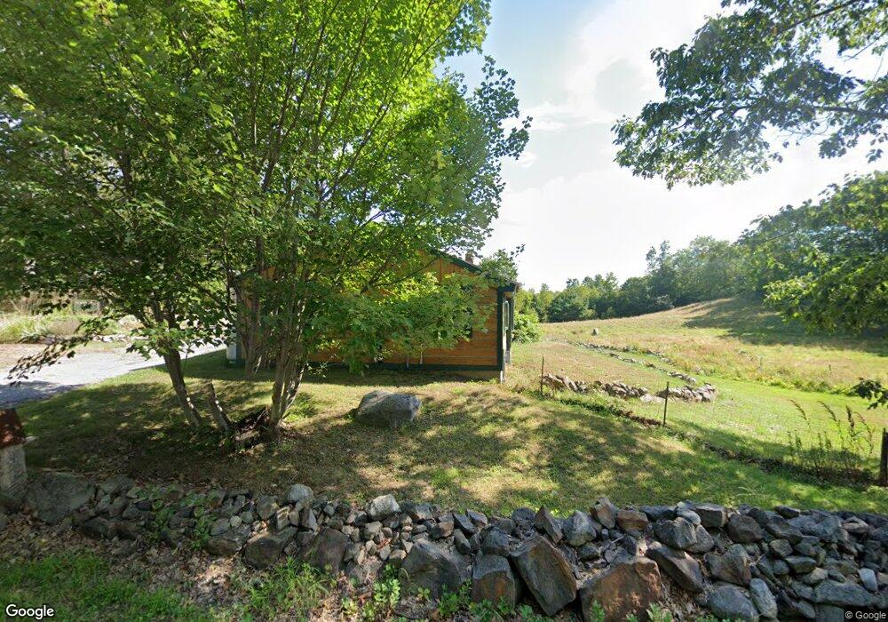
573 Foss Rd Limerick, ME 04048
Estimated Value: $388,000 - $409,958
3
Beds
2
Baths
960
Sq Ft
$416/Sq Ft
Est. Value
About This Home
This home is located at 573 Foss Rd, Limerick, ME 04048 and is currently estimated at $399,490, approximately $416 per square foot. 573 Foss Rd is a home located in York County with nearby schools including Massabesic High School.
Ownership History
Date
Name
Owned For
Owner Type
Purchase Details
Closed on
Dec 19, 2008
Sold by
Moskey Stephen T
Bought by
Corrigan Douglas M
Current Estimated Value
Home Financials for this Owner
Home Financials are based on the most recent Mortgage that was taken out on this home.
Original Mortgage
$75,000
Interest Rate
6.27%
Mortgage Type
Commercial
Create a Home Valuation Report for This Property
The Home Valuation Report is an in-depth analysis detailing your home's value as well as a comparison with similar homes in the area
Home Values in the Area
Average Home Value in this Area
Purchase History
Date | Buyer | Sale Price | Title Company |
---|---|---|---|
Corrigan Douglas M | -- | -- |
Source: Public Records
Mortgage History
Date | Status | Borrower | Loan Amount |
---|---|---|---|
Open | Corrigan Douglas M | $167,000 | |
Closed | Corrigan Douglas M | $75,000 |
Source: Public Records
Tax History Compared to Growth
Tax History
Year | Tax Paid | Tax Assessment Tax Assessment Total Assessment is a certain percentage of the fair market value that is determined by local assessors to be the total taxable value of land and additions on the property. | Land | Improvement |
---|---|---|---|---|
2024 | $3,160 | $332,682 | $110,840 | $221,842 |
2023 | $3,131 | $206,016 | $56,750 | $149,266 |
2022 | $2,925 | $206,016 | $56,750 | $149,266 |
2021 | $2,736 | $164,813 | $45,400 | $119,413 |
2020 | $2,703 | $164,813 | $45,400 | $119,413 |
2019 | $2,596 | $164,813 | $45,400 | $119,413 |
2018 | $2,662 | $164,813 | $45,400 | $119,413 |
2017 | $2,994 | $161,079 | $45,400 | $115,679 |
2016 | $2,424 | $161,079 | $45,400 | $115,679 |
2015 | $2,352 | $161,079 | $45,400 | $115,679 |
2014 | $2,279 | $161,079 | $45,400 | $115,679 |
Source: Public Records
Map
Nearby Homes
- 205 Patterson Rd
- 0 Stone Hill Rd
- 34 Carroll Pit Rd
- 67 Elm St
- Lot B 341 Bridge St
- 00 Bridge St
- 103 Provencher Dr
- Lot #013 Staples Rd
- 711 Newfield Rd
- 585 Newfield Rd
- 590 Newfield Rd
- 45 Katie Cir
- 8 Royal Coachman Way
- 286 Granny Kent Pond Rd
- 32 Raptor Ridge Rd
- 301 Pine Springs Rd
- 33 Maple St
- 27 Maple St
- 17 Blizzard Dr
- 30 Swan Cir