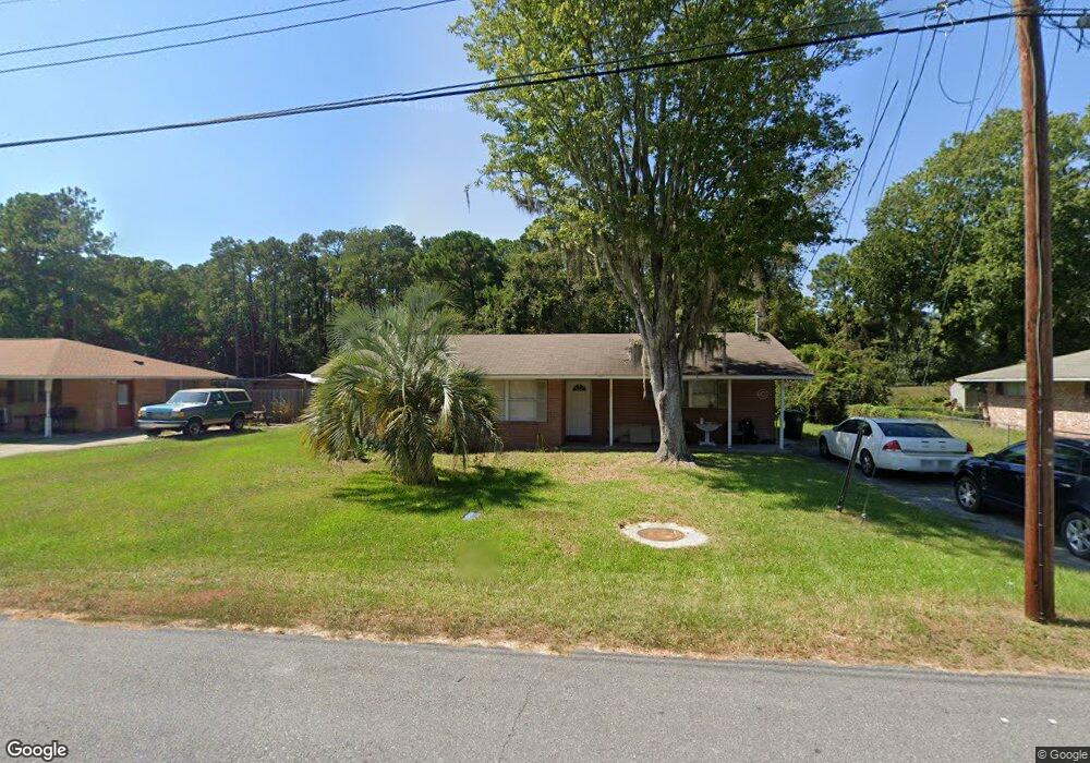
573 Kell Rd Brunswick, GA 31525
Estimated Value: $169,000 - $187,000
3
Beds
2
Baths
1,306
Sq Ft
$134/Sq Ft
Est. Value
About This Home
This home is located at 573 Kell Rd, Brunswick, GA 31525 and is currently estimated at $174,534, approximately $133 per square foot. 573 Kell Rd is a home located in Glynn County with nearby schools including Greer Elementary School, Needwood Middle School, and Brunswick High School.
Ownership History
Date
Name
Owned For
Owner Type
Purchase Details
Closed on
Dec 23, 2014
Sold by
Kpg Investments Llc
Bought by
Ameris Bank
Current Estimated Value
Purchase Details
Closed on
May 31, 2007
Sold by
Atlantic National Bank
Bought by
Kpg Investments Llc
Home Financials for this Owner
Home Financials are based on the most recent Mortgage that was taken out on this home.
Original Mortgage
$84,780
Interest Rate
6.12%
Mortgage Type
New Conventional
Purchase Details
Closed on
Mar 6, 2007
Sold by
Atlantic National Bank
Bought by
Atlantic National Bank
Create a Home Valuation Report for This Property
The Home Valuation Report is an in-depth analysis detailing your home's value as well as a comparison with similar homes in the area
Home Values in the Area
Average Home Value in this Area
Purchase History
| Date | Buyer | Sale Price | Title Company |
|---|---|---|---|
| Ameris Bank | $245,400 | -- | |
| Kpg Investments Llc | $75,000 | -- | |
| Atlantic National Bank | $85,826 | -- |
Source: Public Records
Mortgage History
| Date | Status | Borrower | Loan Amount |
|---|---|---|---|
| Previous Owner | Kpg Investments Llc | $84,780 |
Source: Public Records
Tax History Compared to Growth
Tax History
| Year | Tax Paid | Tax Assessment Tax Assessment Total Assessment is a certain percentage of the fair market value that is determined by local assessors to be the total taxable value of land and additions on the property. | Land | Improvement |
|---|---|---|---|---|
| 2025 | $1,487 | $59,280 | $6,800 | $52,480 |
| 2024 | $1,014 | $40,440 | $6,800 | $33,640 |
| 2023 | $1,124 | $40,640 | $6,000 | $34,640 |
| 2022 | $899 | $36,320 | $6,000 | $30,320 |
| 2021 | $938 | $31,440 | $6,000 | $25,440 |
| 2020 | $804 | $26,000 | $6,000 | $20,000 |
| 2019 | $804 | $26,000 | $6,000 | $20,000 |
| 2018 | $730 | $27,240 | $6,000 | $21,240 |
| 2017 | $782 | $25,160 | $6,000 | $19,160 |
| 2016 | $487 | $15,080 | $6,000 | $9,080 |
| 2015 | $706 | $24,120 | $6,000 | $18,120 |
| 2014 | $706 | $24,120 | $6,000 | $18,120 |
Source: Public Records
Map
Nearby Homes
- 73 Chapel Dr
- 71 E Chapel Dr
- 435 Chapel Crossing Rd
- 136 Peppertree Crossing Ave
- 356 Knox Dr
- 130 Peppertree Crossing Ave
- 342 Peppertree Crossing Ave
- 176 Peppertree Crossing Ave
- 501 Waterstone Cir
- 375 Chapel Crossing Rd
- 204 Peppertree Crossing Ave
- 215 Peppertree Crossing Ave
- 155 Mcdowell Ave
- 246 Commerce Dr
- 116 Chatford Cir
- 204 Rosewood Dr
- 610 Canal Rd
- 590 Canal Rd
- 225 Gateway Center Blvd
- 160 Bel Air Dr