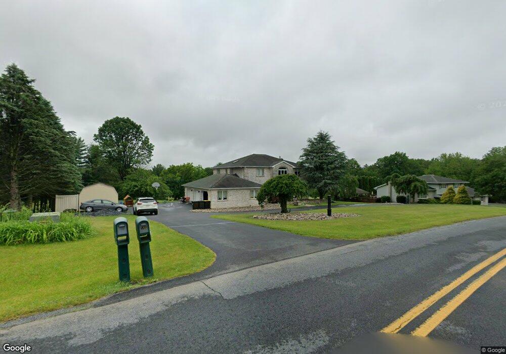
573 Long Lane Rd Walnutport, PA 18088
Estimated Value: $612,000 - $684,000
4
Beds
3
Baths
3,427
Sq Ft
$188/Sq Ft
Est. Value
About This Home
This home is located at 573 Long Lane Rd, Walnutport, PA 18088 and is currently estimated at $643,058, approximately $187 per square foot. 573 Long Lane Rd is a home located in Northampton County with nearby schools including Lehigh Elementary School, Northampton Area Middle School, and Northampton Area High School.
Ownership History
Date
Name
Owned For
Owner Type
Purchase Details
Closed on
Dec 19, 2023
Sold by
Ojeil Patrick L and Ojeil Emily L
Bought by
Ojeil Living Trust and Ojeil
Current Estimated Value
Purchase Details
Closed on
Jun 22, 2023
Sold by
Tripaldi Michael and Tripaldi Pamela T
Bought by
Ojeil Patrick and Ojeil Emily
Home Financials for this Owner
Home Financials are based on the most recent Mortgage that was taken out on this home.
Original Mortgage
$575,000
Interest Rate
6.35%
Mortgage Type
New Conventional
Purchase Details
Closed on
Oct 1, 1988
Bought by
Tripaldi Michael and Tripaldi Pamela T
Create a Home Valuation Report for This Property
The Home Valuation Report is an in-depth analysis detailing your home's value as well as a comparison with similar homes in the area
Home Values in the Area
Average Home Value in this Area
Purchase History
| Date | Buyer | Sale Price | Title Company |
|---|---|---|---|
| Ojeil Living Trust | -- | None Listed On Document | |
| Ojeil Living Trust | -- | None Listed On Document | |
| Ojeil Patrick | $575,000 | None Listed On Document | |
| Tripaldi Michael | $38,000 | -- |
Source: Public Records
Mortgage History
| Date | Status | Borrower | Loan Amount |
|---|---|---|---|
| Previous Owner | Ojeil Patrick | $575,000 |
Source: Public Records
Tax History Compared to Growth
Tax History
| Year | Tax Paid | Tax Assessment Tax Assessment Total Assessment is a certain percentage of the fair market value that is determined by local assessors to be the total taxable value of land and additions on the property. | Land | Improvement |
|---|---|---|---|---|
| 2025 | $1,373 | $127,100 | $29,200 | $97,900 |
| 2024 | $9,343 | $127,100 | $29,200 | $97,900 |
| 2023 | $9,178 | $127,100 | $29,200 | $97,900 |
| 2022 | $9,178 | $127,100 | $29,200 | $97,900 |
| 2021 | $9,201 | $127,100 | $29,200 | $97,900 |
| 2020 | $9,201 | $127,100 | $29,200 | $97,900 |
| 2019 | $5,714 | $127,100 | $29,200 | $97,900 |
| 2018 | $8,931 | $127,100 | $29,200 | $97,900 |
| 2017 | $8,737 | $127,100 | $29,200 | $97,900 |
| 2016 | -- | $127,100 | $29,200 | $97,900 |
| 2015 | -- | $127,100 | $29,200 | $97,900 |
| 2014 | -- | $127,100 | $29,200 | $97,900 |
Source: Public Records
Map
Nearby Homes
- 448 Long Lane Rd
- 464 Long Lane Rd
- 582 Ironwood Rd
- 436 Willow Rd Unit Lot 15
- 390 Long Lane Rd
- 4750 Three Mile Ln
- 4405 Lehigh Dr
- 4266 Chestnut Dr
- 4441 Lehigh Dr
- 315 Long Lane Rd
- 84 Linda Dr
- 12 Stacey Dr
- 43 David Dr
- 744 Williams Ave
- 4586 W Mountain View Dr
- 319 Washington St
- 47 Cherry St
- 1321 Rising Sun Rd
- 1110 Greenbriar Ln
- 1041 Dogwood St
- 579 Long Lane Rd
- 567 Long Lane Rd
- 4578 Barbara Ln
- 4570 Barbara Ln
- 583 Long Lane Rd
- 4562 Barbara Ln
- 4586 Barbara Ln
- 584 Long Lane Rd
- 568 Long Lane Rd
- 587 Long Lane Rd
- 562 Mulberry Dr
- 570 Long Lane Rd
- 554 Mulberry Dr
- 4579 Barbara Ln
- 4571 Barbara Ln
- 4538 Joshua Ln
- 4587 Barbara Ln
- 4563 Barbara Ln
- 566 Long Lane Rd
- 4537 Deerbrook Ct