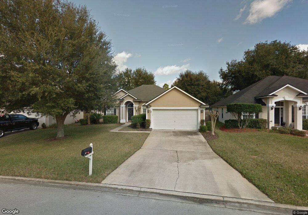
573 Sparrow Branch Cir Saint Johns, FL 32259
Estimated Value: $408,930 - $446,000
3
Beds
2
Baths
1,970
Sq Ft
$215/Sq Ft
Est. Value
About This Home
This home is located at 573 Sparrow Branch Cir, Saint Johns, FL 32259 and is currently estimated at $423,983, approximately $215 per square foot. 573 Sparrow Branch Cir is a home located in St. Johns County with nearby schools including Durbin Creek Elementary School, Fruit Cove Middle School, and Creekside High School.
Ownership History
Date
Name
Owned For
Owner Type
Purchase Details
Closed on
Mar 16, 2015
Sold by
Stevenson Steven and Snyder Lesley
Bought by
Snyder Lesley
Current Estimated Value
Purchase Details
Closed on
May 20, 2004
Sold by
Mirt Chad J and Mirt Yasuko
Bought by
Stevenson Steven and Snyder Lesley
Home Financials for this Owner
Home Financials are based on the most recent Mortgage that was taken out on this home.
Original Mortgage
$168,720
Interest Rate
5.57%
Mortgage Type
Purchase Money Mortgage
Purchase Details
Closed on
Oct 30, 2002
Sold by
Providence Construction Company
Bought by
Mirt Chad J and Mirt Yasuko
Home Financials for this Owner
Home Financials are based on the most recent Mortgage that was taken out on this home.
Original Mortgage
$178,795
Interest Rate
5.93%
Mortgage Type
VA
Create a Home Valuation Report for This Property
The Home Valuation Report is an in-depth analysis detailing your home's value as well as a comparison with similar homes in the area
Home Values in the Area
Average Home Value in this Area
Purchase History
| Date | Buyer | Sale Price | Title Company |
|---|---|---|---|
| Snyder Lesley | $80,200 | Title Source Inc | |
| Stevenson Steven | $210,900 | K T Title Services | |
| Mirt Chad J | $175,300 | -- |
Source: Public Records
Mortgage History
| Date | Status | Borrower | Loan Amount |
|---|---|---|---|
| Previous Owner | Stevenson Steven | $168,720 | |
| Previous Owner | Mirt Chad J | $178,795 | |
| Closed | Stevenson Steven | $21,090 |
Source: Public Records
Tax History Compared to Growth
Tax History
| Year | Tax Paid | Tax Assessment Tax Assessment Total Assessment is a certain percentage of the fair market value that is determined by local assessors to be the total taxable value of land and additions on the property. | Land | Improvement |
|---|---|---|---|---|
| 2025 | $3,048 | $186,513 | -- | -- |
| 2024 | $3,048 | $181,257 | -- | -- |
| 2023 | $3,048 | $175,978 | $0 | $0 |
| 2022 | $2,980 | $170,852 | $0 | $0 |
| 2021 | $2,754 | $165,876 | $0 | $0 |
| 2020 | $2,697 | $163,586 | $0 | $0 |
| 2019 | $2,724 | $159,908 | $0 | $0 |
| 2018 | $2,655 | $156,926 | $0 | $0 |
| 2017 | $2,615 | $153,698 | $0 | $0 |
| 2016 | $2,592 | $155,053 | $0 | $0 |
| 2015 | $2,629 | $153,976 | $0 | $0 |
| 2014 | $2,634 | $151,643 | $0 | $0 |
Source: Public Records
Map
Nearby Homes
- 572 Sparrow Branch Cir
- 1121 Andrea Way
- 1001 Andrea Way
- 520 Sparrow Branch Cir
- 4505 S Pennycress Place
- 1925 Barham Ct
- 4340 Rye Ct
- 1232 Loch Tanna Loop
- 300 Sparrow Branch Cir
- 527 Pine Haven Dr
- 969 W Tennessee Trace
- 252 Pine Haven Dr
- 2708 Caldar Ct
- 1508 Avalon Ct
- 435 Honeycomb Way
- 243 Beech Brook St
- 763 Ginger Mill Dr
- 281 Lakeview Pass Way
- 984 Buttercup Dr
- 1821 W Windy Way
- 577 Sparrow Branch Cir
- 569 Sparrow Branch Cir
- 1109 Andrea Way
- 1113 Andrea Way
- 581 Sparrow Branch Cir
- 1105 Andrea Way
- 565 Sparrow Branch Cir
- 1117 Andrea Way
- 1101 Andrea Way
- 576 Sparrow Branch Cir
- 564 Sparrow Branch Cir
- 564 Sparrow Branch Cr
- 561 Sparrow Branch Cir
- 580 Sparrow Branch Cir
- 560 Sparrow Branch Cir
- 585 Sparrow Branch Cir
- 1125 Andrea Way
- 557 Sparrow Branch Cir
- 1112 Andrea Way
- 908 W Doty Branch Ln