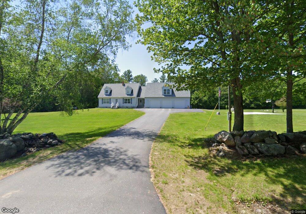
573 Turkey Lane Rd Livermore, ME 04253
Estimated Value: $325,000 - $519,000
--
Bed
--
Bath
1,064
Sq Ft
$376/Sq Ft
Est. Value
About This Home
This home is located at 573 Turkey Lane Rd, Livermore, ME 04253 and is currently estimated at $399,804, approximately $375 per square foot. 573 Turkey Lane Rd is a home with nearby schools including Libby-Tozier School, Sabattus Primary School, and Carrie Ricker School.
Ownership History
Date
Name
Owned For
Owner Type
Purchase Details
Closed on
Jul 23, 2013
Sold by
Flagg James F
Bought by
Flagg Sarah E and Flagg James F
Current Estimated Value
Home Financials for this Owner
Home Financials are based on the most recent Mortgage that was taken out on this home.
Original Mortgage
$195,000
Interest Rate
3.92%
Mortgage Type
New Conventional
Create a Home Valuation Report for This Property
The Home Valuation Report is an in-depth analysis detailing your home's value as well as a comparison with similar homes in the area
Home Values in the Area
Average Home Value in this Area
Purchase History
| Date | Buyer | Sale Price | Title Company |
|---|---|---|---|
| Flagg Sarah E | -- | -- |
Source: Public Records
Mortgage History
| Date | Status | Borrower | Loan Amount |
|---|---|---|---|
| Closed | Flagg Sarah E | $195,000 |
Source: Public Records
Tax History Compared to Growth
Tax History
| Year | Tax Paid | Tax Assessment Tax Assessment Total Assessment is a certain percentage of the fair market value that is determined by local assessors to be the total taxable value of land and additions on the property. | Land | Improvement |
|---|---|---|---|---|
| 2025 | $5,165 | $273,277 | $48,260 | $225,017 |
| 2024 | $4,673 | $273,277 | $48,260 | $225,017 |
| 2023 | $4,441 | $273,277 | $48,260 | $225,017 |
| 2022 | $4,372 | $273,277 | $48,260 | $225,017 |
| 2021 | $4,372 | $273,277 | $48,260 | $225,017 |
| 2020 | $4,167 | $273,277 | $48,260 | $225,017 |
| 2019 | $3,404 | $268,511 | $44,260 | $224,251 |
| 2018 | $4,296 | $268,511 | $44,260 | $224,251 |
| 2017 | $4,404 | $268,511 | $44,260 | $224,251 |
| 2016 | $3,479 | $268,511 | $44,260 | $224,251 |
| 2015 | $4,296 | $268,511 | $44,260 | $224,251 |
| 2014 | $3,813 | $268,511 | $44,260 | $224,251 |
Source: Public Records
Map
Nearby Homes
- R01L73 & M8l32 Marsh Rd
- 18 Terrace View
- 148 School Rd
- 5 Santa Ln
- 41 Hidden Pond Rd
- 64 Ferrin Rd
- 65 Autumn Ridge
- 41 Patriot Ln
- M-4 L 43-D Oak Hill Rd
- 33 Bush Ln
- 761 Huntington Hill Rd
- 63 Riley Rd
- 11 Dustin Dr
- 4 Nancy Ln
- Lot B2 Academy Rd
- Lot B1 Academy Rd
- Lot A2 Academy Rd
- TBD Riley Ridge Ln
- 77 Southern Terrace
- 38 Moore Dr
- 93 Oak Hill Rd
- 81 Oak Hill Rd
- 103 Oak Hill Rd
- 102 Oak Hill Rd
- 94 Oak Hill Rd
- 111 Oak Hill Rd
- 78 Oak Hill Rd
- 238 Litchfield Rd
- 203 Litchfield Rd
- Lot 72D Litchfield Rd
- 206 Litchfield Rd
- 252 Litchfield Rd
- 184 Litchfield Rd
- 96 Oak Hill Rd
- Lot 72C Litchfield Rd
- 265 Litchfield Rd
- 142 Oak Hill Rd
- 23 Polley Dr
- 270 Litchfield Rd
- 37 Morin Dr