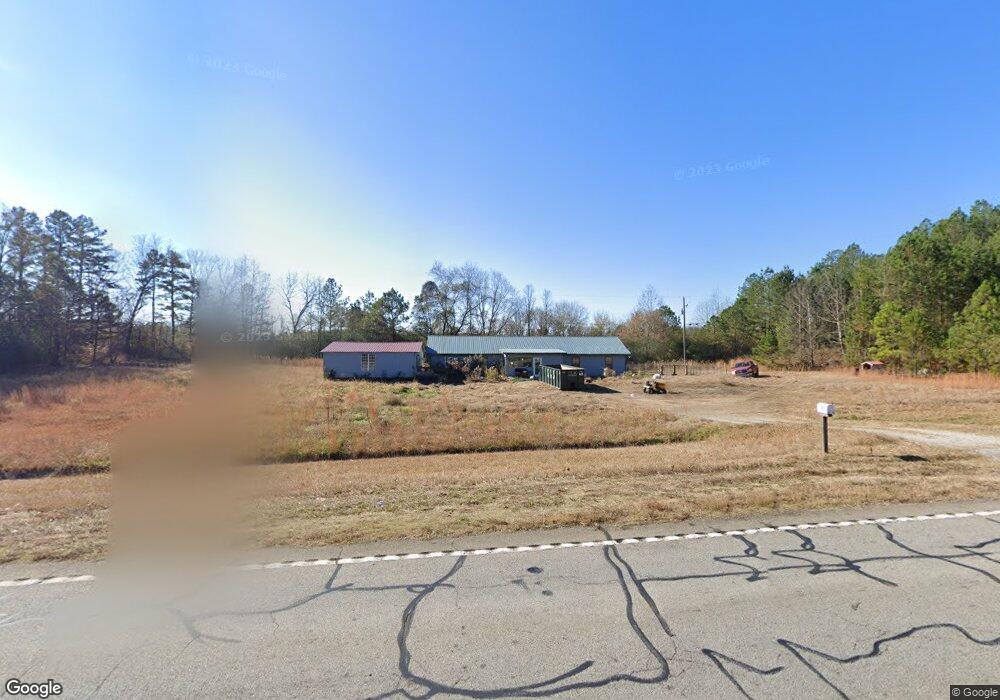
573 Us Highway 78 Tallapoosa, GA 30176
Estimated Value: $251,000 - $400,000
2
Beds
2
Baths
2,190
Sq Ft
$147/Sq Ft
Est. Value
About This Home
This home is located at 573 Us Highway 78, Tallapoosa, GA 30176 and is currently estimated at $321,191, approximately $146 per square foot. 573 Us Highway 78 is a home with nearby schools including Haralson County High School.
Ownership History
Date
Name
Owned For
Owner Type
Purchase Details
Closed on
May 24, 2017
Sold by
Jenkins Frank
Bought by
Lighthouse Ministries
Current Estimated Value
Purchase Details
Closed on
Aug 6, 2004
Sold by
Southwood Corporation
Bought by
Jenkins Frank D/B/A Lighthouse Ministrie
Purchase Details
Closed on
Nov 25, 2003
Sold by
Land Jim
Bought by
Cooper Floyd
Purchase Details
Closed on
Nov 6, 1998
Sold by
Southwood Corporation
Bought by
Cooper Floyd
Create a Home Valuation Report for This Property
The Home Valuation Report is an in-depth analysis detailing your home's value as well as a comparison with similar homes in the area
Home Values in the Area
Average Home Value in this Area
Purchase History
| Date | Buyer | Sale Price | Title Company |
|---|---|---|---|
| Lighthouse Ministries | -- | -- | |
| Jenkins Frank D/B/A Lighthouse Ministrie | -- | -- | |
| Jenkins Frank D/B/A Lighthouse Ministrie | $75,000 | -- | |
| Cooper Floyd | -- | -- | |
| Cooper Floyd | $11,800 | -- |
Source: Public Records
Tax History Compared to Growth
Tax History
| Year | Tax Paid | Tax Assessment Tax Assessment Total Assessment is a certain percentage of the fair market value that is determined by local assessors to be the total taxable value of land and additions on the property. | Land | Improvement |
|---|---|---|---|---|
| 2024 | $2,164 | $83,455 | $8,225 | $75,230 |
| 2023 | $2,343 | $90,370 | $5,742 | $84,628 |
| 2022 | $1,878 | $70,051 | $5,742 | $64,309 |
| 2021 | $1,867 | $63,154 | $21,168 | $41,986 |
| 2020 | $1,867 | $63,154 | $21,168 | $41,986 |
| 2019 | $1,867 | $63,154 | $21,168 | $41,986 |
| 2018 | $1,936 | $63,154 | $21,168 | $41,986 |
| 2017 | $1,556 | $50,746 | $8,760 | $41,986 |
| 2016 | $0 | $56,213 | $14,227 | $41,986 |
| 2015 | -- | $56,213 | $14,227 | $41,986 |
| 2014 | -- | $56,213 | $14,227 | $41,986 |
Source: Public Records
Map
Nearby Homes
- Off Us Hwy 78 Unit LotWP001
- 0 George Green Rd Unit 10614283
- 0 George Green Rd Unit 148073
- 0 George Green Rd Unit 148074
- 0 George Green Rd Unit 10558286
- 0 George Green Rd Unit 10558285
- 302 Riverside Rd
- 0 J Davis Rd Unit LotWP001
- 295 J Davis Rd Unit LotWP001
- 0 Highway 78 Unit 18172206
- 10 + - Acres On J Davis Rd
- 78 Cook St
- 0 Williamson Rd Unit 7660484
- 0 Williamson Rd Unit 10618560
- 1304 Broad St
- 80 Sanders Creek Rd
- 2234 Providence Church Rd
- 897 George Green Rd
- 267 Williams Rd
- 3055 Providence Church Rd
- 413 Us Highway 78
- 413 Highway 78
- 413 Us Hwy 78 W
- 413 Us Highway 78 W
- 413 U S 78
- 115 Shealy Rd
- 115 Shealy Rd
- 389 Us Highway 78
- 732 Liner Rd
- 24 Riverside Rd
- 24 Riverside Rd
- 214 Doe Valley Rd
- 0 Riverside Rd Unit 7055449
- 0 Riverside Rd Unit 7320979
- 0 Riverside Rd Unit 7108326
- 0 Riverside Rd Unit 7187020
- 0 Riverside Rd Unit 7448819
- 0 Riverside Rd Unit 8241424
- 0 Riverside Rd Unit 8265967
- 0 Riverside Rd Unit 8302984