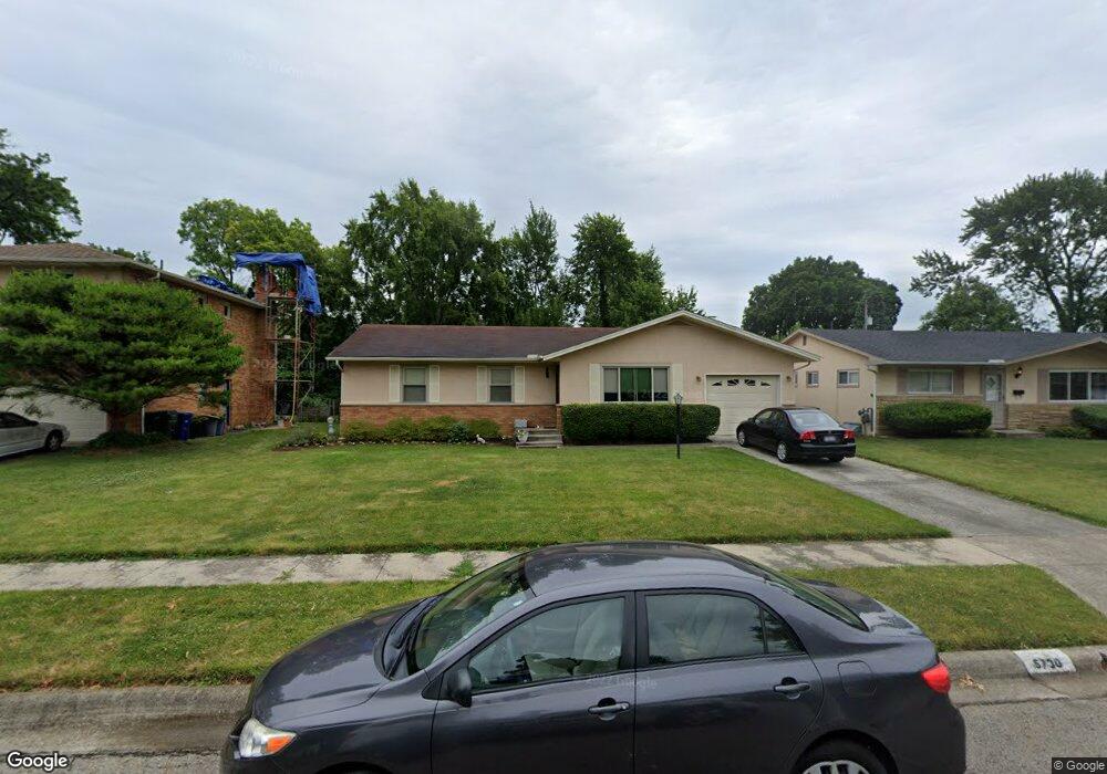
5730 Lindenwood Rd Columbus, OH 43229
Forest Park West NeighborhoodEstimated Value: $266,000 - $294,000
3
Beds
2
Baths
1,358
Sq Ft
$204/Sq Ft
Est. Value
About This Home
This home is located at 5730 Lindenwood Rd, Columbus, OH 43229 and is currently estimated at $277,317, approximately $204 per square foot. 5730 Lindenwood Rd is a home located in Franklin County with nearby schools including Forest Park Elementary School, Woodward Park Middle School, and Northland High School.
Ownership History
Date
Name
Owned For
Owner Type
Purchase Details
Closed on
May 26, 2006
Sold by
Vanpaepeghem John A
Bought by
Anthony Carrie and Anthony Mildred
Current Estimated Value
Home Financials for this Owner
Home Financials are based on the most recent Mortgage that was taken out on this home.
Original Mortgage
$108,000
Outstanding Balance
$59,251
Interest Rate
5.4%
Mortgage Type
Fannie Mae Freddie Mac
Estimated Equity
$218,066
Purchase Details
Closed on
Aug 18, 2004
Sold by
Hiell Mary J
Bought by
Paepeghem John A Van
Purchase Details
Closed on
Jul 17, 1987
Bought by
Hiell Mary J
Create a Home Valuation Report for This Property
The Home Valuation Report is an in-depth analysis detailing your home's value as well as a comparison with similar homes in the area
Home Values in the Area
Average Home Value in this Area
Purchase History
| Date | Buyer | Sale Price | Title Company |
|---|---|---|---|
| Anthony Carrie | $135,000 | Amerititle | |
| Paepeghem John A Van | $134,300 | Chicago Tit | |
| Hiell Mary J | $69,000 | -- |
Source: Public Records
Mortgage History
| Date | Status | Borrower | Loan Amount |
|---|---|---|---|
| Open | Anthony Carrie | $108,000 |
Source: Public Records
Tax History Compared to Growth
Tax History
| Year | Tax Paid | Tax Assessment Tax Assessment Total Assessment is a certain percentage of the fair market value that is determined by local assessors to be the total taxable value of land and additions on the property. | Land | Improvement |
|---|---|---|---|---|
| 2024 | $3,274 | $82,750 | $21,180 | $61,570 |
| 2023 | $3,260 | $82,750 | $21,180 | $61,570 |
| 2022 | $2,097 | $49,180 | $11,830 | $37,350 |
| 2021 | $2,101 | $49,180 | $11,830 | $37,350 |
| 2020 | $2,103 | $49,180 | $11,830 | $37,350 |
| 2019 | $1,830 | $38,920 | $9,450 | $29,470 |
| 2018 | $1,716 | $38,920 | $9,450 | $29,470 |
| 2017 | $1,829 | $38,920 | $9,450 | $29,470 |
| 2016 | $1,769 | $35,460 | $8,890 | $26,570 |
| 2015 | $1,606 | $35,460 | $8,890 | $26,570 |
| 2014 | $1,610 | $35,460 | $8,890 | $26,570 |
| 2013 | $849 | $37,310 | $9,345 | $27,965 |
Source: Public Records
Map
Nearby Homes
- 1492 Cottonwood Dr
- 5548 Roche Dr
- 5579 Norcross Rd
- 5480 Rockwood Ct Unit R1
- 5990 Ambleside Dr
- 5462 Roche Dr
- 5415 Vinewood Ct
- 1171 Newbury Dr
- 1687 Brookfield Square S
- 6035 Karl Rd
- 6189 Northgap Dr
- 1288 Oakfield Dr N
- 6211 Parkdale Dr
- 1752 Pine Tree St S Unit H
- 1743 Pine Tree St N Unit A
- 5318 Eisenhower Rd
- 5485 Tamarack Blvd
- 1549 Alpine Dr
- 5475 Worthington Forest Place E Unit 5475
- 964 Strimple Ave
- 5722 Lindenwood Rd
- 5742 Lindenwood Rd
- 5723 Sandalwood Blvd
- 5714 Lindenwood Rd
- 5715 Sandalwood Blvd
- 5735 Sandalwood Blvd
- 5750 Lindenwood Rd
- 5733 Lindenwood Rd
- 5699 Sandalwood Blvd
- 5743 Sandalwood Blvd
- 5745 Lindenwood Rd
- 5706 Lindenwood Rd
- 5758 Lindenwood Rd
- 5753 Lindenwood Rd
- 5691 Sandalwood Blvd
- 5751 Sandalwood Blvd
- 5699 Lindenwood Rd
- 5761 Lindenwood Rd
- 5770 Lindenwood Rd
- 5683 Sandalwood Blvd