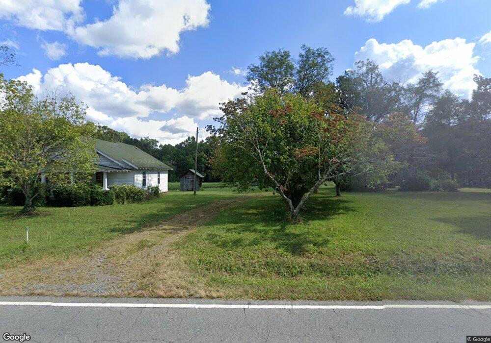
5736 E Old Us 421 Hwy East Bend, NC 27018
Estimated Value: $278,000 - $1,000,891
2
Beds
1
Bath
784
Sq Ft
$684/Sq Ft
Est. Value
About This Home
This home is located at 5736 E Old Us 421 Hwy, East Bend, NC 27018 and is currently estimated at $536,297, approximately $684 per square foot. 5736 E Old Us 421 Hwy is a home located in Yadkin County.
Ownership History
Date
Name
Owned For
Owner Type
Purchase Details
Closed on
Jul 2, 2008
Sold by
Joyce Jonnie R
Bought by
Rierson Martha L
Current Estimated Value
Purchase Details
Closed on
Mar 7, 2008
Sold by
Reaves Terry J
Bought by
Rierson Martha L
Purchase Details
Closed on
Mar 6, 2008
Sold by
Joyce Patricia R
Bought by
Rierson Martha L
Create a Home Valuation Report for This Property
The Home Valuation Report is an in-depth analysis detailing your home's value as well as a comparison with similar homes in the area
Home Values in the Area
Average Home Value in this Area
Purchase History
| Date | Buyer | Sale Price | Title Company |
|---|---|---|---|
| Rierson Martha L | $135,000 | None Available | |
| Rierson Martha L | $90,000 | None Available | |
| Rierson Martha L | $90,000 | None Available | |
| Rierson Martha L | $90,000 | None Available | |
| Rierson Martha L | $90,000 | None Available |
Source: Public Records
Tax History Compared to Growth
Tax History
| Year | Tax Paid | Tax Assessment Tax Assessment Total Assessment is a certain percentage of the fair market value that is determined by local assessors to be the total taxable value of land and additions on the property. | Land | Improvement |
|---|---|---|---|---|
| 2025 | $3,626 | $492,722 | $0 | $0 |
| 2024 | $3,593 | $492,722 | $0 | $0 |
| 2023 | $3,068 | $492,722 | $365,288 | $127,434 |
| 2022 | $3,068 | $415,973 | $0 | $0 |
| 2021 | $2,959 | $415,973 | $333,774 | $82,199 |
| 2020 | $3,055 | $415,973 | $333,774 | $82,199 |
| 2019 | $3,055 | $415,973 | $333,774 | $82,199 |
| 2018 | $3,057 | $415,973 | $333,774 | $82,199 |
| 2017 | $3,037 | $415,973 | $333,774 | $82,199 |
| 2016 | $3,030 | $423,606 | $333,429 | $90,177 |
| 2015 | $3,092 | $423,606 | $333,429 | $90,177 |
| 2014 | $3,092 | $423,606 | $333,429 | $90,177 |
| 2013 | $3,173 | $423,606 | $333,429 | $90,177 |
Source: Public Records
Map
Nearby Homes
- 4192 Emmas Way
- 4198 Emmas Way
- 4196 Emmas Way
- 5339 Old Us Highway 421
- 770 Dalton Rd
- 0 Scott Rd
- 00 Scott Rd
- 710 Dorse Rd
- 8265 Shallowford Rd
- 2628 Bloomtown Rd
- 9664 Lissara Camp Ct
- 9631 Lissara Camp Ct
- 9687 Lissara Camp Ct
- 5611 Stone Ridge Dr
- 4933 Wrenn Rd
- 834 Montrachet Ct
- 9349 Lissara Camp Ct
- 9652 Lissara Camp Ct
- 9427 Lissara Camp Ct
- 9658 Lissara Camp Ct
- 5736 E Old Us 421 Hwy
- 5624 E Old Us 421 Hwy
- 5721 E Old Us 421 Hwy
- 0 Old Highway 421
- 5741 E Old Us 421 Hwy
- 5812 E Old Us 421 Hwy
- 5733 E Old Us 421 Hwy
- 5645 E Old Us 421 Hwy
- 5820 E Old Us 421 Hwy
- 5805 E Old Us 421 Hwy
- 5941 E Old Us 421 Hwy
- 5828 E Old Us 421 Hwy
- 5745 E Old Us 421 Hwy
- 5617 E Old Us 421 Hwy
- 5613 E Old Us 421 Hwy
- 5608 E Old Us Highway 421
- 5844 E Old Us 421 Hwy
- 5148 Hartley Dr
- 5601 E Old Us 421 Hwy
- 5600 E Old Us 421 Hwy