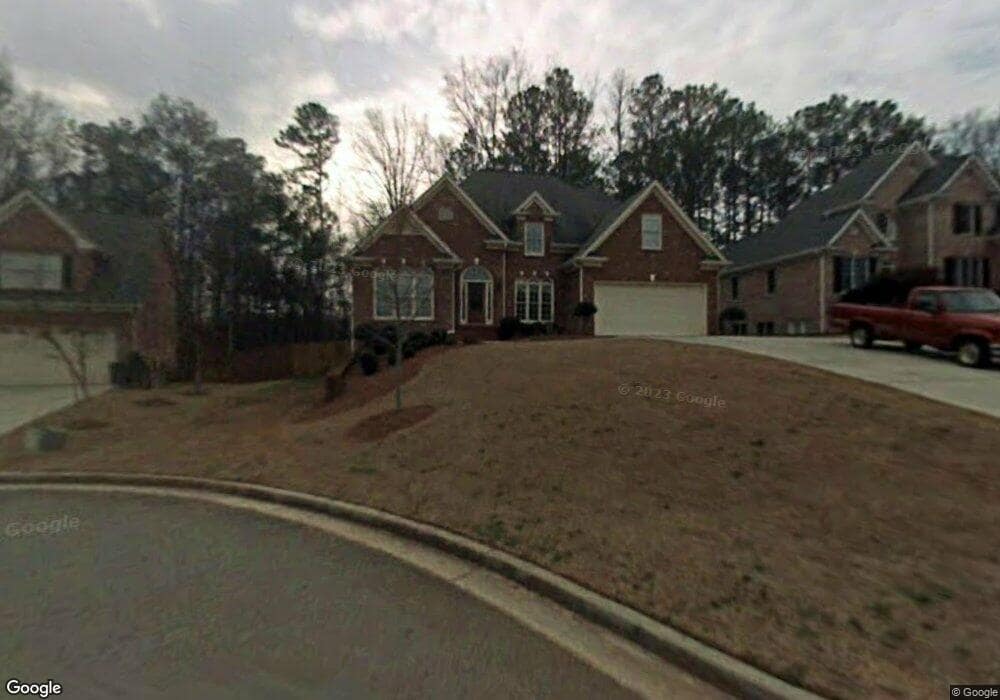
5736 Harmony Point Dr Unit 2 Lilburn, GA 30047
Estimated Value: $599,000 - $760,108
5
Beds
4
Baths
2,954
Sq Ft
$223/Sq Ft
Est. Value
About This Home
This home is located at 5736 Harmony Point Dr Unit 2, Lilburn, GA 30047 and is currently estimated at $658,527, approximately $222 per square foot. 5736 Harmony Point Dr Unit 2 is a home located in Gwinnett County with nearby schools including Arcado Elementary School, Trickum Middle School, and Parkview High School.
Ownership History
Date
Name
Owned For
Owner Type
Purchase Details
Closed on
Feb 11, 2019
Sold by
Thomas Sheela
Bought by
Thomas Sheela and Thomas Ciby
Current Estimated Value
Home Financials for this Owner
Home Financials are based on the most recent Mortgage that was taken out on this home.
Original Mortgage
$294,566
Outstanding Balance
$258,573
Interest Rate
4.62%
Mortgage Type
FHA
Estimated Equity
$399,954
Purchase Details
Closed on
Oct 8, 2003
Sold by
Edenfield Inc
Bought by
Harvey Howard and Harvey Alicia
Home Financials for this Owner
Home Financials are based on the most recent Mortgage that was taken out on this home.
Original Mortgage
$270,320
Interest Rate
6.03%
Mortgage Type
New Conventional
Create a Home Valuation Report for This Property
The Home Valuation Report is an in-depth analysis detailing your home's value as well as a comparison with similar homes in the area
Home Values in the Area
Average Home Value in this Area
Purchase History
| Date | Buyer | Sale Price | Title Company |
|---|---|---|---|
| Thomas Sheela | $300,000 | -- | |
| Thomas Sheela | $300,000 | -- | |
| Harvey Howard | $337,900 | -- |
Source: Public Records
Mortgage History
| Date | Status | Borrower | Loan Amount |
|---|---|---|---|
| Open | Thomas Sheela | $294,566 | |
| Closed | Thomas Sheela | $294,566 | |
| Previous Owner | Harvey Howard | $270,320 |
Source: Public Records
Tax History Compared to Growth
Tax History
| Year | Tax Paid | Tax Assessment Tax Assessment Total Assessment is a certain percentage of the fair market value that is determined by local assessors to be the total taxable value of land and additions on the property. | Land | Improvement |
|---|---|---|---|---|
| 2025 | $11,038 | $303,560 | $36,000 | $267,560 |
| 2024 | $11,237 | $305,840 | $36,000 | $269,840 |
| 2023 | $11,237 | $243,520 | $36,000 | $207,520 |
| 2022 | $9,007 | $243,520 | $36,000 | $207,520 |
| 2021 | $4,699 | $120,000 | $31,200 | $88,800 |
| 2020 | $4,726 | $120,000 | $31,200 | $88,800 |
| 2019 | $5,313 | $141,800 | $24,000 | $117,800 |
| 2018 | $5,323 | $141,800 | $24,000 | $117,800 |
| 2016 | $4,362 | $127,520 | $18,000 | $109,520 |
| 2015 | $3,464 | $93,200 | $18,400 | $74,800 |
| 2014 | $3,482 | $93,200 | $18,400 | $74,800 |
Source: Public Records
Map
Nearby Homes
- 5524 Laurel Ln NW
- 5762 Renee Ct NW
- 5768 Lost Grove Dr NW
- 5798 Lost Grove Dr NW
- 5618 Fern Creek Dr SW
- 5817 Lost Grove Dr NW Unit 2
- 194 Jennifer Ln NW
- 5796 Princeton Run Trail
- 5806 Princeton Run Trail
- 5703 Urban Village Way Unit 32
- 5705 Urban Village Way Unit 31
- 5701 Urban Village Way Unit 33
- 5707 Urban Village Way Unit 30
- 5709 Urban Village Way Unit 29
- 10 Rock Park Way Unit 17
- Evergreen Plan at Parkstone Row
- Sweetwater Plan at Parkstone Row
- Bryson Plan at Parkstone Row
- 5746 Harmony Point Dr
- 5726 Harmony Point Dr
- 5756 Harmony Pt 0
- 5756 Harmony Point 0
- 5756 Harmony Point Dr
- 5716 Harmony Point Dr
- 5747 Harmony Point Dr
- 5717 Harmony Point Dr
- 5766 Harmony Point Dr
- 0 Harmony Point Dr Unit 7010498
- 0 Harmony Point Dr Unit 7059052
- 85 Harmony Point Cove
- 5757 Harmony Point Dr
- 90 Harmony Point Cove
- 95 Harmony Point Cove
- 5776 Harmony Point Dr
- 78 Harmony Grove Rd
- 5626 Bob White Cir NW Unit 4
- 100 Harmony Grove Rd
- 105 Harmony Point Cove