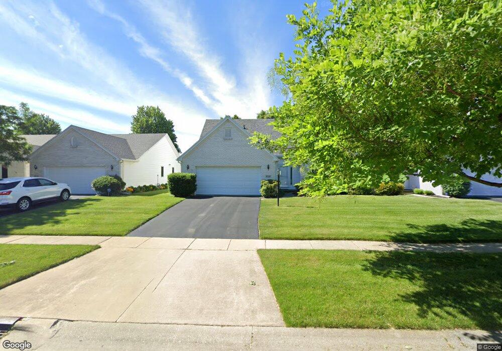
5737 Brook Cliffe Rd Toledo, OH 43614
Southwyck NeighborhoodEstimated Value: $233,903 - $257,000
3
Beds
3
Baths
1,807
Sq Ft
$135/Sq Ft
Est. Value
About This Home
This home is located at 5737 Brook Cliffe Rd, Toledo, OH 43614 and is currently estimated at $243,726, approximately $134 per square foot. 5737 Brook Cliffe Rd is a home located in Lucas County with nearby schools including Holloway Elementary School, Springfield Middle School, and Springfield High School.
Ownership History
Date
Name
Owned For
Owner Type
Purchase Details
Closed on
Feb 25, 2019
Sold by
Quinn Quinn Bernice E Bernice E and Quinn Frederica M
Bought by
Quinn Bernice E and Bernice E Quinn Trust
Current Estimated Value
Purchase Details
Closed on
Aug 5, 1999
Sold by
Quinn Frederick M and Quinn Bernic E
Bought by
Quinn Frederick M and Quinn Bernice E
Purchase Details
Closed on
Jun 25, 1996
Sold by
Mccarthy Builders Inc
Bought by
Quinn Frederick and Quinn Bernice E
Create a Home Valuation Report for This Property
The Home Valuation Report is an in-depth analysis detailing your home's value as well as a comparison with similar homes in the area
Home Values in the Area
Average Home Value in this Area
Purchase History
| Date | Buyer | Sale Price | Title Company |
|---|---|---|---|
| Quinn Bernice E | -- | None Available | |
| Quinn Frederick M | -- | -- | |
| Quinn Frederick | $24,900 | -- |
Source: Public Records
Tax History Compared to Growth
Tax History
| Year | Tax Paid | Tax Assessment Tax Assessment Total Assessment is a certain percentage of the fair market value that is determined by local assessors to be the total taxable value of land and additions on the property. | Land | Improvement |
|---|---|---|---|---|
| 2024 | $1,074 | $49,420 | $5,845 | $43,575 |
| 2023 | $2,617 | $51,135 | $5,110 | $46,025 |
| 2022 | $2,643 | $51,135 | $5,110 | $46,025 |
| 2021 | $2,706 | $51,135 | $5,110 | $46,025 |
| 2020 | $2,674 | $46,095 | $6,475 | $39,620 |
| 2019 | $2,601 | $46,095 | $6,475 | $39,620 |
| 2018 | $2,649 | $46,095 | $6,475 | $39,620 |
| 2017 | $2,683 | $45,045 | $6,335 | $38,710 |
| 2016 | $2,730 | $128,700 | $18,100 | $110,600 |
| 2015 | $2,728 | $128,700 | $18,100 | $110,600 |
| 2014 | $2,410 | $45,050 | $6,340 | $38,710 |
| 2013 | $2,410 | $45,050 | $6,340 | $38,710 |
Source: Public Records
Map
Nearby Homes
- 5770 Staghorn Dr Unit 5770
- 5741 Heatherbank Rd
- 2258 Tanglewood Dr
- 2437 Knights Hill Ln
- 2124 Tanglewood Dr
- 5366 Glenridge Dr
- 6325 Millbrook Rd
- 6524 Glenhurst Dr
- 2001 Perrysburg Holland Rd Unit 118
- 6053 Suffolk Ln Unit 6053
- 1668 Brownstone Blvd Unit 633
- 2158 Laurel Valley Dr
- 1705 Henthorne Dr
- 6627 Embassy Ct Unit I38
- 1562 Saddlebrook Ct Unit B
- 2020 W Crest Dr
- 6652 Sue Ln
- 6705 Garden Rd Unit 6705
- 1533 Eaglebrook Rd
- 6620 Pilliod Rd
- 5743 Brook Cliffe Rd
- 5747 Brook Cliffe Rd
- 5727 Brook Cliffe Rd
- 5751 Brook Cliffe Rd
- 5721 Brook Cliffe Rd
- 5738 Brook Cliffe Rd
- 5730 Brook Cliffe Rd
- 5717 Brook Cliffe Rd
- 5746 Brook Cliffe Rd
- 2443 Whitechapel Dr
- 2449 Whitechapel Dr
- 5720 Brook Cliffe Rd
- 2453 Whitechapel Dr
- 5685 Brook Cliffe Rd
- 2425 Whitechapel Dr
- 2461 Whitechapel Dr
- 5679 Brook Cliffe Rd
- 2384 Shellbrook Ln
- 5734 Shellbrook Ln
- 5682 Brook Cliffe Rd