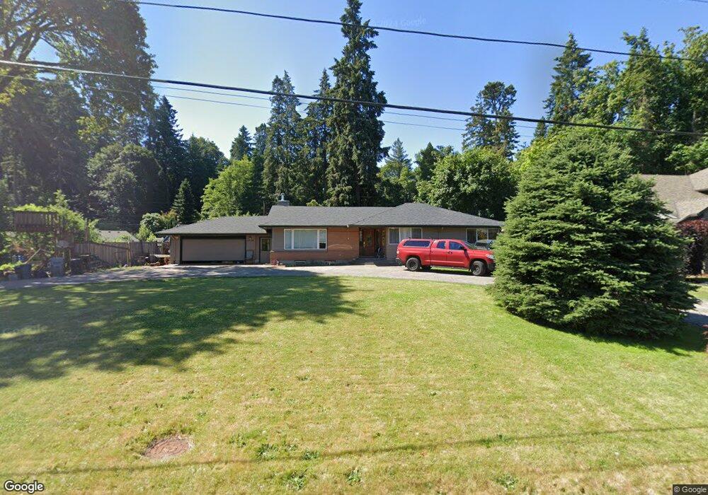
5738 River St West Linn, OR 97068
Bolton NeighborhoodEstimated Value: $807,000 - $984,000
4
Beds
2
Baths
3,131
Sq Ft
$288/Sq Ft
Est. Value
About This Home
This home is located at 5738 River St, West Linn, OR 97068 and is currently estimated at $900,673, approximately $287 per square foot. 5738 River St is a home located in Clackamas County with nearby schools including Bolton Primary School, West Linn High School, and Clackamas Academy of Industrial Sciences (CAIS).
Ownership History
Date
Name
Owned For
Owner Type
Purchase Details
Closed on
Feb 27, 2025
Sold by
Kling David L and Kling Kandace A
Bought by
Kling Family Revocable Living Trust and Kling
Current Estimated Value
Purchase Details
Closed on
Jul 19, 1996
Sold by
Kling David L and Kling Kandace A
Bought by
Newton David W and Newton Valerie
Home Financials for this Owner
Home Financials are based on the most recent Mortgage that was taken out on this home.
Original Mortgage
$253,000
Interest Rate
8.3%
Create a Home Valuation Report for This Property
The Home Valuation Report is an in-depth analysis detailing your home's value as well as a comparison with similar homes in the area
Home Values in the Area
Average Home Value in this Area
Purchase History
| Date | Buyer | Sale Price | Title Company |
|---|---|---|---|
| Kling Family Revocable Living Trust | -- | None Listed On Document | |
| Newton David W | $253,000 | Fidelity National Title Co |
Source: Public Records
Mortgage History
| Date | Status | Borrower | Loan Amount |
|---|---|---|---|
| Previous Owner | Newton David W | $253,000 |
Source: Public Records
Tax History
| Year | Tax Paid | Tax Assessment Tax Assessment Total Assessment is a certain percentage of the fair market value that is determined by local assessors to be the total taxable value of land and additions on the property. | Land | Improvement |
|---|---|---|---|---|
| 2025 | $8,875 | $460,540 | -- | -- |
| 2024 | $8,543 | $447,127 | -- | -- |
| 2023 | $8,543 | $434,104 | -- | -- |
| 2022 | $8,064 | $421,461 | $0 | $0 |
| 2021 | $7,655 | $409,186 | $0 | $0 |
| 2020 | $7,707 | $397,268 | $0 | $0 |
| 2019 | $7,349 | $385,698 | $0 | $0 |
| 2018 | $7,021 | $374,464 | $0 | $0 |
| 2017 | $6,749 | $363,557 | $0 | $0 |
| 2016 | $6,533 | $352,968 | $0 | $0 |
| 2015 | $6,140 | $342,687 | $0 | $0 |
| 2014 | $5,793 | $332,706 | $0 | $0 |
Source: Public Records
Map
Nearby Homes
- 1471 Burns St
- 1310 Heater Ct
- 5557 River St
- 5645 W A St
- 5835 W A St
- 5767 Terrace Dr
- 2145 Webb St
- 5910 W A St
- 1895 Buck St
- 1701 Clackamette Dr Unit 2
- 5089 Territorial Dr
- 19605 River Rd Unit 104
- 6141 Skyline Dr
- 6352 Caufield St
- 6123 Skyline Dr
- 2010 Maple Terrace
- 2334 Randall St
- 19697 SE Cottonwood St
- 390 W Arlington St
- 1016 Center St
Your Personal Tour Guide
Ask me questions while you tour the home.