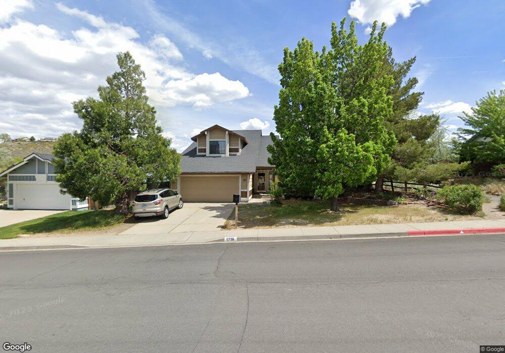
5738 Simons Dr Unit 9B Reno, NV 89523
Mae Anne Avenue NeighborhoodEstimated Value: $669,000 - $690,000
4
Beds
3
Baths
2,272
Sq Ft
$298/Sq Ft
Est. Value
About This Home
This home is located at 5738 Simons Dr Unit 9B, Reno, NV 89523 and is currently estimated at $677,176, approximately $298 per square foot. 5738 Simons Dr Unit 9B is a home located in Washoe County with nearby schools including Sarah Winnemucca Elementary School, B D Billinghurst Middle School, and Robert McQueen High School.
Ownership History
Date
Name
Owned For
Owner Type
Purchase Details
Closed on
Jul 9, 2011
Sold by
Champa James R and Champa Janet E B
Bought by
Beasley Paul A and Beasley Lisa A
Current Estimated Value
Purchase Details
Closed on
Aug 25, 2006
Sold by
Battcher Champa James R and Battcher Champa Janet Elaine
Bought by
Champa James R and Champa Janet E B
Purchase Details
Closed on
Jun 24, 2003
Sold by
Gray James A and Gray Charissa J
Bought by
Battcher Champa James R and Battcher Champa Janet Elaine
Home Financials for this Owner
Home Financials are based on the most recent Mortgage that was taken out on this home.
Original Mortgage
$228,000
Interest Rate
5.13%
Mortgage Type
Unknown
Create a Home Valuation Report for This Property
The Home Valuation Report is an in-depth analysis detailing your home's value as well as a comparison with similar homes in the area
Home Values in the Area
Average Home Value in this Area
Purchase History
| Date | Buyer | Sale Price | Title Company |
|---|---|---|---|
| Beasley Paul A | $200,000 | Western Title Company | |
| Champa James R | -- | None Available | |
| Battcher Champa James R | $285,000 | First American Title |
Source: Public Records
Mortgage History
| Date | Status | Borrower | Loan Amount |
|---|---|---|---|
| Previous Owner | Battcher Champa James R | $228,000 |
Source: Public Records
Tax History
| Year | Tax Paid | Tax Assessment Tax Assessment Total Assessment is a certain percentage of the fair market value that is determined by local assessors to be the total taxable value of land and additions on the property. | Land | Improvement |
|---|---|---|---|---|
| 2026 | $2,190 | $108,095 | $46,445 | $61,650 |
| 2024 | $2,841 | $105,729 | $41,300 | $64,429 |
| 2023 | $2,758 | $105,357 | $43,855 | $61,502 |
| 2022 | $2,679 | $87,651 | $36,120 | $51,531 |
| 2021 | $3,424 | $76,320 | $24,675 | $51,645 |
| 2020 | $3,192 | $75,296 | $25,795 | $49,501 |
| 2019 | $2,384 | $71,736 | $23,590 | $48,146 |
| 2018 | $2,314 | $64,538 | $17,220 | $47,318 |
| 2017 | $2,246 | $63,721 | $16,065 | $47,656 |
| 2016 | $2,190 | $64,599 | $15,680 | $48,919 |
| 2015 | $2,660 | $62,756 | $13,685 | $49,071 |
| 2014 | $2,124 | $58,752 | $11,060 | $47,692 |
| 2013 | -- | $56,168 | $9,065 | $47,103 |
Source: Public Records
Map
Nearby Homes
- 1586 Grazer Way
- 1596 Grazer Way
- 1598 Grazer Way
- 5833 Altitude St
- 0 Simons Dr
- 5865 Mitra Way
- 5857 Morgan Horse St
- 5861 Morgan Horse St
- 5330 Windwood Ln
- 1091 Crown View Dr
- 1473 Hogadon Way
- 1820 Terrace Heights Ln
- 6052 Bankside Way
- 5540 Daybreak Dr
- 5875 Walnut Creek Rd
- 5846 Walnut Creek Rd
- 5421 Daybreak Dr
- 1927 Tuolumne Dr Unit 70
- 5764 Golden Eagle Dr
- 5722 Golden Eagle Dr
- 5728 Simons Dr
- 5748 Simons Dr
- 1580 Shadow Park Dr
- 5758 Simons Dr
- 1579 Shadow Park Dr
- 1620 Catherine Way
- 1556 Lindsay Dr
- 1590 Shadow Park Dr
- 1589 Shadow Park Dr
- 1630 Catherine Way
- 5778 Simons Dr
- 5781 Simons Dr
- 1550 Lindsay Dr
- 1599 Shadow Park Dr
- 1640 Catherine Way
- 1609 Shadow Park Dr
- 5788 Simons Dr
- 1540 Lindsay Dr
- 1518 Backer Way
- 1508 Backer Way
Your Personal Tour Guide
Ask me questions while you tour the home.