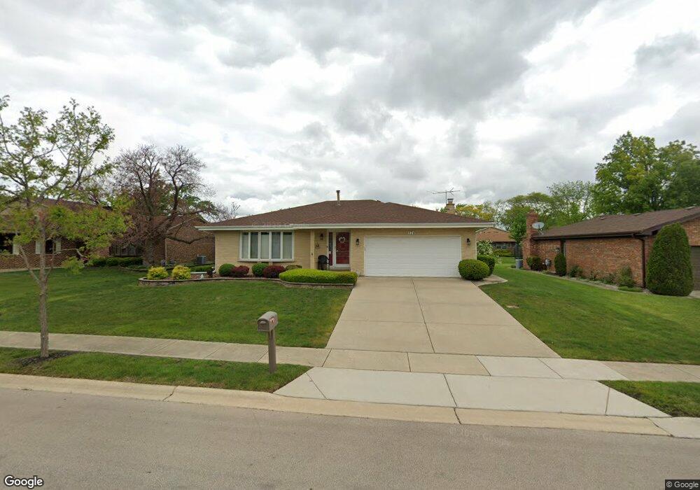
574 Lorelei Dr Schaumburg, IL 60193
South Schaumburg NeighborhoodEstimated Value: $523,090 - $574,000
4
Beds
2
Baths
1,984
Sq Ft
$274/Sq Ft
Est. Value
About This Home
This home is located at 574 Lorelei Dr, Schaumburg, IL 60193 and is currently estimated at $544,273, approximately $274 per square foot. 574 Lorelei Dr is a home located in Cook County with nearby schools including Nathan Hale Elementary School, Robert Frost Junior High School, and Schaumburg High School.
Ownership History
Date
Name
Owned For
Owner Type
Purchase Details
Closed on
Jun 18, 2019
Sold by
Viverito Candice Baum
Bought by
Viverito Candice Baum
Current Estimated Value
Purchase Details
Closed on
Mar 21, 2012
Sold by
Baum Charlene A
Bought by
Baum Charlene A and Earl F & Charlene A Baum Trust
Home Financials for this Owner
Home Financials are based on the most recent Mortgage that was taken out on this home.
Original Mortgage
$47,500
Interest Rate
3.86%
Mortgage Type
New Conventional
Purchase Details
Closed on
Feb 24, 2012
Sold by
Baum Charlene A
Bought by
Baum Charlene M
Home Financials for this Owner
Home Financials are based on the most recent Mortgage that was taken out on this home.
Original Mortgage
$47,500
Interest Rate
3.86%
Mortgage Type
New Conventional
Create a Home Valuation Report for This Property
The Home Valuation Report is an in-depth analysis detailing your home's value as well as a comparison with similar homes in the area
Home Values in the Area
Average Home Value in this Area
Purchase History
| Date | Buyer | Sale Price | Title Company |
|---|---|---|---|
| Viverito Candice Baum | -- | Attorney | |
| Baum Charlene A | -- | Old Republic National Title | |
| Baum Charlene M | -- | Old Republic National Title |
Source: Public Records
Mortgage History
| Date | Status | Borrower | Loan Amount |
|---|---|---|---|
| Closed | Baum Charlene M | $47,500 |
Source: Public Records
Tax History Compared to Growth
Tax History
| Year | Tax Paid | Tax Assessment Tax Assessment Total Assessment is a certain percentage of the fair market value that is determined by local assessors to be the total taxable value of land and additions on the property. | Land | Improvement |
|---|---|---|---|---|
| 2024 | $10,925 | $39,000 | $8,550 | $30,450 |
| 2023 | $10,594 | $39,000 | $8,550 | $30,450 |
| 2022 | $10,594 | $39,000 | $8,550 | $30,450 |
| 2021 | $10,168 | $33,549 | $6,412 | $27,137 |
| 2020 | $9,993 | $33,549 | $6,412 | $27,137 |
| 2019 | $9,992 | $37,277 | $6,412 | $30,865 |
| 2018 | $10,218 | $34,048 | $5,462 | $28,586 |
| 2017 | $8,263 | $34,048 | $5,462 | $28,586 |
| 2016 | $9,405 | $34,048 | $5,462 | $28,586 |
| 2015 | $8,338 | $32,367 | $4,750 | $27,617 |
| 2014 | $8,274 | $32,367 | $4,750 | $27,617 |
| 2013 | $8,032 | $32,367 | $4,750 | $27,617 |
Source: Public Records
Map
Nearby Homes
- 1109 Beach Comber Dr
- 415 Laconia Ln
- 357 Lucille Ln Unit 30
- 1342 Lunt Ct Unit 56
- 1520 Grant St
- 1008 Shannock Ln
- 988 Chelsea Ln
- 818 Brentwood Ct
- 1104 Taunton Ct
- 1150 Attleboro Ct
- 1285 Cranbrook Dr
- 1300 Cranbrook Dr
- 516 W Weathersfield Way
- 727 Killarney Ct Unit 1C
- 635 Limerick Ln Unit 2B
- 507 Ash Ct
- 733 Limerick Ln Unit 7333D
- 1171 Regency Dr
- 631 Derry Ct Unit 3C
- 1027 Duxbury Ln
- 578 Lorelei Dr
- 570 Lorelei Dr
- 1038 Seaview Ct
- 582 Lorelei Dr
- 566 Lorelei Dr
- 1035 Seaview Ct
- 575 Lorelei Dr
- 1034 Seaview Ct
- 571 Lorelei Dr
- 579 Lorelei Dr
- 567 Lorelei Dr
- 586 Lorelei Dr
- 583 Lorelei Dr
- 562 Lorelei Dr
- 1038 Spring Cove Dr
- 1031 Seaview Ct
- 563 Lorelei Dr
- 1030 Seaview Ct
- 1034 Spring Cove Dr
- 587 Lorelei Dr