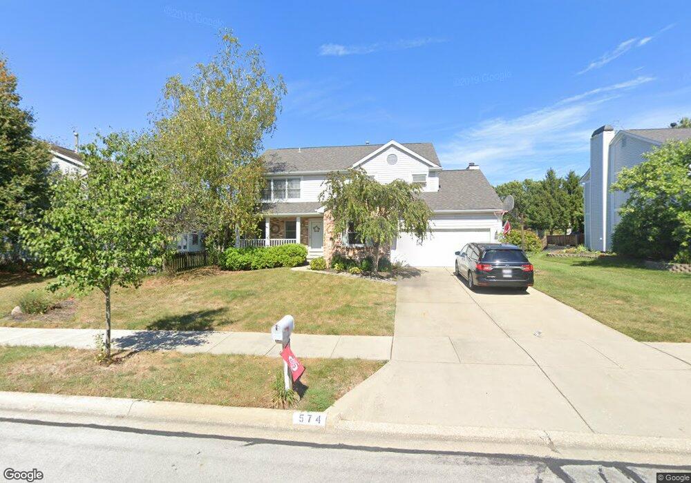
574 Peach St Westerville, OH 43082
Estimated Value: $445,000 - $469,000
4
Beds
3
Baths
2,363
Sq Ft
$193/Sq Ft
Est. Value
About This Home
This home is located at 574 Peach St, Westerville, OH 43082 and is currently estimated at $456,289, approximately $193 per square foot. 574 Peach St is a home located in Delaware County with nearby schools including Robert Frost Elementary School, Heritage Middle School, and Westerville-North High School.
Ownership History
Date
Name
Owned For
Owner Type
Purchase Details
Closed on
Oct 29, 2024
Sold by
Bogosian Victor and Bogosian Kathleen M
Bought by
Bogosian Family Trust and Bogosian
Current Estimated Value
Purchase Details
Closed on
Jan 10, 1991
Bought by
Bogosian Victor Jr Kathleen M
Create a Home Valuation Report for This Property
The Home Valuation Report is an in-depth analysis detailing your home's value as well as a comparison with similar homes in the area
Home Values in the Area
Average Home Value in this Area
Purchase History
| Date | Buyer | Sale Price | Title Company |
|---|---|---|---|
| Bogosian Family Trust | -- | None Listed On Document | |
| Bogosian Victor Jr Kathleen M | $138,000 | -- |
Source: Public Records
Tax History
| Year | Tax Paid | Tax Assessment Tax Assessment Total Assessment is a certain percentage of the fair market value that is determined by local assessors to be the total taxable value of land and additions on the property. | Land | Improvement |
|---|---|---|---|---|
| 2024 | $6,614 | $129,820 | $29,400 | $100,420 |
| 2023 | $6,538 | $129,820 | $29,400 | $100,420 |
| 2022 | $6,391 | $98,180 | $20,130 | $78,050 |
| 2021 | $6,446 | $98,180 | $20,130 | $78,050 |
| 2020 | $6,489 | $98,180 | $20,130 | $78,050 |
| 2019 | $5,601 | $80,960 | $17,500 | $63,460 |
| 2018 | $5,507 | $80,960 | $17,500 | $63,460 |
| 2017 | $5,342 | $73,540 | $12,740 | $60,800 |
| 2016 | $5,457 | $73,540 | $12,740 | $60,800 |
| 2015 | $5,220 | $73,540 | $12,740 | $60,800 |
| 2014 | $5,273 | $73,540 | $12,740 | $60,800 |
| 2013 | $5,029 | $70,110 | $12,740 | $57,370 |
Source: Public Records
Map
Nearby Homes
- 478 Burns Dr N
- 222 Juniper Ave
- 393 Canterbury Ct
- 660 Albion Place Unit 8660
- 373 Wyndham Park S
- 192 Sassafras Way
- 570 Susan Ave
- 339 Aylesbury Dr S
- 629 Andrew Ave
- 403 Windemere Cir Unit 403
- 266 Black Walnut Dr
- 303 Pointe Place
- 787 Centerpark Dr
- 852 Karen Ct
- 329 Hampton Park
- 687 E College Ave
- 328 Myrtle Dr Unit Lot 5
- 348 Myrtle Dr Unit Lot 10
- 337 Myrtle Dr Unit Lot 2
- 334 Myrtle Dr Unit Lot 7
- 390 Mulberry Way W
- 582 Peach St
- 575 Mulberry Way N
- 567 Mulberry Way N
- 573 Peach St
- 401 Burns Dr N
- 579 Peach St
- 391 Burns Dr N
- 585 Mulberry Way N
- 585 Peach St
- 393 Mulberry Way W
- 385 Mulberry Way W
- 399 Mulberry Way W
- 379 Mulberry Way W
- 595 Peach St
- 572 Mulberry Way N
- 407 Mulberry Way W
- 568 Apple St
- 582 Mulberry Way N
- 566 Mulberry Way N
Your Personal Tour Guide
Ask me questions while you tour the home.