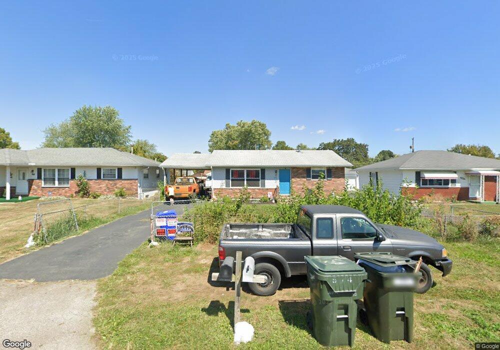
574 Rumsey Rd Columbus, OH 43207
Obetz-Lockbourne NeighborhoodEstimated Value: $166,000 - $182,000
3
Beds
1
Bath
980
Sq Ft
$176/Sq Ft
Est. Value
About This Home
This home is located at 574 Rumsey Rd, Columbus, OH 43207 and is currently estimated at $172,032, approximately $175 per square foot. 574 Rumsey Rd is a home located in Franklin County with nearby schools including Parsons Elementary School, Buckeye Middle School, and Marion-Franklin High School.
Ownership History
Date
Name
Owned For
Owner Type
Purchase Details
Closed on
Aug 23, 2024
Sold by
Hatfield Jimmy J
Bought by
Rockstar Realty Llc
Current Estimated Value
Purchase Details
Closed on
Dec 16, 2004
Sold by
Dale Carlos D
Bought by
Hatfield Jimmy J
Purchase Details
Closed on
Jul 14, 2000
Sold by
Davis Irene
Bought by
Dale Carlos D
Home Financials for this Owner
Home Financials are based on the most recent Mortgage that was taken out on this home.
Original Mortgage
$48,150
Interest Rate
7.4%
Purchase Details
Closed on
Feb 10, 2000
Sold by
Estate Of Cassen Davis
Bought by
Davis Irene
Purchase Details
Closed on
May 6, 1966
Bought by
Davis Cassen and Davis Irene
Create a Home Valuation Report for This Property
The Home Valuation Report is an in-depth analysis detailing your home's value as well as a comparison with similar homes in the area
Home Values in the Area
Average Home Value in this Area
Purchase History
| Date | Buyer | Sale Price | Title Company |
|---|---|---|---|
| Rockstar Realty Llc | $100,000 | Chase Title & Escrow Services | |
| Hatfield Jimmy J | $62,500 | Land Sel Ti | |
| Dale Carlos D | $53,500 | Landsel Title Agency Inc | |
| Davis Irene | -- | -- | |
| Davis Cassen | -- | -- |
Source: Public Records
Mortgage History
| Date | Status | Borrower | Loan Amount |
|---|---|---|---|
| Previous Owner | Dale Carlos D | $48,150 |
Source: Public Records
Tax History
| Year | Tax Paid | Tax Assessment Tax Assessment Total Assessment is a certain percentage of the fair market value that is determined by local assessors to be the total taxable value of land and additions on the property. | Land | Improvement |
|---|---|---|---|---|
| 2025 | $2,562 | $55,900 | $17,610 | $38,290 |
| 2024 | $2,562 | $55,900 | $17,610 | $38,290 |
| 2023 | $2,530 | $55,895 | $17,605 | $38,290 |
| 2022 | $2,159 | $26,190 | $9,420 | $16,770 |
| 2021 | $1,394 | $26,190 | $9,420 | $16,770 |
| 2020 | $1,396 | $26,190 | $9,420 | $16,770 |
| 2019 | $1,400 | $22,510 | $8,190 | $14,320 |
| 2018 | $699 | $22,510 | $8,190 | $14,320 |
| 2017 | $1,399 | $22,510 | $8,190 | $14,320 |
| 2016 | $1,529 | $22,510 | $2,940 | $19,570 |
| 2015 | $696 | $22,510 | $2,940 | $19,570 |
| 2014 | $1,396 | $22,510 | $2,940 | $19,570 |
| 2013 | $724 | $23,660 | $3,080 | $20,580 |
Source: Public Records
Map
Nearby Homes
- 691 Colton Rd
- 1633-1635 E Greenway Ave
- 3380 Parsons Ave
- 780 Basswood Rd
- 435 Carolann Ave
- 3302 Hilock Place
- 0 Williams Rd
- 860 Basswood Rd
- 3251 Hilock Ct
- 562 Ashwood Rd
- 460 Coulter Ave
- 525 Ashwood Rd
- 3608 S Champion Ave
- 577 Barcher Rd
- 884 Bruckner Rd
- 135 Rumsey Rd
- 228 Currier Dr
- 245 Marilla Rd
- 211 Delaney Dr
- 484 Cedarwood Rd
- 580 Rumsey Rd
- 568 Rumsey Rd
- 584 Rumsey Rd
- 1119 Rumsey Rd
- 563 Stockbridge Rd
- 551 Stockbridge Rd
- 569 Stockbridge Rd
- 590 Rumsey Rd
- 539 Stockbridge Rd
- 575 Stockbridge Rd
- 571 Rumsey Rd
- 577 Rumsey Rd
- 577 Stockbridge Rd
- 531 Stockbridge Rd
- 600 Rumsey Rd
- 555 Rumsey Rd
- 581 Stockbridge Rd
- 589 Rumsey Rd
- 524 Rumsey Rd
- 0 Rumsey Rd
Your Personal Tour Guide
Ask me questions while you tour the home.