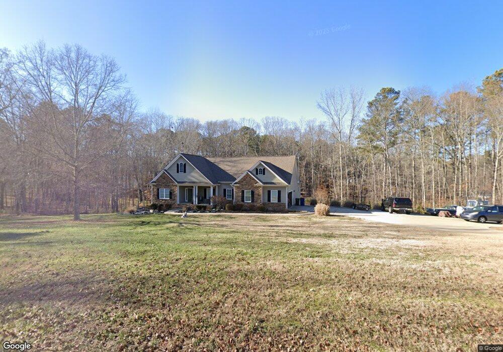
5740 Cook Rd Powder Springs, GA 30127
West Cobb NeighborhoodEstimated Value: $433,000 - $813,535
3
Beds
3
Baths
1,844
Sq Ft
$364/Sq Ft
Est. Value
About This Home
This home is located at 5740 Cook Rd, Powder Springs, GA 30127 and is currently estimated at $670,384, approximately $363 per square foot. 5740 Cook Rd is a home with nearby schools including Vaughan Elementary School, Lost Mountain Middle School, and Harrison High School.
Ownership History
Date
Name
Owned For
Owner Type
Purchase Details
Closed on
Aug 21, 2020
Sold by
Phillips Taylor and Phillips Kelsey Ann
Bought by
Davis Sean and Kostova Raina
Current Estimated Value
Home Financials for this Owner
Home Financials are based on the most recent Mortgage that was taken out on this home.
Original Mortgage
$481,500
Outstanding Balance
$427,124
Interest Rate
3%
Mortgage Type
New Conventional
Estimated Equity
$243,260
Purchase Details
Closed on
Jan 29, 2020
Sold by
Larkin Charles J
Bought by
Phillips Taylor and Phillips Kelsey Ann
Home Financials for this Owner
Home Financials are based on the most recent Mortgage that was taken out on this home.
Original Mortgage
$350,000
Interest Rate
3.72%
Mortgage Type
New Conventional
Create a Home Valuation Report for This Property
The Home Valuation Report is an in-depth analysis detailing your home's value as well as a comparison with similar homes in the area
Home Values in the Area
Average Home Value in this Area
Purchase History
| Date | Buyer | Sale Price | Title Company |
|---|---|---|---|
| Davis Sean | $535,000 | None Available | |
| Phillips Taylor | $500,000 | -- |
Source: Public Records
Mortgage History
| Date | Status | Borrower | Loan Amount |
|---|---|---|---|
| Open | Davis Sean | $481,500 | |
| Previous Owner | Phillips Taylor | $350,000 |
Source: Public Records
Tax History Compared to Growth
Tax History
| Year | Tax Paid | Tax Assessment Tax Assessment Total Assessment is a certain percentage of the fair market value that is determined by local assessors to be the total taxable value of land and additions on the property. | Land | Improvement |
|---|---|---|---|---|
| 2025 | $8,604 | $285,576 | $150,900 | $134,676 |
| 2024 | $8,610 | $285,576 | $150,900 | $134,676 |
| 2023 | $7,625 | $252,904 | $140,672 | $112,232 |
| 2022 | $6,320 | $208,248 | $112,536 | $95,712 |
| 2021 | $6,320 | $208,248 | $112,536 | $95,712 |
| 2020 | $4,037 | $154,764 | $92,076 | $62,688 |
| 2019 | $4,037 | $154,764 | $92,076 | $62,688 |
| 2018 | $3,762 | $142,184 | $84,404 | $57,780 |
| 2017 | $3,607 | $142,184 | $84,404 | $57,780 |
| 2016 | $3,216 | $124,280 | $66,500 | $57,780 |
| 2015 | $2,953 | $109,076 | $63,940 | $45,136 |
| 2014 | $2,978 | $109,076 | $0 | $0 |
Source: Public Records
Map
Nearby Homes
- 5750 Cook Rd
- 329 Mont Harmony Rd SW
- 5455 Malone Ct
- 5684 Sunburst Dale
- 846 Holland Rd
- 303 Rockledge Bend SW
- 247 Rockledge Bend SW
- 264 Rockledge Bend SW
- 21 Nuttail Ln
- 251 Rockledge Bend
- 252 Rockledge Bend SW
- 243 Rockledge Bend SW
- 260 Rockledge Bend SW
- 239 Rockledge Bend SW
- 284 Rockledge Bend SW
- 276 Rockledge Bend SW
- 6013 Katie Emma Dr
- 5907 Seven Oaks Dr
- 0 Seven Oaks Dr Unit 1523471
- 679 Crest Line Trail
- 5755 Cook Rd
- 1008 Holland Rd
- 1035 Holland Rd
- 1025 Holland Rd
- 0 Holland Rd & Cook
- 5760 Cook Rd
- 992 Holland Rd
- 5765 Cook Rd
- 5768 Cook Rd
- 5743 Sunburst Dr
- 5737 Sunburst Dr
- 984 Holland Rd
- 355 Brinkley Rd
- 1030 Holland Rd Unit 36494347
- 1030 Holland Rd Unit 36438920
- 1030 Holland Rd Unit 36028874
- 1030 Holland Rd Unit 36028687
- 1030 Holland Rd Unit 36028663
- 1030 Holland Rd
- 5731 Sunburst Dr