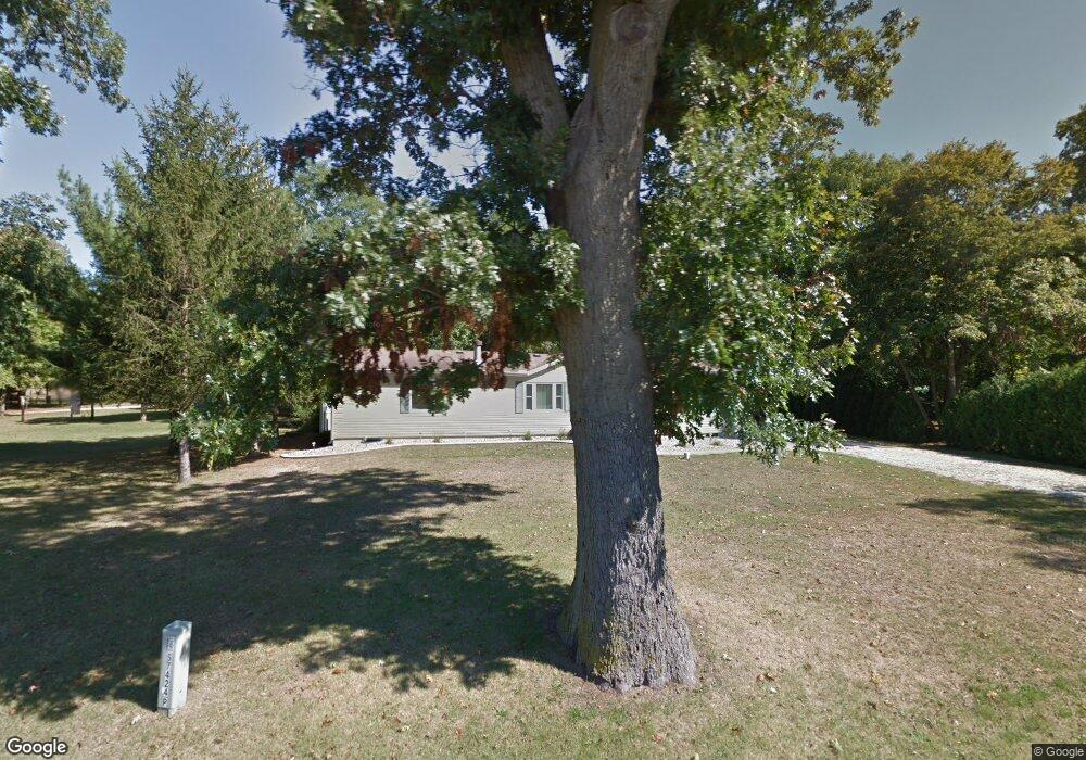
57436 Pear Rd South Bend, IN 46619
Estimated Value: $238,000 - $276,000
3
Beds
2
Baths
1,716
Sq Ft
$147/Sq Ft
Est. Value
About This Home
This home is located at 57436 Pear Rd, South Bend, IN 46619 and is currently estimated at $252,337, approximately $147 per square foot. 57436 Pear Rd is a home located in St. Joseph County with nearby schools including Paton-Churdan Elementary School, Wilson Elementary School, and Clay Intermediate Center.
Ownership History
Date
Name
Owned For
Owner Type
Purchase Details
Closed on
Sep 26, 2007
Sold by
American General Financial Services Inc
Bought by
Kukla Angelia M
Current Estimated Value
Purchase Details
Closed on
May 10, 2007
Sold by
Ruszkowski Dan A and Yoder Susan L
Bought by
American General Financial Services Inc
Create a Home Valuation Report for This Property
The Home Valuation Report is an in-depth analysis detailing your home's value as well as a comparison with similar homes in the area
Home Values in the Area
Average Home Value in this Area
Purchase History
| Date | Buyer | Sale Price | Title Company |
|---|---|---|---|
| Kukla Angelia M | -- | Stewart Title | |
| Kukla Angela M | -- | None Available | |
| American General Financial Services Inc | $85,000 | None Available |
Source: Public Records
Tax History Compared to Growth
Tax History
| Year | Tax Paid | Tax Assessment Tax Assessment Total Assessment is a certain percentage of the fair market value that is determined by local assessors to be the total taxable value of land and additions on the property. | Land | Improvement |
|---|---|---|---|---|
| 2024 | $1,712 | $153,600 | $32,500 | $121,100 |
| 2023 | $1,657 | $157,900 | $32,500 | $125,400 |
| 2022 | $1,807 | $158,900 | $32,500 | $126,400 |
| 2021 | $1,784 | $146,800 | $15,700 | $131,100 |
| 2020 | $1,341 | $123,100 | $13,100 | $110,000 |
| 2019 | $1,031 | $116,200 | $12,200 | $104,000 |
| 2018 | $1,035 | $115,000 | $11,600 | $103,400 |
| 2017 | $1,044 | $112,500 | $11,600 | $100,900 |
| 2016 | $1,094 | $114,400 | $11,600 | $102,800 |
| 2014 | $812 | $97,200 | $9,600 | $87,600 |
Source: Public Records
Map
Nearby Homes
- 26541 Gaited Horse Trail
- 57223 Pine Needle Ct
- 57210 White Pine Trail
- 57115 White Pine Trail
- 27180 Harrison Rd
- 56451 Quince Rd
- 57248 Mcquade St
- 57860 Crumstown Hwy
- 57195 Pinewood Dr
- 55629 Cardinal Dr
- 26366 Hummingbird Rd
- 56435 Eastlea Dr
- 55915 Dorn St
- 54962 Quince Rd
- 25260 Fillmore Rd
- 56915 Tulip Rd
- 56803 Tulip Rd
- 56729 Tulip Rd
- 56659 Tulip Rd
- 56611 Tulip Rd
- 57424 Pear Rd
- 57458 Pear Rd
- 57369 Pear Rd
- 57510 Pear Rd
- 57485 Pear Rd
- 57358 Pear Rd
- 26625 Gaited Horse Trail
- LOT 3 Pear Rd
- LOT 4 Pear Rd
- 26529 Gaited Horse Trail
- 57324 Pear Rd
- 26581 Gaited Horse Trail
- 57521 Pear Rd
- 57325 Pear Rd
- 57503 Walking Horse Cir
- 26632 Gaited Horse Trail
- 26632 Gaited Horse Trail Unit 14
- 57292 Pear Rd
- 57606 Pear Rd
- 26521 Gaited Horse Trail