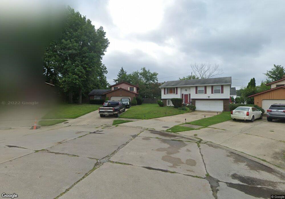
5745 E 146th St Maple Heights, OH 44137
Estimated Value: $160,000 - $185,000
3
Beds
2
Baths
1,736
Sq Ft
$100/Sq Ft
Est. Value
About This Home
This home is located at 5745 E 146th St, Maple Heights, OH 44137 and is currently estimated at $174,360, approximately $100 per square foot. 5745 E 146th St is a home located in Cuyahoga County with nearby schools including Abraham Lincoln Elementary School, Rockside/ J.F. Kennedy School, and Barack Obama School.
Ownership History
Date
Name
Owned For
Owner Type
Purchase Details
Closed on
Jul 2, 2013
Sold by
Wells Fargo Bank Na
Bought by
Nicholson Robert L
Current Estimated Value
Home Financials for this Owner
Home Financials are based on the most recent Mortgage that was taken out on this home.
Original Mortgage
$69,117
Interest Rate
3.87%
Mortgage Type
FHA
Purchase Details
Closed on
Feb 13, 2013
Sold by
Petway Holland E
Bought by
Wells Fargo Bank Na
Purchase Details
Closed on
Jan 27, 2009
Sold by
Estate Of Ellen L Loury
Bought by
Petway Holland E
Purchase Details
Closed on
Jul 30, 2004
Sold by
Hodali Qais A and Hodali Zahia
Bought by
Loury Ellen L
Home Financials for this Owner
Home Financials are based on the most recent Mortgage that was taken out on this home.
Original Mortgage
$115,920
Interest Rate
6.75%
Mortgage Type
Purchase Money Mortgage
Purchase Details
Closed on
Feb 22, 2001
Sold by
Dayem Maher A and Dayem Islam Y
Bought by
Hodali Oais A and Hodali Zahia
Home Financials for this Owner
Home Financials are based on the most recent Mortgage that was taken out on this home.
Original Mortgage
$102,400
Interest Rate
6.91%
Purchase Details
Closed on
Dec 13, 2000
Sold by
Dayem Maher A
Bought by
Dayem Maher A and Dayem Islam Y
Purchase Details
Closed on
Aug 28, 1998
Sold by
Phillips Laron and Phillips Edna J
Bought by
Dayem Maher A
Home Financials for this Owner
Home Financials are based on the most recent Mortgage that was taken out on this home.
Original Mortgage
$99,450
Interest Rate
10.25%
Purchase Details
Closed on
Oct 7, 1991
Sold by
Piunno Richard J
Bought by
Phillips Laron
Purchase Details
Closed on
Aug 10, 1978
Bought by
Piunno Richard J
Purchase Details
Closed on
Jul 20, 1977
Bought by
Northern Industries Inc
Purchase Details
Closed on
May 12, 1977
Sold by
Seminsky Kathleen
Bought by
Norther Industies Inc
Purchase Details
Closed on
Jan 1, 1975
Bought by
Seminsky Kathleen
Create a Home Valuation Report for This Property
The Home Valuation Report is an in-depth analysis detailing your home's value as well as a comparison with similar homes in the area
Home Values in the Area
Average Home Value in this Area
Purchase History
| Date | Buyer | Sale Price | Title Company |
|---|---|---|---|
| Nicholson Robert L | $43,000 | Servicelink | |
| Wells Fargo Bank Na | $26,667 | Attorney | |
| Petway Holland E | -- | None Available | |
| Loury Ellen L | $144,900 | Land Title Agency | |
| Hodali Oais A | -- | Midland Title Security Inc | |
| Dayem Maher A | -- | Midland Commerce Group | |
| Dayem Maher A | $117,000 | -- | |
| Phillips Laron | $92,500 | -- | |
| Piunno Richard J | $60,200 | -- | |
| Northern Industries Inc | -- | -- | |
| Norther Industies Inc | -- | -- | |
| Seminsky Kathleen | -- | -- |
Source: Public Records
Mortgage History
| Date | Status | Borrower | Loan Amount |
|---|---|---|---|
| Previous Owner | Nicholson Robert L | $69,117 | |
| Previous Owner | Loury Ellen L | $115,920 | |
| Previous Owner | Hodali Oais A | $102,400 | |
| Previous Owner | Dayem Maher A | $99,450 | |
| Closed | Loury Ellen L | $21,735 |
Source: Public Records
Tax History
| Year | Tax Paid | Tax Assessment Tax Assessment Total Assessment is a certain percentage of the fair market value that is determined by local assessors to be the total taxable value of land and additions on the property. | Land | Improvement |
|---|---|---|---|---|
| 2025 | $4,280 | $55,825 | $8,575 | $47,250 |
| 2024 | $4,783 | $55,825 | $8,575 | $47,250 |
| 2023 | $3,577 | $35,920 | $6,340 | $29,580 |
| 2022 | $3,563 | $35,910 | $6,340 | $29,580 |
| 2021 | $3,815 | $35,910 | $6,340 | $29,580 |
| 2020 | $3,220 | $27,200 | $4,800 | $22,400 |
| 2019 | $3,210 | $77,700 | $13,700 | $64,000 |
| 2018 | $3,046 | $27,200 | $4,800 | $22,400 |
| 2017 | $3,107 | $25,770 | $3,960 | $21,810 |
| 2016 | $3,008 | $25,770 | $3,960 | $21,810 |
| 2015 | $2,875 | $25,770 | $3,960 | $21,810 |
| 2014 | $2,875 | $26,570 | $4,060 | $22,510 |
Source: Public Records
Map
Nearby Homes
- 14808 James Ave
- 14214 Tabor Ave
- 14203 Tabor Ave
- 14012 Wheeler Rd
- 14413 Krems Ave
- 14320 Janice Dr
- 5853 Monica Ln
- 14112 Krems Ave
- 13804 Rockside Rd
- 13905 Thraves Ave
- 5948 Dunham Rd
- 15313 Fernway Dr
- 13800 Milo Rd
- 15800 Northwood Ave
- 13810 Martin Dr
- 6039 E 135th St
- 15817 Northwood Ave
- 13741 Grove Dr
- 6045 Dunham Rd
- 13513 York Blvd
- 5741 E 146th St
- 5749 E 146th St
- 14609 Rockside Rd
- 5737 E 146th St
- 14601 Rockside Rd
- 5744 E 146th St
- 14551 Rockside Rd
- 14705 Rockside Rd
- 5733 E 146th St
- 5740 E 146th St
- 14519 Rockside Rd
- 14709 Rockside Rd
- 5736 E 146th St
- 5729 E 146th St
- 14713 Rockside Rd
- 14513 Rockside Rd
- 5732 E 146th St
- 5725 E 146th St
- 14721 Rockside Rd
Your Personal Tour Guide
Ask me questions while you tour the home.