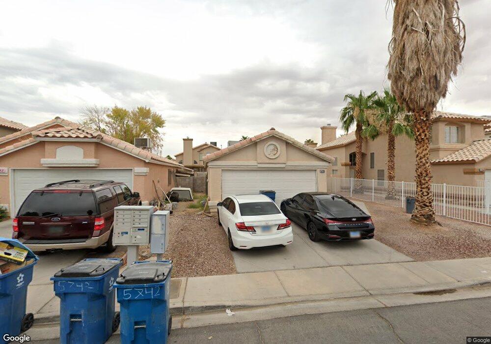
5748 Slice Dr Las Vegas, NV 89142
Estimated Value: $320,130 - $342,000
2
Beds
2
Baths
1,051
Sq Ft
$317/Sq Ft
Est. Value
About This Home
This home is located at 5748 Slice Dr, Las Vegas, NV 89142 and is currently estimated at $333,283, approximately $317 per square foot. 5748 Slice Dr is a home located in Clark County with nearby schools including John F. Mendoza Elementary School, Duane D. Keller Middle School, and Las Vegas High School.
Ownership History
Date
Name
Owned For
Owner Type
Purchase Details
Closed on
Jul 27, 2002
Sold by
Acevedo Jamie
Bought by
Acevedo Gloria
Current Estimated Value
Purchase Details
Closed on
Sep 28, 1994
Sold by
Pacific Properties & Development Corp
Bought by
Acevedo Jaime and Acevedo Gloria
Home Financials for this Owner
Home Financials are based on the most recent Mortgage that was taken out on this home.
Original Mortgage
$92,514
Interest Rate
8.58%
Mortgage Type
VA
Create a Home Valuation Report for This Property
The Home Valuation Report is an in-depth analysis detailing your home's value as well as a comparison with similar homes in the area
Home Values in the Area
Average Home Value in this Area
Purchase History
| Date | Buyer | Sale Price | Title Company |
|---|---|---|---|
| Acevedo Gloria | -- | -- | |
| Acevedo Jaime | $91,000 | Nevada Title Company |
Source: Public Records
Mortgage History
| Date | Status | Borrower | Loan Amount |
|---|---|---|---|
| Closed | Acevedo Jaime | $92,514 |
Source: Public Records
Tax History
| Year | Tax Paid | Tax Assessment Tax Assessment Total Assessment is a certain percentage of the fair market value that is determined by local assessors to be the total taxable value of land and additions on the property. | Land | Improvement |
|---|---|---|---|---|
| 2026 | $1,175 | $60,805 | $23,450 | $37,355 |
| 2025 | $1,088 | $60,937 | $22,750 | $38,187 |
| 2024 | $1,152 | $60,937 | $22,750 | $38,187 |
| 2023 | $1,152 | $62,685 | $26,250 | $36,435 |
| 2022 | $934 | $55,152 | $21,700 | $33,452 |
| 2021 | $865 | $52,001 | $19,950 | $32,051 |
| 2020 | $800 | $50,842 | $18,900 | $31,942 |
| 2019 | $750 | $47,613 | $16,100 | $31,513 |
| 2018 | $716 | $43,811 | $13,300 | $30,511 |
| 2017 | $1,197 | $40,822 | $9,800 | $31,022 |
| 2016 | $671 | $36,539 | $8,400 | $28,139 |
| 2015 | $669 | $26,661 | $5,600 | $21,061 |
| 2014 | $649 | $21,875 | $5,250 | $16,625 |
Source: Public Records
Map
Nearby Homes
- 5650 E Sahara Ave Unit 1037
- 5650 E Sahara Ave Unit 2026
- 5650 E Sahara Ave Unit 1039
- 5650 E Sahara Ave Unit 1057
- 5650 E Sahara Ave Unit 2010
- 5655 E Sahara Ave Unit 1023
- 5921 Sunrise Hills Dr
- 5686 Roundrock Dr
- 5679 Roundrock Dr
- 5832 Ballinger Dr
- 5747 Coleridge Way
- 5816 Glory Canyon Way
- 1841 Skywood Way
- 2508 Alfa Cir
- 5539 Ballinger Dr
- 6045 Peach Orchard Rd
- 2711 Morning Break Ct
- 2184 Raspberry Hill Rd
- 5634 Alcott Ave
- 5973 Balsam Pine Dr
- 5756 Slice Dr
- 5742 Slice Dr
- 5764 Slice Dr
- 5734 Slice Dr
- 5751 Sandtrap Ct
- 5743 Sandtrap Ct
- 5735 Sandtrap Ct
- 5759 Sandtrap Ct
- 5774 Slice Dr
- 5726 Slice Dr
- 2304 Underpar Cir
- 5769 Sandtrap Ct
- 5727 Sandtrap Ct
- 2314 Underpar Cir
- 5777 Sandtrap Ct
- 5786 Slice Dr
- 2301 Crowley Way
- 2303 Underpar Cir
- 2288 Bowstring Dr
- 2296 Bowstring Dr
Your Personal Tour Guide
Ask me questions while you tour the home.