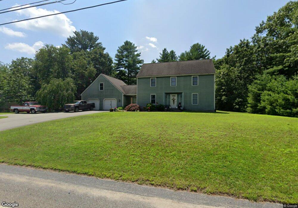
575 E Hartford Ave Uxbridge, MA 01569
Estimated Value: $679,000 - $774,000
4
Beds
3
Baths
2,648
Sq Ft
$270/Sq Ft
Est. Value
About This Home
This home is located at 575 E Hartford Ave, Uxbridge, MA 01569 and is currently estimated at $713,989, approximately $269 per square foot. 575 E Hartford Ave is a home located in Worcester County with nearby schools including Uxbridge High School, Our Lady of the Valley Regional School, and Whitinsville Christian School.
Create a Home Valuation Report for This Property
The Home Valuation Report is an in-depth analysis detailing your home's value as well as a comparison with similar homes in the area
Home Values in the Area
Average Home Value in this Area
Tax History Compared to Growth
Tax History
| Year | Tax Paid | Tax Assessment Tax Assessment Total Assessment is a certain percentage of the fair market value that is determined by local assessors to be the total taxable value of land and additions on the property. | Land | Improvement |
|---|---|---|---|---|
| 2025 | $74 | $566,500 | $141,700 | $424,800 |
| 2024 | $6,988 | $540,900 | $130,000 | $410,900 |
| 2023 | $6,788 | $486,600 | $118,000 | $368,600 |
| 2022 | $6,255 | $412,600 | $107,000 | $305,600 |
| 2021 | $6,453 | $407,900 | $102,300 | $305,600 |
| 2020 | $6,349 | $379,300 | $106,300 | $273,000 |
| 2019 | $6,140 | $353,900 | $98,400 | $255,500 |
| 2018 | $6,188 | $360,400 | $98,400 | $262,000 |
| 2017 | $5,722 | $337,400 | $92,900 | $244,500 |
| 2016 | $6,083 | $346,200 | $95,400 | $250,800 |
| 2015 | $5,942 | $341,500 | $95,400 | $246,100 |
Source: Public Records
Map
Nearby Homes
- 14 Woodland Rd
- 46 Pouts Ln Unit 46
- 230 Quaker St
- 20 Nature View Dr Unit 20
- 107 Henry St
- 24 Olde Canal Way Unit 24
- 75 Lake St
- 50 Carrington Ln
- 37 Elizabeth St
- 44 Arthur Dr Unit 44
- next 191 Mendon Rd
- 185 Prairie St
- 0 Louis St
- 4 Strathmore Shire Dr Unit B
- 3 Strathmore Shire Unit A
- 72 Homeward Ave
- 27 Taft Ave
- 30 Taft Ave
- 23 Uxbridge Rd
- 13A Asylum St