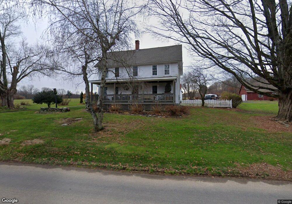
575 Grant Hill Rd Coventry, CT 06238
Estimated Value: $409,892 - $474,000
3
Beds
2
Baths
2,062
Sq Ft
$215/Sq Ft
Est. Value
About This Home
This home is located at 575 Grant Hill Rd, Coventry, CT 06238 and is currently estimated at $443,723, approximately $215 per square foot. 575 Grant Hill Rd is a home located in Tolland County with nearby schools including Coventry Grammar School, George Hersey Robertson School, and Capt. Nathan Hale School.
Ownership History
Date
Name
Owned For
Owner Type
Purchase Details
Closed on
Oct 1, 2007
Sold by
Brousseau-Bell Linda
Bought by
Decormier Matthew C
Current Estimated Value
Home Financials for this Owner
Home Financials are based on the most recent Mortgage that was taken out on this home.
Original Mortgage
$172,500
Interest Rate
6.65%
Create a Home Valuation Report for This Property
The Home Valuation Report is an in-depth analysis detailing your home's value as well as a comparison with similar homes in the area
Home Values in the Area
Average Home Value in this Area
Purchase History
| Date | Buyer | Sale Price | Title Company |
|---|---|---|---|
| Decormier Matthew C | $150,000 | -- | |
| Decormier Matthew C | $150,000 | -- |
Source: Public Records
Mortgage History
| Date | Status | Borrower | Loan Amount |
|---|---|---|---|
| Open | Decormier Matthew C | $22,500 | |
| Open | Decormier Matthew C | $218,500 | |
| Closed | Decormier Matthew C | $172,500 |
Source: Public Records
Tax History
| Year | Tax Paid | Tax Assessment Tax Assessment Total Assessment is a certain percentage of the fair market value that is determined by local assessors to be the total taxable value of land and additions on the property. | Land | Improvement |
|---|---|---|---|---|
| 2025 | $6,023 | $253,500 | $58,300 | $195,200 |
| 2024 | $5,879 | $176,500 | $48,100 | $128,400 |
| 2023 | $5,602 | $176,500 | $48,100 | $128,400 |
| 2022 | $5,498 | $176,500 | $48,100 | $128,400 |
| 2021 | $5,498 | $176,500 | $48,100 | $128,400 |
| 2020 | $5,502 | $176,500 | $48,100 | $128,400 |
| 2019 | $5,683 | $176,500 | $48,100 | $128,400 |
| 2018 | $5,754 | $178,700 | $48,100 | $130,600 |
| 2017 | $5,718 | $178,700 | $48,100 | $130,600 |
| 2016 | $5,575 | $178,700 | $48,100 | $130,600 |
| 2015 | $5,575 | $178,700 | $48,100 | $130,600 |
| 2014 | $5,489 | $192,800 | $58,700 | $134,100 |
Source: Public Records
Map
Nearby Homes
- 395 Grant Hill Rd Unit Lot21
- 395 Grant Hill (Mill Race Drive) Lot #21 Rd
- 37 Wolf Hill Rd Unit Lot 40
- 37 Wolf Hill Lot (#40) Rd
- 279 Mark Dr
- 25 Wolf Hill Rd
- 0 Boston Turnpike Unit 24128587
- 64 Columbine Rd
- 23 Neville St
- 864 Boston Turnpike
- 15 Elm Rd
- 499 Woodmont Dr
- 106 David Dr
- 93 Dockerel Rd
- 5 Laurelwood Ln Unit lot 16
- 0 Mile Hill Rd
- 7 Laurelwood Ln Unit Lot 15
- 12 Laurelwood Ln Unit lot 8
- 39 Josephine Way
- 16 Higgins Way
- 568 Grant Hill Rd
- 599 Grant Hill Rd
- 492 Grant Hill Rd
- 658 Broad Way
- 509 N School Rd
- 600 Broad Way
- 651 Broad Way
- 660 Grant Hill Rd
- 640 Broad Way
- 861 Dunn Rd
- 645 Broad Way
- 22 Tedford Dr
- 28 Tedford Dr
- 690 Grant Hill Rd
- 612 Broad Way
- 845 Dunn Rd
- 14 Tedford Dr
- 685 Grant Hill Rd
- 449 N School Rd
- 38 Tedford Dr
Your Personal Tour Guide
Ask me questions while you tour the home.