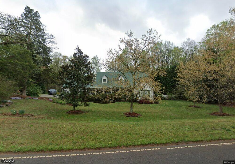
575 Hauser Rd Lewisville, NC 27023
Estimated Value: $361,084 - $445,000
3
Beds
2
Baths
1,578
Sq Ft
$260/Sq Ft
Est. Value
About This Home
This home is located at 575 Hauser Rd, Lewisville, NC 27023 and is currently estimated at $409,771, approximately $259 per square foot. 575 Hauser Rd is a home located in Forsyth County with nearby schools including Lewisville Elementary School, Meadowlark Middle School, and West Forsyth High.
Ownership History
Date
Name
Owned For
Owner Type
Purchase Details
Closed on
Mar 20, 2020
Sold by
Reid Christi Michelle
Bought by
Spicer Brian Scott
Current Estimated Value
Purchase Details
Closed on
Apr 21, 2016
Sold by
Holden Barbara A and Holden Williams E
Bought by
Spicer Brian S and Reid Christi M
Home Financials for this Owner
Home Financials are based on the most recent Mortgage that was taken out on this home.
Original Mortgage
$195,494
Interest Rate
3.68%
Mortgage Type
New Conventional
Purchase Details
Closed on
Aug 27, 1999
Sold by
Mcclearen Timothy T
Bought by
Mcclearen Barbara A
Create a Home Valuation Report for This Property
The Home Valuation Report is an in-depth analysis detailing your home's value as well as a comparison with similar homes in the area
Home Values in the Area
Average Home Value in this Area
Purchase History
| Date | Buyer | Sale Price | Title Company |
|---|---|---|---|
| Spicer Brian Scott | -- | None Available | |
| Spicer Brian S | $206,000 | None Available | |
| Mcclearen Barbara A | -- | -- |
Source: Public Records
Mortgage History
| Date | Status | Borrower | Loan Amount |
|---|---|---|---|
| Previous Owner | Spicer Brian S | $195,494 |
Source: Public Records
Tax History Compared to Growth
Tax History
| Year | Tax Paid | Tax Assessment Tax Assessment Total Assessment is a certain percentage of the fair market value that is determined by local assessors to be the total taxable value of land and additions on the property. | Land | Improvement |
|---|---|---|---|---|
| 2025 | $2,109 | $347,900 | $65,000 | $282,900 |
| 2024 | $2,013 | $213,300 | $47,100 | $166,200 |
| 2023 | $2,013 | $213,300 | $47,100 | $166,200 |
| 2022 | $2,013 | $213,300 | $47,100 | $166,200 |
| 2021 | $2,002 | $213,300 | $47,100 | $166,200 |
| 2020 | $1,877 | $186,200 | $41,600 | $144,600 |
| 2019 | $1,895 | $186,200 | $41,600 | $144,600 |
| 2018 | $1,832 | $186,200 | $41,600 | $144,600 |
| 2016 | $1,676 | $169,562 | $38,535 | $131,027 |
| 2015 | $1,676 | $169,562 | $38,535 | $131,027 |
| 2014 | $1,648 | $169,562 | $38,535 | $131,027 |
Source: Public Records
Map
Nearby Homes
- 1287 Creek Knoll Dr
- 1317 Creek Knoll Dr
- 1329 Creek Knoll Dr
- 1335 Creek Knoll Dr
- Roller Mill Plan at Montrachet
- Roller Mill II Plan at Montrachet
- Oak Crest Plan at Montrachet
- Heritage Bridge Plan at Montrachet
- 9340 Eden Grove Ct
- 9363 Eden Grove Ct
- 814 Montrachet Ct
- 834 Montrachet Ct
- 937 Montrachet Ct
- 1430 Messick Oaks Trail
- 9190 Top Ridge Ct
- 1492 Williams Rd
- 9109 Top Ridge Ct
- 9447 Lissara Camp Ct
- 9349 Lissara Camp Ct
- 9652 Lissara Camp Ct
- 582 Hauser Rd
- 561 Hauser Rd
- 13M,13N,14 Hauser Rd
- 501 Hauser Rd
- 465 Country Ln
- 463 Country Ln
- 475 Country Ln
- 610 Hauser Rd
- 531 Belmeade Way Trail
- 460 Country Ln
- 541 Belmeade Way Trail
- 521 Belmeade Way Trail
- 467 Brooke Hill Dr
- 449 Brooke Hill Dr
- 407 Brooke Hill Dr
- 461 Brooke Hill Dr
- 419 Brooke Hill Dr
- 413 Brooke Hill Dr
- 511 Belmeade Way Trail
- 545 Belmeade Way Trail