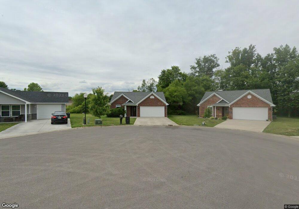
575 N Opal Dr Scottsburg, IN 47170
Estimated Value: $151,000 - $350,000
3
Beds
2
Baths
1,288
Sq Ft
$178/Sq Ft
Est. Value
About This Home
This home is located at 575 N Opal Dr, Scottsburg, IN 47170 and is currently estimated at $229,864, approximately $178 per square foot. 575 N Opal Dr is a home located in Scott County with nearby schools including Scottsburg Senior High School and Grace Christian Academy Inc.
Ownership History
Date
Name
Owned For
Owner Type
Purchase Details
Closed on
Sep 26, 2018
Sold by
Mayer Holding Co
Bought by
Woodard James P and Amburgey Michelle M
Current Estimated Value
Home Financials for this Owner
Home Financials are based on the most recent Mortgage that was taken out on this home.
Original Mortgage
$154,057
Outstanding Balance
$135,390
Interest Rate
4.87%
Mortgage Type
FHA
Estimated Equity
$94,474
Create a Home Valuation Report for This Property
The Home Valuation Report is an in-depth analysis detailing your home's value as well as a comparison with similar homes in the area
Home Values in the Area
Average Home Value in this Area
Purchase History
| Date | Buyer | Sale Price | Title Company |
|---|---|---|---|
| Woodard James P | -- | Signature Title Llc |
Source: Public Records
Mortgage History
| Date | Status | Borrower | Loan Amount |
|---|---|---|---|
| Open | Woodard James P | $154,057 |
Source: Public Records
Tax History Compared to Growth
Tax History
| Year | Tax Paid | Tax Assessment Tax Assessment Total Assessment is a certain percentage of the fair market value that is determined by local assessors to be the total taxable value of land and additions on the property. | Land | Improvement |
|---|---|---|---|---|
| 2024 | $1,281 | $128,100 | $20,000 | $108,100 |
| 2023 | $1,317 | $131,700 | $20,000 | $111,700 |
| 2022 | $1,338 | $133,800 | $20,000 | $113,800 |
| 2021 | $1,255 | $125,500 | $20,000 | $105,500 |
| 2020 | $1,267 | $125,700 | $25,000 | $100,700 |
| 2019 | $921 | $105,100 | $16,000 | $89,100 |
| 2018 | $352 | $64,500 | $6,500 | $58,000 |
| 2017 | $78 | $2,700 | $2,700 | $0 |
| 2016 | $78 | $2,700 | $2,700 | $0 |
| 2014 | $78 | $2,700 | $2,700 | $0 |
| 2013 | $78 | $2,700 | $2,700 | $0 |
Source: Public Records
Map
Nearby Homes
- 779 N Washington St
- 431 N 3rd St
- 476 N Meridian St
- 320 N 2nd St
- 615 Lakeshore Dr
- 688 Wanda St
- 0 W State Rd 56 Unit 2025010768
- 1114 N Pine St
- 914 W Owen St
- 82 Park Dr
- 43 S Railroad St
- 633 W Cherry St
- 951 York Rd
- 516 W Green St
- 973 Wooded Trail
- 25 N Beechwood Ave
- 251 E Davis St
- 1231 Woodland Ave
- 1239 Rolling Meadows Ct
- 865 S Main St
- 575 N Opal Dr
- 579 N Opal Dr
- 574 Opal Dr
- 573 N Opal Dr
- 541 N Main St
- 581 N Opal Dr
- 565 N Main St
- 544 N Opal Dr
- 553 N Main St
- 566 N Opal Dr
- 553 N Opal Dr
- 0 Lot 6 Opal Dr
- 0 N Opal Dr Unit 200807525
- 0 N Opal Dr Unit 3 200908358
- 0 N Opal Dr Unit 7-8 201003491
- 0 N Opal Dr Unit 8 201003489
- 0 N Opal Dr Unit 7 201003487
- 0 N Opal Dr Unit 6 201003484
- 0 N Opal Dr Unit 5 201003483
- 0 N Opal Dr Unit 201005297