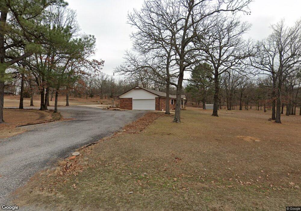
5750 W 163rd St N Skiatook, OK 74070
Estimated Value: $192,833 - $326,000
2
Beds
1
Bath
1,335
Sq Ft
$188/Sq Ft
Est. Value
About This Home
This home is located at 5750 W 163rd St N, Skiatook, OK 74070 and is currently estimated at $250,958, approximately $187 per square foot. 5750 W 163rd St N is a home located in Osage County with nearby schools including Marrs Elementary School, Newman Middle School, and Skiatook High School.
Ownership History
Date
Name
Owned For
Owner Type
Purchase Details
Closed on
Aug 25, 2023
Sold by
Willer Inge
Bought by
Inge M Willer Revocable Living Trust
Current Estimated Value
Purchase Details
Closed on
Jul 2, 2003
Sold by
Oxley Lee Forrest and Oxley Judy
Bought by
Willer Inge
Purchase Details
Closed on
Sep 28, 1994
Sold by
Oxley Lee F and Oxley Judy E
Bought by
Okla Conf Corp Of Seventh-Day
Create a Home Valuation Report for This Property
The Home Valuation Report is an in-depth analysis detailing your home's value as well as a comparison with similar homes in the area
Home Values in the Area
Average Home Value in this Area
Purchase History
| Date | Buyer | Sale Price | Title Company |
|---|---|---|---|
| Inge M Willer Revocable Living Trust | -- | None Listed On Document | |
| Willer Inge | $114,000 | -- | |
| Oxley Lee Forrest | -- | -- | |
| Okla Conf Corp Of Seventh-Day | -- | -- |
Source: Public Records
Tax History Compared to Growth
Tax History
| Year | Tax Paid | Tax Assessment Tax Assessment Total Assessment is a certain percentage of the fair market value that is determined by local assessors to be the total taxable value of land and additions on the property. | Land | Improvement |
|---|---|---|---|---|
| 2025 | $1,224 | $14,303 | $2,400 | $11,903 |
| 2024 | $1,228 | $14,303 | $2,400 | $11,903 |
| 2023 | $1,228 | $14,303 | $2,400 | $11,903 |
| 2022 | $1,219 | $14,303 | $2,400 | $11,903 |
| 2021 | $1,223 | $14,303 | $2,400 | $11,903 |
| 2020 | $1,230 | $14,303 | $2,400 | $11,903 |
| 2019 | $1,245 | $14,303 | $2,400 | $11,903 |
| 2018 | $1,240 | $14,303 | $2,400 | $11,903 |
| 2017 | $1,259 | $14,303 | $2,400 | $11,903 |
| 2016 | $1,263 | $14,305 | $2,317 | $11,988 |
| 2015 | $1,254 | $14,305 | $2,317 | $11,988 |
| 2014 | $1,192 | $14,305 | $2,317 | $11,988 |
| 2013 | $1,385 | $14,304 | $2,364 | $11,940 |
Source: Public Records
Map
Nearby Homes
- 16561 N 56th West Ave
- 5694 W 161st St N
- 5854 W 168th St N
- 5117 Woodland Dr
- 15524 N 55th West Ave
- 15439 N 55th West Ave
- 15971 Munson Ct
- 15823 Colonial Ln
- 18053 N Lombard
- 101 N Castle St
- 0 W Rogers Blvd Unit 2543424
- 401 S Buffalo
- 4 N 52nd West Ave
- 8 N 52nd West Ave
- 3 N 52nd West Ave
- 5 N 52nd West Ave
- 2 N 52nd West Ave
- 103 N Phillips St
- 501 Maplewood Ln
- 2 N Phillips St
- 5725 W 163rd St N
- 5755 W 163rd St N
- 16250 N 56th West Ave
- 5662 W 163rd St N
- 5850 W 163rd St N
- 16200 N 56th West Ave
- 16390 N 56th West Ave
- 16200 N 56th Ave W
- 16277 N 56th West Ave
- 11501 W 163rd St N
- 5601 W 163rd St N
- 16253 N 56th West Ave
- 16233 N 56th West Ave
- null N 56th West Ave
- 0 N 56th West Ave
- 0 N 56th Ave W Unit 2420372
- 0 N 56th Ave W Unit 2343342
- 0 N 56th Ave W Unit 2342096
- 5250 163rd West Ave
- 5535 W 163rd St N