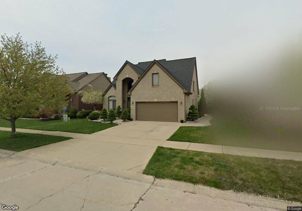
57501 Suffield Dr Washington, MI 48094
Estimated Value: $431,896 - $517,000
4
Beds
3
Baths
2,107
Sq Ft
$226/Sq Ft
Est. Value
About This Home
This home is located at 57501 Suffield Dr, Washington, MI 48094 and is currently estimated at $476,474, approximately $226 per square foot. 57501 Suffield Dr is a home located in Macomb County with nearby schools including Peace Lutheran School.
Ownership History
Date
Name
Owned For
Owner Type
Purchase Details
Closed on
Mar 13, 2018
Sold by
Srbinoska Donka and Srbinoski Velce
Bought by
Srbinoska Donka and Srbinoski Blagoja
Current Estimated Value
Purchase Details
Closed on
Jun 7, 2002
Sold by
Legacy Residential Inc
Bought by
Srbinoski Velce
Home Financials for this Owner
Home Financials are based on the most recent Mortgage that was taken out on this home.
Original Mortgage
$145,000
Outstanding Balance
$61,742
Interest Rate
6.91%
Estimated Equity
$414,732
Create a Home Valuation Report for This Property
The Home Valuation Report is an in-depth analysis detailing your home's value as well as a comparison with similar homes in the area
Home Values in the Area
Average Home Value in this Area
Purchase History
| Date | Buyer | Sale Price | Title Company |
|---|---|---|---|
| Srbinoska Donka | -- | None Available | |
| Srbinoski Velce | $223,000 | -- |
Source: Public Records
Mortgage History
| Date | Status | Borrower | Loan Amount |
|---|---|---|---|
| Open | Srbinoski Velce | $145,000 |
Source: Public Records
Tax History
| Year | Tax Paid | Tax Assessment Tax Assessment Total Assessment is a certain percentage of the fair market value that is determined by local assessors to be the total taxable value of land and additions on the property. | Land | Improvement |
|---|---|---|---|---|
| 2025 | $2,881 | $198,100 | $0 | $0 |
| 2024 | $28 | $205,900 | $0 | $0 |
| 2023 | $2,652 | $171,500 | $0 | $0 |
| 2022 | $3,731 | $156,200 | $0 | $0 |
| 2021 | $3,887 | $150,500 | $0 | $0 |
| 2020 | $2,456 | $144,400 | $0 | $0 |
| 2019 | $3,308 | $137,800 | $0 | $0 |
| 2018 | $3,144 | $131,700 | $0 | $0 |
| 2017 | $3,126 | $125,500 | $23,400 | $102,100 |
| 2016 | $3,131 | $125,500 | $0 | $0 |
| 2015 | -- | $120,300 | $0 | $0 |
| 2013 | $2,897 | $111,300 | $19,800 | $91,500 |
| 2012 | $2,897 | $98,800 | $0 | $0 |
Source: Public Records
Map
Nearby Homes
- 7427 Emerson
- 7640 Garland
- 57136 Megan Dr
- 6988 Boulder Pointe Dr Unit 85
- 58019 Van Dyke Rd
- 58106 Delmar
- 5748 Brookside Ln
- 58843 Gallery Ct Unit 28
- 5500 Crystal Creek Ln
- 8080 Wicker
- 0 Cathey Unit Lot 4
- 0 Cathey Unit Lot 5
- 55975 Sequoia Ct
- 58210 Timothy Ln
- 59807 Glacier Ridge N
- 8402 27 Mile Rd
- 57714 Abraham Dr
- 56696 Long Island Dr Unit 26
- 55712 Glenbrooke Dr
- 55667 Lochmoor Dr
- 57519 Suffield Dr
- 57483 Suffield Dr
- 6653 Breckenridge Dr
- 57537 Suffield Dr
- 6635 Breckenridge Dr
- 57504 Suffield Dr
- 57522 Suffield Dr
- 57555 Suffield Dr
- 57486 Suffield Dr
- 57540 Suffield Dr
- 6678 Breckenridge Dr
- 57468 Suffield Dr
- 6660 Breckenridge Dr
- 6617 Breckenridge Dr
- 57558 Suffield Dr
- 57561 Suffield Dr
- 6642 Breckenridge Dr
- 57450 Suffield Dr
- 57413 Suffield Dr
- 57528 Yorkshire Dr
Your Personal Tour Guide
Ask me questions while you tour the home.