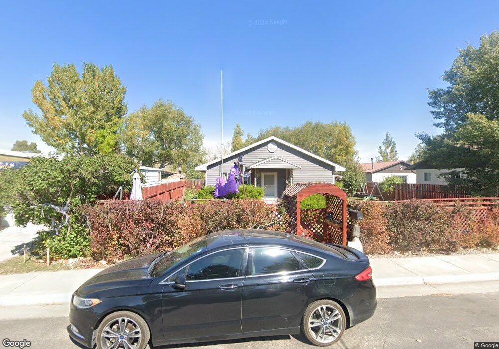
576 Johnson St Lander, WY 82520
Estimated Value: $276,000 - $347,000
3
Beds
2
Baths
1,325
Sq Ft
$235/Sq Ft
Est. Value
About This Home
This home is located at 576 Johnson St, Lander, WY 82520 and is currently estimated at $312,000, approximately $235 per square foot. 576 Johnson St is a home located in Fremont County with nearby schools including Lander Valley High School.
Ownership History
Date
Name
Owned For
Owner Type
Purchase Details
Closed on
Mar 7, 2014
Sold by
Brown Charlle Francis and Brown Amber S
Bought by
Brown Amber S
Current Estimated Value
Home Financials for this Owner
Home Financials are based on the most recent Mortgage that was taken out on this home.
Original Mortgage
$100,000
Outstanding Balance
$76,083
Interest Rate
4.44%
Mortgage Type
Credit Line Revolving
Estimated Equity
$235,917
Purchase Details
Closed on
Aug 17, 2006
Sold by
Brown Clinton J
Bought by
Brown Cynthia D
Create a Home Valuation Report for This Property
The Home Valuation Report is an in-depth analysis detailing your home's value as well as a comparison with similar homes in the area
Home Values in the Area
Average Home Value in this Area
Purchase History
| Date | Buyer | Sale Price | Title Company |
|---|---|---|---|
| Brown Amber S | -- | First American Title Ins Co | |
| Brown Cynthia D | -- | None Available |
Source: Public Records
Mortgage History
| Date | Status | Borrower | Loan Amount |
|---|---|---|---|
| Open | Brown Amber S | $100,000 |
Source: Public Records
Tax History
| Year | Tax Paid | Tax Assessment Tax Assessment Total Assessment is a certain percentage of the fair market value that is determined by local assessors to be the total taxable value of land and additions on the property. | Land | Improvement |
|---|---|---|---|---|
| 2025 | $1,893 | $18,851 | $4,009 | $14,842 |
| 2024 | $1,893 | $24,524 | $5,346 | $19,178 |
| 2023 | $1,781 | $23,265 | $4,771 | $18,494 |
| 2022 | $1,500 | $20,018 | $4,771 | $15,247 |
| 2021 | $1,403 | $18,124 | $4,685 | $13,439 |
| 2020 | $1,319 | $17,072 | $4,685 | $12,387 |
| 2019 | $1,289 | $16,422 | $4,685 | $11,737 |
| 2018 | $1,243 | $15,667 | $4,647 | $11,020 |
| 2017 | $1,221 | $15,343 | $4,647 | $10,696 |
| 2016 | $1,308 | $16,467 | $4,647 | $11,820 |
| 2015 | $1,173 | $14,930 | $4,647 | $10,283 |
| 2014 | $1,167 | $14,876 | $4,647 | $10,229 |
Source: Public Records
Map
Nearby Homes
- 980 Riverview Dr
- 764 N 4th St
- 537 Market St
- 1105 N 2nd St
- 385 Wood St
- 787 Victory Ln
- 766 Victory Ln
- 442 Eugene St
- 106 Rail Ln
- 360 N 9th St
- 625 Cottonwood Ln
- 1530 W Main St
- 617 Main St Unit LotWP001
- 824 Main St
- 835 Garfield St
- 180 S 10th St
- 1100 Pronghorn Dr
- 1072 Pronghorn Dr
- 1062 Pronghorn Dr
- 1176 Garfield St
- 580 Johnson St
- 570 Johnson St
- 585 Johnson St
- 1070 N 6th St
- 1070 N 6th St Unit Johnson
- 575 Johnson St
- 560 Johnson St
- 600 Johnson St
- 565 Johnson St
- 1055 N 6th St
- 615 Johnson St
- 615 Johnson St
- 1075 N 5th St
- 610 Johnson St
- 610 Johnson St Unit N. 5th
- 1000 N 6th St
- 570 Adams St
- 560 Adams St
- 580 Adams St
- 620 Johnson St
Your Personal Tour Guide
Ask me questions while you tour the home.