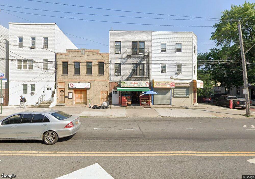
576 Morris Park Ave Unit Storefront Bronx, NY 10460
Van Nest NeighborhoodEstimated Value: $1,324,724
--
Bed
--
Bath
900
Sq Ft
$1,472/Sq Ft
Est. Value
About This Home
This home is located at 576 Morris Park Ave Unit Storefront, Bronx, NY 10460 and is currently estimated at $1,324,724, approximately $1,471 per square foot. 576 Morris Park Ave Unit Storefront is a home located in Bronx County with nearby schools including P.S. 105 Senator Abraham Bernstein, Pelham Academy, and Bronx Green Middle School.
Ownership History
Date
Name
Owned For
Owner Type
Purchase Details
Closed on
Jul 21, 2020
Sold by
Morris Park Ave Development Llc
Bought by
576 Morris Park Avenue Llc
Current Estimated Value
Purchase Details
Closed on
Sep 8, 2016
Sold by
Gwynne Properties Ltd
Bought by
Morris Park Ave Development Llc
Create a Home Valuation Report for This Property
The Home Valuation Report is an in-depth analysis detailing your home's value as well as a comparison with similar homes in the area
Home Values in the Area
Average Home Value in this Area
Purchase History
| Date | Buyer | Sale Price | Title Company |
|---|---|---|---|
| 576 Morris Park Avenue Llc | $1,100,000 | -- | |
| Morris Park Ave Development Llc | $355,000 | -- |
Source: Public Records
Tax History Compared to Growth
Tax History
| Year | Tax Paid | Tax Assessment Tax Assessment Total Assessment is a certain percentage of the fair market value that is determined by local assessors to be the total taxable value of land and additions on the property. | Land | Improvement |
|---|---|---|---|---|
| 2025 | $16,133 | $132,324 | $21,384 | $110,940 |
| 2024 | $16,133 | $129,045 | $25,026 | $104,019 |
| 2023 | $14,932 | $121,721 | $28,327 | $93,394 |
| 2022 | $13,789 | $243,900 | $45,450 | $198,450 |
| 2021 | $0 | $206,280 | $45,450 | $160,830 |
| 2020 | $12,696 | $200,250 | $45,450 | $154,800 |
| 2019 | $11,459 | $220,050 | $113,400 | $106,650 |
| 2018 | $11,286 | $88,737 | $40,003 | $48,734 |
| 2017 | $7,514 | $59,077 | $37,978 | $21,099 |
| 2016 | $7,056 | $54,731 | $38,742 | $15,989 |
| 2015 | $4,578 | $50,679 | $30,923 | $19,756 |
| 2014 | $4,578 | $50,679 | $30,848 | $19,831 |
Source: Public Records
Map
Nearby Homes
- 1738 Melville St
- 1713 Taylor Ave
- 518 Morris Park Ave
- 591 van Nest Ave
- 506 van Nest Ave
- 1622 Van Buren St
- 504 van Nest Ave
- 508 van Nest Ave
- 500 van Nest Ave
- 633 Mead St
- 677 van Nest Ave
- 679 van Nest Ave
- 1760 E Tremont Ave
- 1827 Amethyst St
- 1721 White Plains Rd
- 1731 White Plains Rd
- 1667 Hunt Ave
- 1517 Rosedale Ave
- 1513 Rosedale Ave
- 1735 Mansion St
- 576 Morris Park Ave
- 580 Morris Park Ave
- 574 Morris Park Ave
- 582 Morris Park Ave
- 1750 Taylor Ave
- 1748 Taylor Ave
- 586 Morris Park Ave
- 1755 Taylor Ave
- 1746 Taylor Ave
- 590 Morris Park Ave
- 1751 Garfield St
- 1749 Garfield St
- 564 Morris Park Ave
- 1744 Taylor Ave
- 1747 Garfield St
- 592 Morris Park Ave
- 562 Morris Park Ave
- 1751 Taylor Ave
- 1740 Taylor Ave
- 1743 Garfield St