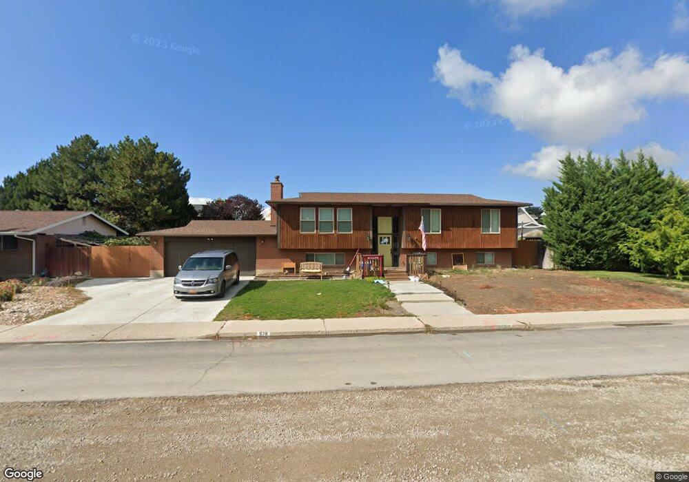
576 S 600 W Orem, UT 84058
Sunset Heights NeighborhoodEstimated Value: $548,000 - $678,000
5
Beds
3
Baths
2,484
Sq Ft
$240/Sq Ft
Est. Value
About This Home
This home is located at 576 S 600 W, Orem, UT 84058 and is currently estimated at $595,769, approximately $239 per square foot. 576 S 600 W is a home located in Utah County with nearby schools including Orem Elementary School, Lakeridge Jr High School, and Mountain View High School.
Ownership History
Date
Name
Owned For
Owner Type
Purchase Details
Closed on
Mar 27, 2024
Sold by
Miller Michael J and Miller Elizabeth A
Bought by
Kuo Rita
Current Estimated Value
Purchase Details
Closed on
Dec 17, 2021
Sold by
Moore Brent C
Bought by
Miller Michael J and Miller Elizabeth A
Home Financials for this Owner
Home Financials are based on the most recent Mortgage that was taken out on this home.
Original Mortgage
$509,437
Interest Rate
3.09%
Mortgage Type
New Conventional
Purchase Details
Closed on
Nov 30, 2017
Sold by
Beaudin Carl L and Beaudin Margery
Bought by
Moore Brent C and Moore Amy Freestone
Home Financials for this Owner
Home Financials are based on the most recent Mortgage that was taken out on this home.
Original Mortgage
$256,000
Interest Rate
3.94%
Mortgage Type
New Conventional
Purchase Details
Closed on
Aug 8, 2008
Sold by
Beaudin Carl Lawrence and Beaudin Margery
Bought by
Beaudin Carl L and Beaudin Margery
Create a Home Valuation Report for This Property
The Home Valuation Report is an in-depth analysis detailing your home's value as well as a comparison with similar homes in the area
Home Values in the Area
Average Home Value in this Area
Purchase History
| Date | Buyer | Sale Price | Title Company |
|---|---|---|---|
| Kuo Rita | -- | Eagle Gate Title | |
| Miller Michael J | -- | Access Title | |
| Moore Brent C | -- | Utah First Title Ins Agency | |
| Beaudin Carl L | -- | None Available |
Source: Public Records
Mortgage History
| Date | Status | Borrower | Loan Amount |
|---|---|---|---|
| Previous Owner | Miller Michael J | $509,437 | |
| Previous Owner | Moore Brent C | $256,000 |
Source: Public Records
Tax History
| Year | Tax Paid | Tax Assessment Tax Assessment Total Assessment is a certain percentage of the fair market value that is determined by local assessors to be the total taxable value of land and additions on the property. | Land | Improvement |
|---|---|---|---|---|
| 2025 | $2,307 | $295,625 | -- | -- |
| 2024 | $2,162 | $282,040 | $0 | $0 |
| 2023 | $2,162 | $284,075 | $0 | $0 |
| 2022 | $2,098 | $267,135 | $0 | $0 |
| 2021 | $1,953 | $376,700 | $172,900 | $203,800 |
| 2020 | $1,784 | $338,100 | $138,300 | $199,800 |
| 2019 | $1,634 | $322,000 | $127,700 | $194,300 |
| 2018 | $1,580 | $297,600 | $110,000 | $187,600 |
| 2017 | $1,300 | $131,120 | $0 | $0 |
| 2016 | $1,288 | $119,790 | $0 | $0 |
| 2015 | $1,309 | $115,115 | $0 | $0 |
| 2014 | $1,297 | $113,575 | $0 | $0 |
Source: Public Records
Map
Nearby Homes
Your Personal Tour Guide
Ask me questions while you tour the home.