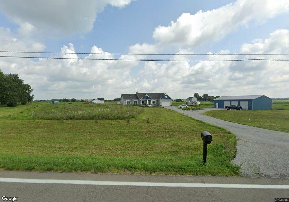
5760 State Route 203 Radnor, OH 43066
Estimated Value: $589,000 - $722,028
4
Beds
3
Baths
2,616
Sq Ft
$247/Sq Ft
Est. Value
About This Home
This home is located at 5760 State Route 203, Radnor, OH 43066 and is currently estimated at $646,676, approximately $247 per square foot. 5760 State Route 203 is a home with nearby schools including Buckeye Valley High School.
Ownership History
Date
Name
Owned For
Owner Type
Purchase Details
Closed on
Nov 12, 2020
Sold by
Schumacher Homes Of Columbus Inc
Bought by
Slutz Scott and Slutz Alice
Current Estimated Value
Home Financials for this Owner
Home Financials are based on the most recent Mortgage that was taken out on this home.
Original Mortgage
$466,600
Outstanding Balance
$413,848
Interest Rate
2.62%
Mortgage Type
New Conventional
Estimated Equity
$232,828
Purchase Details
Closed on
Jun 1, 2020
Sold by
Rmh Investments Llc
Bought by
Schumacher Homes Of Columbus Inc
Purchase Details
Closed on
Jan 13, 2011
Sold by
Howald Mary E and Howald Rodney E
Bought by
Rmh Investments Llc
Create a Home Valuation Report for This Property
The Home Valuation Report is an in-depth analysis detailing your home's value as well as a comparison with similar homes in the area
Home Values in the Area
Average Home Value in this Area
Purchase History
| Date | Buyer | Sale Price | Title Company |
|---|---|---|---|
| Slutz Scott | $64,500 | Wesbanco Title Agency | |
| Schumacher Homes Of Columbus Inc | $428,700 | Lawyers Title Agency | |
| Rmh Investments Llc | $215,500 | Attorney |
Source: Public Records
Mortgage History
| Date | Status | Borrower | Loan Amount |
|---|---|---|---|
| Open | Slutz Scott | $466,600 |
Source: Public Records
Tax History Compared to Growth
Tax History
| Year | Tax Paid | Tax Assessment Tax Assessment Total Assessment is a certain percentage of the fair market value that is determined by local assessors to be the total taxable value of land and additions on the property. | Land | Improvement |
|---|---|---|---|---|
| 2024 | $7,630 | $203,040 | $24,150 | $178,890 |
| 2023 | $7,627 | $203,040 | $24,150 | $178,890 |
| 2022 | $6,696 | $158,280 | $24,120 | $134,160 |
| 2021 | $963 | $22,190 | $22,190 | $0 |
| 2020 | $962 | $22,190 | $22,190 | $0 |
| 2019 | $196 | $19,290 | $19,290 | $0 |
| 2018 | $194 | $19,290 | $19,290 | $0 |
| 2017 | $205 | $15,510 | $15,510 | $0 |
| 2016 | $223 | $15,510 | $15,510 | $0 |
| 2015 | $232 | $15,510 | $15,510 | $0 |
| 2014 | $214 | $15,510 | $15,510 | $0 |
| 2013 | $98 | $15,510 | $15,510 | $0 |
Source: Public Records
Map
Nearby Homes
- 4518 State Route 257
- 4093 State Route 257
- 0 Norton Rd Unit 225044832
- 0 Norton Rd Unit 225044831
- 0 Norton Rd
- 0 Norton Rd Unit 225044837
- 0 Norton Rd Unit 225044834
- 0 Norton Rd Unit 225044830
- 0 Norton Rd Unit 225044835
- 3414 State Route 203
- 2217 Radnor Rd
- 2390 Penry Rd
- 206 S East St
- 303 Park Ave
- 3935 N Section Line Rd
- 6412 Troy Rd
- 1859 State Route 257 N
- 3232 Gallant Rd
- 6343 State Route 4
- 541 Willey Rd
- 5772 State Route 203
- 5772 Street
- 5915 Curtis Rd
- 5901 Curtis Rd
- 5975 Curtis Rd
- 5702 Curtis Rd
- 5959 Curtis Rd
- 5937 Curtis Rd
- 5972 Curtis Rd
- 5942 Curtis Rd
- 5858 Curtis Rd
- 5732 Curtis Rd
- 5987 Curtis Rd
- 5968 Curtis Rd
- 5982 Curtis Rd
- 5872 Curtis Rd
- 5840 Curtis Rd
- 6241 Curtis Rd
- 6230 Ohio 203
- 6230 State Route 203