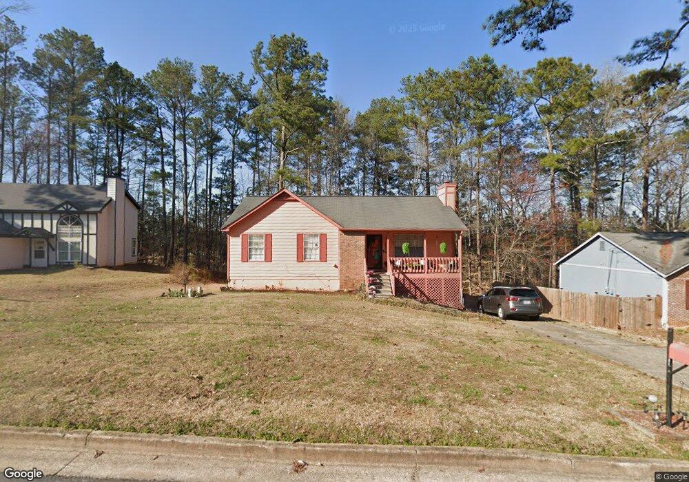
5763 Rock Rd Unit 5 Union City, GA 30291
Estimated Value: $216,000 - $241,000
4
Beds
2
Baths
1,128
Sq Ft
$205/Sq Ft
Est. Value
About This Home
This home is located at 5763 Rock Rd Unit 5, Union City, GA 30291 and is currently estimated at $231,500, approximately $205 per square foot. 5763 Rock Rd Unit 5 is a home located in Fulton County with nearby schools including Liberty Point Elementary School, Camp Creek Middle School, and Langston Hughes High School.
Ownership History
Date
Name
Owned For
Owner Type
Purchase Details
Closed on
Oct 23, 2001
Sold by
Fry Ernest R
Bought by
Fry Valerie
Current Estimated Value
Home Financials for this Owner
Home Financials are based on the most recent Mortgage that was taken out on this home.
Original Mortgage
$104,037
Interest Rate
6.42%
Mortgage Type
FHA
Purchase Details
Closed on
Mar 28, 2000
Sold by
Fry Valerie
Bought by
Fay Valerie and Fay Ernest R
Home Financials for this Owner
Home Financials are based on the most recent Mortgage that was taken out on this home.
Original Mortgage
$100,818
Interest Rate
8.34%
Mortgage Type
FHA
Create a Home Valuation Report for This Property
The Home Valuation Report is an in-depth analysis detailing your home's value as well as a comparison with similar homes in the area
Home Values in the Area
Average Home Value in this Area
Purchase History
| Date | Buyer | Sale Price | Title Company |
|---|---|---|---|
| Fry Valerie | -- | -- | |
| Fay Valerie | -- | -- | |
| Fry Valerie | $100,900 | -- |
Source: Public Records
Mortgage History
| Date | Status | Borrower | Loan Amount |
|---|---|---|---|
| Previous Owner | Fry Valerie | $104,037 | |
| Previous Owner | Fry Valerie | $100,818 |
Source: Public Records
Tax History Compared to Growth
Tax History
| Year | Tax Paid | Tax Assessment Tax Assessment Total Assessment is a certain percentage of the fair market value that is determined by local assessors to be the total taxable value of land and additions on the property. | Land | Improvement |
|---|---|---|---|---|
| 2025 | $1,085 | $68,680 | $16,800 | $51,880 |
| 2023 | $1,085 | $74,600 | $19,640 | $54,960 |
| 2022 | $1,367 | $51,960 | $12,680 | $39,280 |
| 2021 | $1,072 | $39,520 | $7,880 | $31,640 |
| 2020 | $1,086 | $39,080 | $7,800 | $31,280 |
| 2019 | $1,239 | $29,320 | $5,560 | $23,760 |
| 2018 | $663 | $23,480 | $3,040 | $20,440 |
| 2017 | $685 | $23,480 | $3,040 | $20,440 |
| 2016 | $783 | $26,840 | $4,880 | $21,960 |
| 2015 | $1,208 | $26,840 | $4,880 | $21,960 |
| 2014 | $499 | $16,280 | $1,960 | $14,320 |
Source: Public Records
Map
Nearby Homes
- 5856 Rock Rd
- 6024 Diamond Ln
- 6000 Diamond Ln
- 5910 Rock Rd
- 3227 Diamond Bluff
- 4695 Ravenwood Loop
- 4605 Ravenwood Loop
- 4611 Ravenwood Loop
- 4615 Ravenwood Loop
- 0 Lower Dixie Lake Rd Unit 22475153
- 0 Lower Dixie Lake Rd Unit 7515143
- 000 Highpoint Rd
- 99 Highpoint Rd
- 5900 Union Woods Way
- 0 Lakeside Dr Unit 22475152
- 0 Lakeside Dr Unit 7515650
- 0 Highpoint Rd Unit 10553938
- 4111 Ravenwood Ct Unit 6
- 5771 Rock Rd
- 5753 Rock Rd
- 5753 Rock Rd Unit 9
- 3242 Diamond Bluff
- 3244 Diamond Bluff
- 5779 Rock Rd
- 3240 Diamond Bluff
- 3246 Diamond Bluff
- 3238 Diamond Bluff
- 5754 Rock Rd
- 3248 Diamond Bluff
- 5780 Rock Rd
- 5787 Rock Rd Unit 5
- 3250 Diamond Bluff
- 3236 Diamond Bluff
- 5735 Rock Rd Unit 5
- 5734 Rock Rd
- 0 Diamond Bluff Unit 8562510
- 0 Diamond Bluff Unit 8876063
- 0 Diamond Bluff Unit 8665800