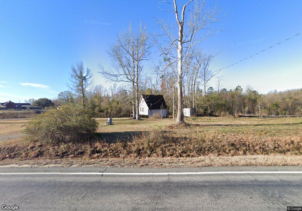
5765 Ga Highway 199 Soperton, GA 30457
Estimated Value: $58,094 - $98,000
--
Bed
--
Bath
544
Sq Ft
$141/Sq Ft
Est. Value
About This Home
This home is located at 5765 Ga Highway 199, Soperton, GA 30457 and is currently estimated at $76,698, approximately $140 per square foot. 5765 Ga Highway 199 is a home with nearby schools including Treutlen Elementary School and Treutlen Middle/High School.
Ownership History
Date
Name
Owned For
Owner Type
Purchase Details
Closed on
Oct 25, 2018
Sold by
Cauley Wayne
Bought by
Yates Carson Lyle
Current Estimated Value
Purchase Details
Closed on
Jan 10, 2013
Sold by
Cauley Carey
Bought by
Cauley Wayne
Home Financials for this Owner
Home Financials are based on the most recent Mortgage that was taken out on this home.
Original Mortgage
$25,426
Interest Rate
3.36%
Mortgage Type
New Conventional
Purchase Details
Closed on
Feb 3, 1999
Sold by
Cauley Carey
Bought by
Cauley Wayne
Purchase Details
Closed on
Sep 16, 1994
Bought by
Cauley Carey
Purchase Details
Closed on
May 2, 1994
Bought by
Trull Priscilla P
Purchase Details
Closed on
Dec 3, 1988
Bought by
Trull Wilford
Purchase Details
Closed on
Jul 3, 1950
Create a Home Valuation Report for This Property
The Home Valuation Report is an in-depth analysis detailing your home's value as well as a comparison with similar homes in the area
Home Values in the Area
Average Home Value in this Area
Purchase History
| Date | Buyer | Sale Price | Title Company |
|---|---|---|---|
| Yates Carson Lyle | $15,000 | -- | |
| Cauley Wayne | -- | -- | |
| Cauley Wayne | -- | -- | |
| Cauley Carey | $6,000 | -- | |
| Trull Priscilla P | $4,700 | -- | |
| Trull Wilford | $1,600 | -- | |
| -- | $1,600 | -- | |
| -- | -- | -- |
Source: Public Records
Mortgage History
| Date | Status | Borrower | Loan Amount |
|---|---|---|---|
| Previous Owner | Cauley Wayne | $25,426 |
Source: Public Records
Tax History Compared to Growth
Tax History
| Year | Tax Paid | Tax Assessment Tax Assessment Total Assessment is a certain percentage of the fair market value that is determined by local assessors to be the total taxable value of land and additions on the property. | Land | Improvement |
|---|---|---|---|---|
| 2024 | $311 | $11,120 | $7,280 | $3,840 |
| 2023 | $311 | $11,120 | $7,280 | $3,840 |
| 2022 | $295 | $10,920 | $7,280 | $3,640 |
| 2021 | $309 | $11,480 | $7,280 | $4,200 |
| 2020 | $309 | $11,480 | $7,280 | $4,200 |
| 2019 | $161 | $11,480 | $7,280 | $4,200 |
| 2018 | $278 | $11,360 | $7,280 | $4,080 |
| 2017 | $301 | $11,360 | $7,280 | $4,080 |
| 2016 | $295 | $11,360 | $7,280 | $4,080 |
| 2015 | -- | $11,360 | $7,280 | $4,080 |
| 2014 | -- | $11,360 | $7,280 | $4,080 |
| 2013 | -- | $11,360 | $7,280 | $4,080 |
Source: Public Records
Map
Nearby Homes
- 4281 Ga Highway 46
- 4281 Sr-46
- 481 Windmill Way
- 0 Rivoli Clay Rd
- 00 Rivoli Clay Rd
- 1936 Cedar Grove Rd
- 0 Cedar Grove Rd
- 0 County Line Rd Unit n/a 113727
- 1671 U S 221
- 7586 Eastman Rd
- 4798 S Third St
- 2166 Ga Highway 199
- 1785 Martin Luther King jr Dr
- 46 Georgia 46
- 0 Hwy 297 - Tract 2 & 3
- 0 Knox Mill Rd Unit 10640244
- 1671 U S 221 North Hwy
- 4004 E Louisiana Ave
- 95 Railroad Ave
- 0 Lake Helen Loop Unit 10640271
- 5645 Ga Highway 199
- 4876 Ga Highway 46
- 5141 Ga Highway 46
- 5974 Ga Hwy 199
- 5974 Georgia 199
- 5974 Ga Highway 199
- 5189 Ga Highway 46
- 5974 Ga Hwy 199 SW
- 131 Mustang Rd
- 5401 Ga Highway 199
- 199 Georgia Ave E
- 207 Hillcrest Ln
- 252 Hillcrest Ln
- 223 Hillcrest Ln
- 5529 Ga Highway 46
- 152 Hillcrest Ln
- 6254 Ga Highway 199
- 6278 Ga Highway 199
- 199 Georgia Ave E
- 5523 Ga Highway 46