Estimated Value: $432,000 - $497,000
4
Beds
3
Baths
2,156
Sq Ft
$219/Sq Ft
Est. Value
About This Home
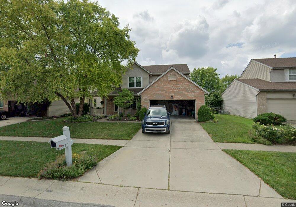
This home is located at 5767 Stone Trace Dr, Mason, OH 45040 and is currently estimated at $472,673, approximately $219 per square foot. 5767 Stone Trace Dr is a home located in Warren County with nearby schools including Mason Intermediate Elementary School, Mason Middle School, and William Mason High School.
Ownership History
Date
Name
Owned For
Owner Type
Purchase Details
Closed on
Jun 11, 2001
Sold by
Beck Joe
Bought by
Arends Thomas D and Arends Julia C
Current Estimated Value
Home Financials for this Owner
Home Financials are based on the most recent Mortgage that was taken out on this home.
Original Mortgage
$170,412
Outstanding Balance
$61,232
Interest Rate
7.18%
Mortgage Type
New Conventional
Estimated Equity
$411,441
Purchase Details
Closed on
Dec 1, 1998
Sold by
Dixon Builders & Develop
Bought by
Beck Joe M
Home Financials for this Owner
Home Financials are based on the most recent Mortgage that was taken out on this home.
Original Mortgage
$144,000
Interest Rate
7.01%
Mortgage Type
New Conventional
Create a Home Valuation Report for This Property
The Home Valuation Report is an in-depth analysis detailing your home's value as well as a comparison with similar homes in the area
Home Values in the Area
Average Home Value in this Area
Purchase History
| Date | Buyer | Sale Price | Title Company |
|---|---|---|---|
| Arends Thomas D | $185,000 | -- | |
| Beck Joe M | $170,000 | -- |
Source: Public Records
Mortgage History
| Date | Status | Borrower | Loan Amount |
|---|---|---|---|
| Open | Arends Thomas D | $170,412 | |
| Previous Owner | Beck Joe M | $144,000 |
Source: Public Records
Tax History
| Year | Tax Paid | Tax Assessment Tax Assessment Total Assessment is a certain percentage of the fair market value that is determined by local assessors to be the total taxable value of land and additions on the property. | Land | Improvement |
|---|---|---|---|---|
| 2025 | $5,471 | $127,620 | $35,000 | $92,620 |
| 2024 | $5,471 | $127,620 | $35,000 | $92,620 |
| 2023 | $5,189 | $99,823 | $19,057 | $80,766 |
| 2022 | $5,098 | $99,824 | $19,058 | $80,766 |
| 2021 | $4,849 | $99,824 | $19,058 | $80,766 |
| 2020 | $4,720 | $82,499 | $15,750 | $66,749 |
| 2019 | $4,374 | $82,499 | $15,750 | $66,749 |
| 2018 | $4,356 | $82,499 | $15,750 | $66,749 |
| 2017 | $4,217 | $73,059 | $15,967 | $57,092 |
| 2016 | $4,335 | $73,059 | $15,967 | $57,092 |
| 2015 | $4,310 | $73,059 | $15,967 | $57,092 |
| 2014 | $4,023 | $62,980 | $13,770 | $49,220 |
| 2013 | $4,032 | $72,060 | $15,750 | $56,310 |
Source: Public Records
Map
Nearby Homes
- 5369 N Shore Place
- 5661 Harbourside Dr
- 5576 Winding Cape Way
- 6285 Greenwood Ct
- 6291 Greenwood Ct
- 6266 Trailwood Ct
- 6418 Sherman Terrace Rd
- 8845 Suncrest Ln
- 6304 Trailwood Ct
- 8588 Charleston Creek Dr
- 9018 Boylston St
- Winslow Plan at Losh Landing - Masterpiece Collection
- Paxton Plan at Losh Landing - Masterpiece Collection
- Huxley Plan at Losh Landing - Masterpiece Collection
- Pearson Plan at Losh Landing - Masterpiece Collection
- Beckett Plan at Losh Landing - Masterpiece Collection
- Leland Plan at Losh Landing - Masterpiece Collection
- Clay Plan at Losh Landing - Masterpiece Collection
- Mitchell Plan at Losh Landing - Masterpiece Collection
- Margot Plan at Losh Landing - Masterpiece Collection
- 5775 Stone Trace Dr
- 5757 Stone Trace Dr
- 5749 Stone Trace Dr
- 5781 Stone Trace Dr
- 5766 Stone Trace Dr
- 8385 Lee Ct
- 5741 Stone Trace Dr
- 5758 Stone Trace Dr
- 5789 Stone Trace Dr
- 5748 Stone Trace Dr
- 5731 Stone Trace Dr
- 5811 Stone Trace Dr
- 5738 Stone Trace Dr
- 8374 Lee Ct
- 8379 Lee Ct
- 8350 Snider Rd
- 5827 Stone Trace Dr
- 8411 Cameron Ct
- 5723 Stone Trace Dr
- 5730 Stone Trace Dr
Your Personal Tour Guide
Ask me questions while you tour the home.