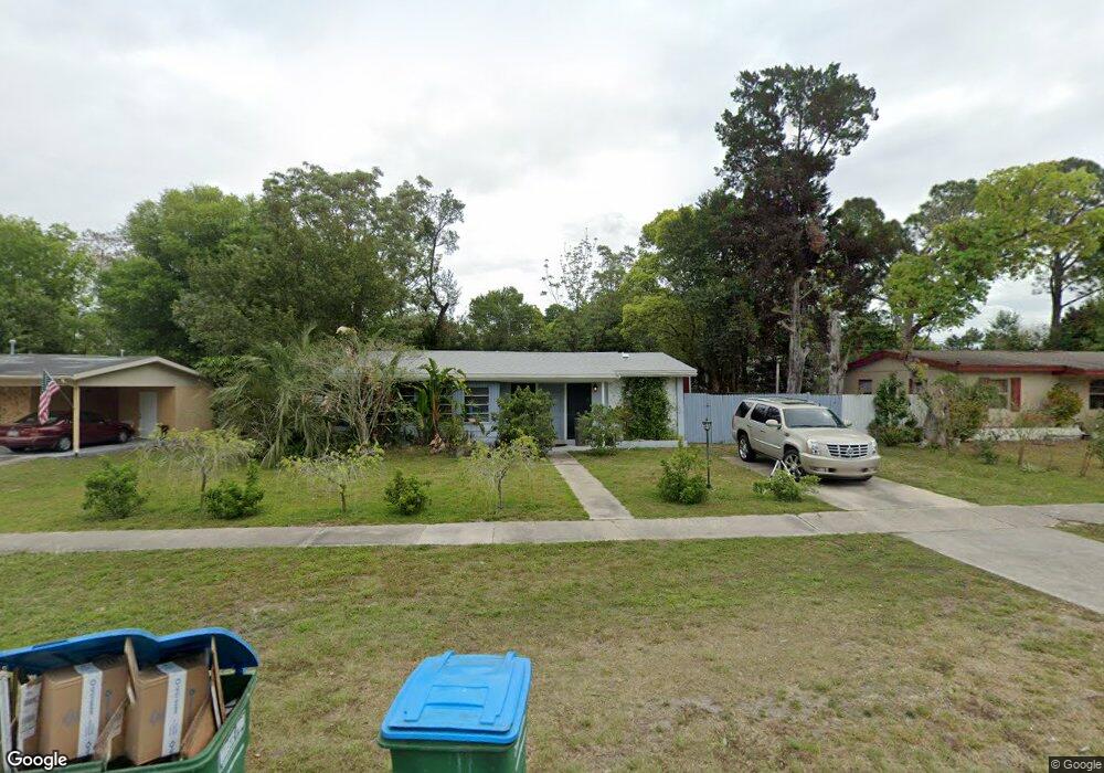
577 E Normandy Blvd Deltona, FL 32725
Estimated Value: $174,000 - $216,148
2
Beds
1
Bath
1,083
Sq Ft
$183/Sq Ft
Est. Value
About This Home
This home is located at 577 E Normandy Blvd, Deltona, FL 32725 and is currently estimated at $198,537, approximately $183 per square foot. 577 E Normandy Blvd is a home located in Volusia County with nearby schools including Discovery Elementary School, Deltona Middle School, and University High School.
Ownership History
Date
Name
Owned For
Owner Type
Purchase Details
Closed on
Aug 26, 2004
Sold by
Connolly Lucille M and Smith Suzanne
Bought by
Mcphail Grant M
Current Estimated Value
Home Financials for this Owner
Home Financials are based on the most recent Mortgage that was taken out on this home.
Original Mortgage
$65,975
Outstanding Balance
$31,822
Interest Rate
5.91%
Mortgage Type
FHA
Estimated Equity
$166,715
Create a Home Valuation Report for This Property
The Home Valuation Report is an in-depth analysis detailing your home's value as well as a comparison with similar homes in the area
Home Values in the Area
Average Home Value in this Area
Purchase History
| Date | Buyer | Sale Price | Title Company |
|---|---|---|---|
| Mcphail Grant M | $78,000 | Associated Land Title Group |
Source: Public Records
Mortgage History
| Date | Status | Borrower | Loan Amount |
|---|---|---|---|
| Open | Mcphail Grant M | $65,975 | |
| Closed | Mcphail Grant M | $15,000 |
Source: Public Records
Tax History
| Year | Tax Paid | Tax Assessment Tax Assessment Total Assessment is a certain percentage of the fair market value that is determined by local assessors to be the total taxable value of land and additions on the property. | Land | Improvement |
|---|---|---|---|---|
| 2026 | $1,399 | $94,126 | -- | -- |
| 2025 | $1,399 | $94,126 | -- | -- |
| 2024 | $1,232 | $91,712 | -- | -- |
| 2023 | $1,232 | $89,041 | $0 | $0 |
| 2022 | $1,203 | $86,448 | $0 | $0 |
| 2021 | $1,209 | $83,930 | $0 | $0 |
| 2020 | $1,189 | $82,771 | $0 | $0 |
| 2019 | $1,183 | $80,910 | $0 | $0 |
| 2018 | $1,151 | $79,401 | $13,133 | $66,268 |
| 2017 | $1,578 | $59,505 | $7,690 | $51,815 |
| 2016 | $1,414 | $49,243 | $0 | $0 |
| 2015 | $1,366 | $48,212 | $0 | $0 |
| 2014 | $1,224 | $39,976 | $0 | $0 |
Source: Public Records
Map
Nearby Homes
- 568 E Normandy Blvd
- 1347 W Wellington Dr
- 732 Waterfall Cir
- 1333 N Fowler Dr
- 631 Merrimac St
- 952 Leyburn Dr
- 745 Waterfall Cir
- 649 N Wellington Dr
- 1144 Gerona Ave
- 1333 E Lombardy Dr
- 366 Diamond St
- 1528 N Normandy Blvd
- 1085 Whitewood Dr
- 466 Haversham Rd
- 458 Haversham Rd
- 1131 W Hancock Dr
- 1476 Valiant Ave
- 386 Haversham Rd
- 1429 E Lombardy Dr
- 691 Piedmont Dr
- 575 E Normandy Blvd
- 581 E Normandy Blvd
- 1320 Hartley Ave
- 1316 Hartley Ave
- 1324 Hartley Ave
- 573 E Normandy Blvd
- 583 E Normandy Blvd
- 1312 Hartley Ave
- 578 E Normandy Blvd
- 580 E Normandy Blvd
- 576 E Normandy Blvd
- 1332 Hartley Ave
- 571 E Normandy Blvd
- 585 E Normandy Blvd
- 582 E Normandy Blvd
- 1308 Hartley Ave
- 1317 Hartley Ave
- 1315 Hartley Ave
- 584 E Normandy Blvd
- 1323 Hartley Ave