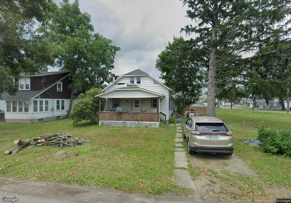
577 Freeman St Corning, NY 14830
Corning AreaEstimated Value: $159,000 - $186,009
About This Home
This home is located at 577 Freeman St, Corning, NY 14830 and is currently estimated at $174,752, approximately $121 per square foot. 577 Freeman St is a home located in Steuben County with nearby schools including Hugh W. Gregg Elementary School, Corning-Painted Post Middle School, and Corning-Painted Post High School.
Ownership History
We collect this data history from publicly available records. To have your information removed, we recommend requesting removal directly through your county’s website.
Purchase Details
Home Values in the Area
Average Home Value in this Area
Purchase History
We collect this data history from publicly available records. To have your information removed, we recommend requesting removal directly through your county’s website.
| Date | Buyer | Sale Price | Title Company |
|---|---|---|---|
| -- | None Available |
Tax History
We collect this data history from publicly available records. To have your information removed, we recommend requesting removal directly through your county’s website.
| Year | Tax Paid | Tax Assessment Tax Assessment Total Assessment is a certain percentage of the fair market value that is determined by local assessors to be the total taxable value of land and additions on the property. | Land | Improvement |
|---|---|---|---|---|
| 2025 | $5,227 | $149,000 | $21,000 | $128,000 |
| 2024 | $5,108 | $149,000 | $21,000 | $128,000 |
| 2023 | $5,077 | $149,000 | $21,000 | $128,000 |
| 2022 | $4,430 | $149,000 | $21,000 | $128,000 |
| 2021 | $3,327 | $89,500 | $10,400 | $79,100 |
| 2020 | $1,407 | $89,500 | $10,400 | $79,100 |
| 2019 | $1,727 | $89,500 | $10,400 | $79,100 |
| 2018 | $1,727 | $89,500 | $10,400 | $79,100 |
| 2017 | $1,862 | $83,700 | $7,800 | $75,900 |
| 2016 | $1,566 | $76,700 | $7,800 | $68,900 |
| 2015 | -- | $76,700 | $7,800 | $68,900 |
| 2014 | -- | $76,700 | $7,800 | $68,900 |
Map
- 16 Townsend Ave
- 22 Charles St
- 224 Onondaga St
- 316 W William St
- 24 Stanton St
- 165 Onondaga St
- 199 Kingsbury Ave
- 227 Kingsbury Ave
- 340 E High St
- 176 W Pulteney St
- 348 Delaware Ave
- 357 Delaware Ave
- 00 Delaware Ave
- 228 Princeton Ave
- 3405 Stanton St
- 176 N Franklin St
- 364 Imperial Ave
- 213 E High St
- 138 W William St
- 00-3 Winfield St
Ask me questions while you tour the home.