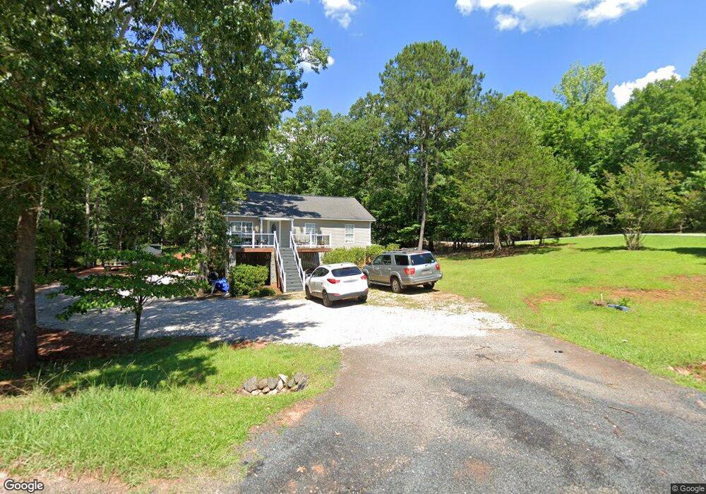
577 Gunsite Rd Unit 11 Winnsboro, SC 29180
Estimated Value: $178,032 - $428,000
2
Beds
1
Bath
1,035
Sq Ft
$292/Sq Ft
Est. Value
About This Home
This home is located at 577 Gunsite Rd Unit 11, Winnsboro, SC 29180 and is currently estimated at $302,008, approximately $291 per square foot. 577 Gunsite Rd Unit 11 is a home located in Fairfield County with nearby schools including Fairfield Middle School and Fairfield Central High School.
Ownership History
Date
Name
Owned For
Owner Type
Purchase Details
Closed on
May 5, 2021
Sold by
Floyd Kevin N
Bought by
Colvin Kimberly C
Current Estimated Value
Home Financials for this Owner
Home Financials are based on the most recent Mortgage that was taken out on this home.
Original Mortgage
$121,184
Outstanding Balance
$109,823
Interest Rate
3.1%
Mortgage Type
FHA
Estimated Equity
$192,185
Purchase Details
Closed on
Jul 1, 2010
Sold by
Brown Russell M and J Daniel Felder F
Bought by
Floyd Kevin N
Home Financials for this Owner
Home Financials are based on the most recent Mortgage that was taken out on this home.
Original Mortgage
$105,900
Interest Rate
4.79%
Purchase Details
Closed on
Jun 11, 2007
Sold by
Hudson Sallie G
Bought by
Brown Russell M and J Daniel Felder F
Create a Home Valuation Report for This Property
The Home Valuation Report is an in-depth analysis detailing your home's value as well as a comparison with similar homes in the area
Home Values in the Area
Average Home Value in this Area
Purchase History
| Date | Buyer | Sale Price | Title Company |
|---|---|---|---|
| Colvin Kimberly C | $123,500 | None Available | |
| Floyd Kevin N | $111,500 | -- | |
| Brown Russell M | $25,000 | None Available |
Source: Public Records
Mortgage History
| Date | Status | Borrower | Loan Amount |
|---|---|---|---|
| Open | Colvin Kimberly C | $121,184 | |
| Previous Owner | Floyd Kevin N | $105,900 |
Source: Public Records
Tax History Compared to Growth
Tax History
| Year | Tax Paid | Tax Assessment Tax Assessment Total Assessment is a certain percentage of the fair market value that is determined by local assessors to be the total taxable value of land and additions on the property. | Land | Improvement |
|---|---|---|---|---|
| 2024 | $887 | $4,928 | $1,000 | $3,928 |
| 2023 | $887 | $4,928 | $1,000 | $3,928 |
| 2022 | $597 | $3,552 | $1,000 | $2,552 |
| 2021 | $2,041 | $5,328 | $1,500 | $3,828 |
| 2020 | $2,079 | $5,328 | $1,500 | $3,828 |
| 2019 | $2,070 | $5,304 | $1,500 | $3,804 |
| 2018 | $2,058 | $5,304 | $1,500 | $3,804 |
| 2017 | $2,043 | $5,304 | $0 | $0 |
| 2016 | $2,049 | $5,304 | $0 | $0 |
| 2015 | $807 | $0 | $0 | $0 |
| 2014 | $807 | $6,690 | $0 | $0 |
| 2012 | $807 | $6,690 | $0 | $0 |
Source: Public Records
Map
Nearby Homes
- 284 Gunsite Rd
- 570 Wateree Key Ct
- 1225 Wateree Rd
- 80 Valley 1 Dr
- 101 Inlet Harbor Ct
- 518 Valley 1 Dr Unit 19
- 2427 Great Rd N
- 2557 Great Rd N
- 0 Woodside Dr
- 2081 Great Rd N
- 2075 Great Rd N
- 2051 Great Rd N
- 98 Great Rd N
- TBD Wateree Rd
- 275 S Waters Edge Dr
- 242 Morninglow Dr Unit 146
- 4472 River Rd
- 951 State Road S-20-317
- 1595 State Road S-20-317
- 2793 Catawba Rd Unit 24
- 605 Gunsite Rd
- 604 Gunsite Rd
- 623 Gunsite Rd
- 500 Gunsite Rd
- 500 Gunsite Rd Unit 67
- 622 Gunsite Rd
- 640 Gunsite Rd
- 464 Gunsite Rd
- 523 Gunsite Rd
- 674 Gunsite Rd
- 435 Gunsite Rd
- 434 Gunsite Rd
- 707 Gunsite Rd
- 420 Gunsite Rd Unit 64
- 772 Gunsite Rd
- 380 Gunsite Rd
- 1124 Woodside Dr
- 337 Gunsite Rd
- 792 Gunsite Rd
- 1121 Woodside Dr