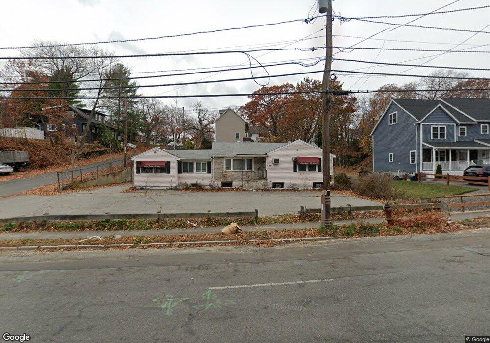
577 Main St Stoneham, MA 02180
Nobility Hill NeighborhoodEstimated Value: $675,644
Studio
--
Bath
3,152
Sq Ft
$214/Sq Ft
Est. Value
About This Home
This home is located at 577 Main St, Stoneham, MA 02180 and is currently estimated at $675,644, approximately $214 per square foot. 577 Main St is a home located in Middlesex County with nearby schools including Stoneham High School, Greater Boston Academy, and St. Patrick Elementary School.
Ownership History
Date
Name
Owned For
Owner Type
Purchase Details
Closed on
May 15, 2024
Sold by
Middlesex Purple Rt and Leblanc
Bought by
577 Main Street Rt and Casazza
Current Estimated Value
Purchase Details
Closed on
Oct 24, 2013
Sold by
Aeschlimann Mirna I
Bought by
577 Main St Nt and Aeschlimann
Create a Home Valuation Report for This Property
The Home Valuation Report is an in-depth analysis detailing your home's value as well as a comparison with similar homes in the area
Home Values in the Area
Average Home Value in this Area
Purchase History
| Date | Buyer | Sale Price | Title Company |
|---|---|---|---|
| 577 Main Street Rt | -- | None Available | |
| 577 Main Street Rt | -- | None Available | |
| 577 Main St Nt | -- | -- | |
| 577 Main St Nt | -- | -- |
Source: Public Records
Mortgage History
| Date | Status | Borrower | Loan Amount |
|---|---|---|---|
| Previous Owner | 577 Main St Nt | $198,000 |
Source: Public Records
Tax History
| Year | Tax Paid | Tax Assessment Tax Assessment Total Assessment is a certain percentage of the fair market value that is determined by local assessors to be the total taxable value of land and additions on the property. | Land | Improvement |
|---|---|---|---|---|
| 2025 | $8,206 | $423,000 | $419,300 | $3,700 |
| 2024 | $8,100 | $401,600 | $398,300 | $3,300 |
| 2023 | $10,184 | $481,300 | $372,100 | $109,200 |
| 2022 | $9,012 | $454,900 | $356,400 | $98,500 |
| 2021 | $5,843 | $452,600 | $356,400 | $96,200 |
| 2020 | $9,278 | $452,600 | $356,400 | $96,200 |
| 2019 | $9,567 | $448,500 | $335,400 | $113,100 |
| 2018 | $5,096 | $442,000 | $335,400 | $106,600 |
| 2017 | $4,727 | $439,900 | $293,500 | $146,400 |
| 2016 | $9,936 | $440,600 | $293,500 | $147,100 |
| 2015 | $8,803 | $398,700 | $251,600 | $147,100 |
| 2014 | -- | $377,500 | $230,600 | $146,900 |
Source: Public Records
Map
Nearby Homes
- 7 Carol St
- 6 Everett St
- 57 Park St
- 137 Franklin St Unit 102
- 17 Franklin St
- 159 Franklin St Unit D2
- 159 Franklin St Unit C2
- 159 Franklin St Unit E6
- 8 Common St Unit 3
- 5 Chapel Way
- 2 Mason Way Unit 6524
- 6 Mason Way Unit 6324
- 10 Pomeworth St Unit A
- 100 Ledgewood Dr Unit 410
- 200 Ledgewood Dr Unit 601
- 6 Stratton Dr Unit 208
- 6 Stratton Dr Unit 303
- 53 Perkins St
- 33 Lake Ave
- 51 Spring St
- 573 Main St
- 573 Main St Unit 1
- 573 Main St Unit 2
- 5 Kenwood Ave
- 583 Main St
- 580 Main St
- 4 Kenwood Ave
- 578 Main St Unit 1
- 578 Main St Unit 2
- 578 Main St
- 576 Main St
- 6 Kenwood Ave
- 7 Kenwood Ave
- 571 Main St
- 569 Main St
- 588 Main St
- 588 Main St Unit 4D
- 588 Main St Unit 4C
- 588 Main St Unit 4B
- 588 Main St Unit 4A
Your Personal Tour Guide
Ask me questions while you tour the home.