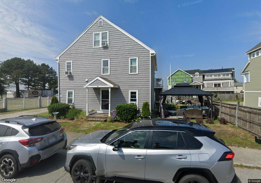
577 N End Blvd Salisbury, MA 01952
Estimated Value: $766,000 - $1,095,680
4
Beds
2
Baths
2,481
Sq Ft
$372/Sq Ft
Est. Value
About This Home
This home is located at 577 N End Blvd, Salisbury, MA 01952 and is currently estimated at $922,670, approximately $371 per square foot. 577 N End Blvd is a home located in Essex County with nearby schools including Triton Regional High School.
Ownership History
Date
Name
Owned For
Owner Type
Purchase Details
Closed on
Jan 5, 2001
Sold by
Rogers Francis Carl and Rogers Gloria C
Bought by
Smith Robert and Smith Joyce
Current Estimated Value
Home Financials for this Owner
Home Financials are based on the most recent Mortgage that was taken out on this home.
Original Mortgage
$120,000
Outstanding Balance
$44,757
Interest Rate
7.69%
Mortgage Type
Purchase Money Mortgage
Estimated Equity
$877,913
Create a Home Valuation Report for This Property
The Home Valuation Report is an in-depth analysis detailing your home's value as well as a comparison with similar homes in the area
Home Values in the Area
Average Home Value in this Area
Purchase History
| Date | Buyer | Sale Price | Title Company |
|---|---|---|---|
| Smith Robert | $320,000 | -- |
Source: Public Records
Mortgage History
| Date | Status | Borrower | Loan Amount |
|---|---|---|---|
| Open | Smith Robert | $120,000 |
Source: Public Records
Tax History
| Year | Tax Paid | Tax Assessment Tax Assessment Total Assessment is a certain percentage of the fair market value that is determined by local assessors to be the total taxable value of land and additions on the property. | Land | Improvement |
|---|---|---|---|---|
| 2025 | $9,406 | $933,100 | $456,000 | $477,100 |
| 2024 | $9,331 | $892,900 | $463,300 | $429,600 |
| 2023 | $7,711 | $714,000 | $360,400 | $353,600 |
| 2022 | $7,266 | $652,200 | $298,600 | $353,600 |
| 2021 | $7,142 | $634,300 | $298,600 | $335,700 |
| 2020 | $6,798 | $593,200 | $281,400 | $311,800 |
| 2019 | $6,116 | $515,700 | $271,700 | $244,000 |
| 2018 | $6,035 | $512,300 | $271,700 | $240,600 |
| 2017 | $5,387 | $451,900 | $232,800 | $219,100 |
| 2016 | $5,428 | $465,100 | $247,100 | $218,000 |
| 2015 | $5,420 | $461,300 | $216,300 | $245,000 |
Source: Public Records
Map
Nearby Homes
- 595 N End Blvd Unit 2
- 42 Commonwealth Ave
- 308 State Route 286 Unit Lot 73
- 308 State Route 286 Unit Lot 108
- 308 State Route 286 Unit Lot 23
- 308 State Route 286 Unit Lot 87
- 492 N End Blvd
- 432 N End Blvd
- 308 Route 286 Unit Lot 58
- 3 Tyngsboro St
- 9 Tyngsboro St
- 27 Cross Beach Rd
- 376 Ocean Blvd
- 23 River St
- 108 Ocean Dr Unit 1
- 20 Campton St
- 8 Portsmouth Ave
- 100 Forest Rd
- 98 Central Ave
- 78 N End Blvd Unit 1
- 577 North End Blvd
- 585 N End Blvd Unit 1
- 585 N End Blvd Unit 4
- 585 N End Blvd
- 585 N End Blvd Unit 8
- 585 N End Blvd Unit 6
- 585 N End Blvd Unit 3
- 585 N End Blvd Unit 7
- 579 N End Blvd Unit B
- 579 North End Blvd
- 579 North End Blvd Unit B
- 579 North End Blvd
- 575 North End Blvd
- 574 North End Blvd
- 574 N End Blvd
- 578 North End Blvd
- 578 N End Blvd
- 569 North End Blvd
- 585 North End Blvd Unit 8
- 585 North End Blvd Unit 7
Your Personal Tour Guide
Ask me questions while you tour the home.