Estimated Value: $635,000 - $847,000
2
Beds
1
Bath
650
Sq Ft
$1,148/Sq Ft
Est. Value
About This Home
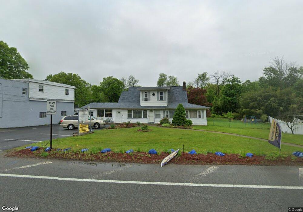
This home is located at 577 Newark Pompton Turnpike Unit B, Wayne, NJ 07470 and is currently estimated at $746,481, approximately $1,148 per square foot. 577 Newark Pompton Turnpike Unit B is a home located in Passaic County with nearby schools including Ryerson Elementary School, George Washington Middle School, and Wayne Valley High School.
Ownership History
Date
Name
Owned For
Owner Type
Purchase Details
Closed on
Aug 30, 1995
Sold by
Macgregor Richard
Bought by
Bandeli Wadi and Bandeli Rima
Current Estimated Value
Home Financials for this Owner
Home Financials are based on the most recent Mortgage that was taken out on this home.
Original Mortgage
$165,000
Interest Rate
7.6%
Create a Home Valuation Report for This Property
The Home Valuation Report is an in-depth analysis detailing your home's value as well as a comparison with similar homes in the area
Home Values in the Area
Average Home Value in this Area
Purchase History
| Date | Buyer | Sale Price | Title Company |
|---|---|---|---|
| Bandeli Wadi | $220,000 | -- |
Source: Public Records
Mortgage History
| Date | Status | Borrower | Loan Amount |
|---|---|---|---|
| Previous Owner | Bandeli Wadi | $165,000 |
Source: Public Records
Tax History Compared to Growth
Tax History
| Year | Tax Paid | Tax Assessment Tax Assessment Total Assessment is a certain percentage of the fair market value that is determined by local assessors to be the total taxable value of land and additions on the property. | Land | Improvement |
|---|---|---|---|---|
| 2025 | $13,902 | $233,800 | $103,200 | $130,600 |
| 2024 | $13,369 | $233,800 | $103,200 | $130,600 |
| 2022 | $13,219 | $233,800 | $103,200 | $130,600 |
| 2021 | $13,205 | $233,800 | $103,200 | $130,600 |
| 2020 | $13,147 | $233,800 | $103,200 | $130,600 |
| 2019 | $12,892 | $233,800 | $103,200 | $130,600 |
| 2018 | $12,777 | $233,800 | $103,200 | $130,600 |
| 2017 | $12,660 | $233,800 | $103,200 | $130,600 |
| 2016 | $12,483 | $233,800 | $103,200 | $130,600 |
| 2015 | $12,333 | $233,800 | $103,200 | $130,600 |
| 2014 | $11,985 | $233,800 | $103,200 | $130,600 |
Source: Public Records
Map
Nearby Homes
- 20 Newark Pompton Turnpike
- 0 Oakwood Ave Unit 3989632
- 00 Oakwood Ave
- 27 Marlin Ave
- 38 Marlin Ave
- 43 Madison St
- 107 Randolph St
- 7 1st St
- 202 Newark Pompton Turnpike
- 120 Greenwood Ave
- 7 Parsons Rd
- 11 Robin Hood Way
- 187 Hillcrest Dr
- 8 Torbet Dr
- 48 Mandeville Ave
- 20 Knight Rd
- 108 Boulevard
- 134 Oakwood Dr
- 63 William St
- 66 William St
- 577 Newark Pompton Turnpike
- 577 Newark Pompton Turnpike Unit 2
- 585 Newark Pompton Turnpike
- 569 Newark Pompton Turnpike
- 15 Black Oak Ridge Rd
- 610 Newark Pompton Turnpike
- 564 Newark Pompton Turnpike
- 8 Linwood Ave
- 559 Newark Pompton Turnpike
- 14 Black Oak Ridge Rd
- 556 Newark Pompton Turnpike
- 12 Linwood Ave
- 551 Newark Pompton Turnpike
- 27 Black Oak Ridge Rd
- 7 Post Ln
- 5 Riverside Dr
- 7 Linwood Ave
- 547 Newark Pompton Turnpike
- 2 Post Ln
- 31 Black Oak Ridge Rd