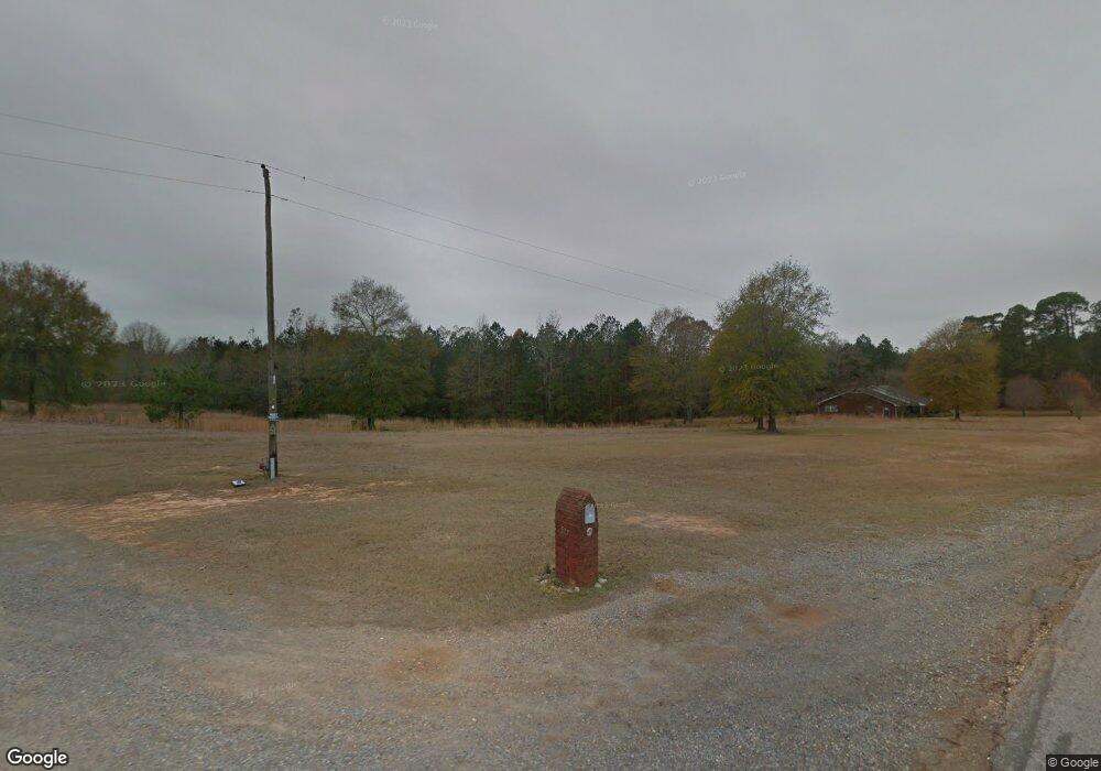
577 Rough Edge Rd Ruston, LA 71270
Estimated Value: $271,000 - $377,729
3
Beds
3
Baths
2,044
Sq Ft
$163/Sq Ft
Est. Value
About This Home
This home is located at 577 Rough Edge Rd, Ruston, LA 71270 and is currently estimated at $332,182, approximately $162 per square foot. 577 Rough Edge Rd is a home located in Lincoln Parish with nearby schools including Choudrant Elementary School, Choudrant High School, and Ruston Junior High School.
Ownership History
Date
Name
Owned For
Owner Type
Purchase Details
Closed on
Aug 4, 2025
Sold by
Hay John Randolph
Bought by
Branch Field Services Llc
Current Estimated Value
Home Financials for this Owner
Home Financials are based on the most recent Mortgage that was taken out on this home.
Original Mortgage
$357,173
Outstanding Balance
$355,636
Interest Rate
6.81%
Mortgage Type
New Conventional
Estimated Equity
-$23,454
Create a Home Valuation Report for This Property
The Home Valuation Report is an in-depth analysis detailing your home's value as well as a comparison with similar homes in the area
Purchase History
| Date | Buyer | Sale Price | Title Company |
|---|---|---|---|
| Branch Field Services Llc | $350,000 | None Listed On Document |
Source: Public Records
Mortgage History
| Date | Status | Borrower | Loan Amount |
|---|---|---|---|
| Open | Branch Field Services Llc | $357,173 |
Source: Public Records
Tax History
| Year | Tax Paid | Tax Assessment Tax Assessment Total Assessment is a certain percentage of the fair market value that is determined by local assessors to be the total taxable value of land and additions on the property. | Land | Improvement |
|---|---|---|---|---|
| 2025 | $5,124 | $61,906 | $39,368 | $22,538 |
| 2024 | $2,260 | $26,431 | $3,893 | $22,538 |
| 2023 | $1,883 | $21,704 | $2,699 | $19,005 |
| 2022 | $1,871 | $21,704 | $2,699 | $19,005 |
| 2021 | $1,843 | $21,704 | $2,699 | $19,005 |
| 2020 | $1,831 | $21,527 | $2,699 | $18,828 |
| 2019 | $1,857 | $21,511 | $2,683 | $18,828 |
| 2018 | $1,858 | $21,511 | $2,683 | $18,828 |
| 2017 | $1,862 | $21,511 | $2,683 | $18,828 |
| 2016 | $1,898 | $0 | $0 | $0 |
| 2015 | $1,984 | $20,803 | $2,335 | $18,468 |
| 2013 | $2,059 | $21,295 | $2,335 | $18,960 |
Source: Public Records
Map
Nearby Homes
- 0 N Service Rd Unit 202955
- 804 Quitman St
- 2301 E Georgia Ave
- 294 Moody Rd
- 197 Baxter Rd
- 0 Louisiana 33
- 2420 Highway 33
- 1727 Trade Dr
- 2003 Jonathan Dr
- 1815 E Georgia Ave
- 1414 Brewster Ave
- 145 Woodshire Ln
- 1406 Brewster Ave
- 305 Oak Alley Dr
- 128 Marlou Cir
- 634 Cheatwood Rd
- 173 Oak Alley Dr
- 1709 Rampart Dr
- 322 N Bernard St
- 910 Laura Ln
- TBA Rough Edge Rd
- 597 Rough Edge Rd
- 599 Rough Edge Rd
- 2812 Cook Rd
- 2797 Cook Rd
- 2802 Cook Rd
- 2761 Cook Rd
- 2770 Cook Rd
- 151 Cook Dairy Rd
- 398 Rough Edge Rd
- 170 Cooley Rd
- 2745 Cook Rd
- 396 Rough Edge Rd
- 729 Rough Edge Rd
- 731 Rough Edge Rd
- 2752 Cook Rd
- 733 Rough Edge Rd
- 130 Cooley Rd
- 111 Tally Ho Ln
- 0000 Rough Edge Rd
Your Personal Tour Guide
Ask me questions while you tour the home.
