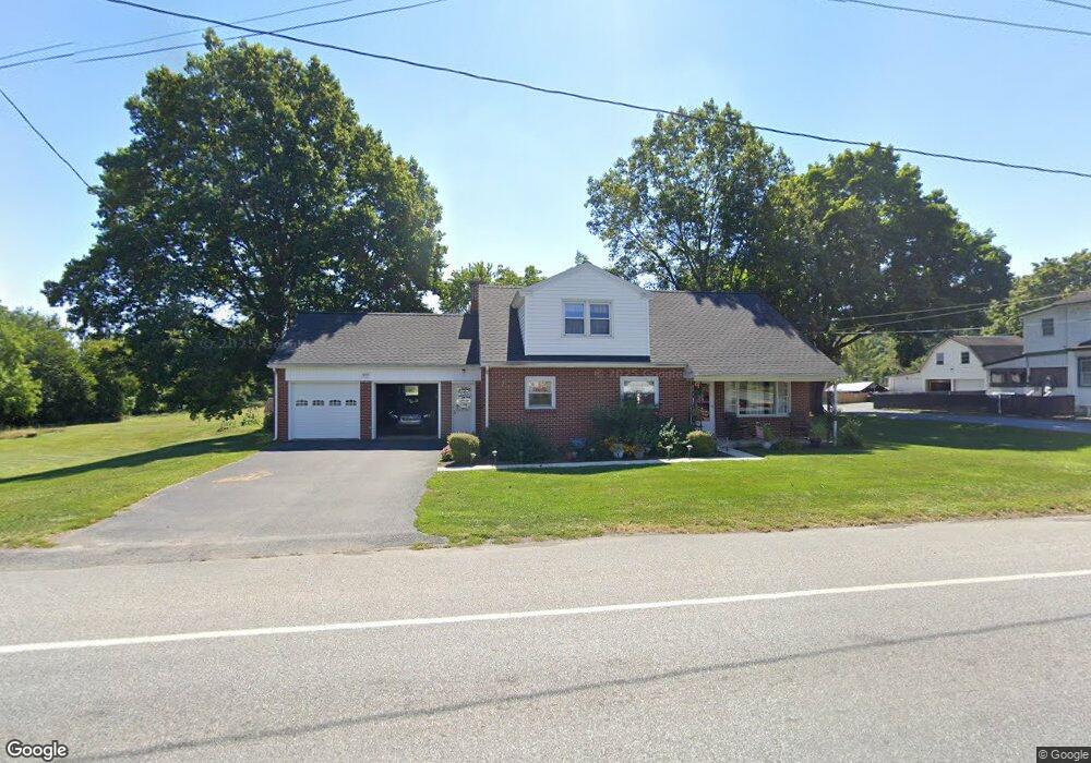
577 W High St Manheim, PA 17545
Estimated Value: $277,000 - $357,000
3
Beds
2
Baths
1,636
Sq Ft
$195/Sq Ft
Est. Value
About This Home
This home is located at 577 W High St, Manheim, PA 17545 and is currently estimated at $319,729, approximately $195 per square foot. 577 W High St is a home located in Lancaster County with nearby schools including Manheim Central Senior High School, Manheim Christian Day School, and Sporting Hill Christian School.
Ownership History
Date
Name
Owned For
Owner Type
Purchase Details
Closed on
Aug 30, 2001
Sold by
Nauman Paul B and Nauman Mabel E
Bought by
Collins John R and Collins Jo Anne
Current Estimated Value
Home Financials for this Owner
Home Financials are based on the most recent Mortgage that was taken out on this home.
Original Mortgage
$55,000
Interest Rate
7.05%
Create a Home Valuation Report for This Property
The Home Valuation Report is an in-depth analysis detailing your home's value as well as a comparison with similar homes in the area
Home Values in the Area
Average Home Value in this Area
Purchase History
| Date | Buyer | Sale Price | Title Company |
|---|---|---|---|
| Collins John R | $90,000 | -- |
Source: Public Records
Mortgage History
| Date | Status | Borrower | Loan Amount |
|---|---|---|---|
| Closed | Collins John R | $55,000 |
Source: Public Records
Tax History Compared to Growth
Tax History
| Year | Tax Paid | Tax Assessment Tax Assessment Total Assessment is a certain percentage of the fair market value that is determined by local assessors to be the total taxable value of land and additions on the property. | Land | Improvement |
|---|---|---|---|---|
| 2025 | $4,313 | $179,000 | $60,300 | $118,700 |
| 2024 | $4,313 | $179,000 | $60,300 | $118,700 |
| 2023 | $4,099 | $179,000 | $60,300 | $118,700 |
| 2022 | $4,099 | $179,000 | $60,300 | $118,700 |
| 2021 | $4,021 | $179,000 | $60,300 | $118,700 |
| 2020 | $4,021 | $179,000 | $60,300 | $118,700 |
| 2019 | $3,917 | $179,000 | $60,300 | $118,700 |
| 2018 | $0 | $179,000 | $60,300 | $118,700 |
| 2017 | $3,488 | $127,500 | $43,800 | $83,700 |
| 2016 | $3,386 | $127,500 | $43,800 | $83,700 |
| 2015 | -- | $127,500 | $43,800 | $83,700 |
| 2014 | -- | $127,500 | $43,800 | $83,700 |
Source: Public Records
Map
Nearby Homes
- 51 S Snyder St
- 218 W Ferdinand St
- 55 S Grant St
- 113 S Grant St
- 2 S Charlotte St
- 162 N Charlotte St
- 524 Madison Way
- 140 S Charlotte St
- 43 W Ferdinand St
- 37 W Ferdinand St
- 33 W Ferdinand St
- 27 W Ferdinand St
- 552 Madison Way
- 18 Crystal Dr
- 108 110 S Main St
- 123 S Main St
- 125 S Main St
- 188 N Main St
- 742 Power Rd
- 121 Mill St