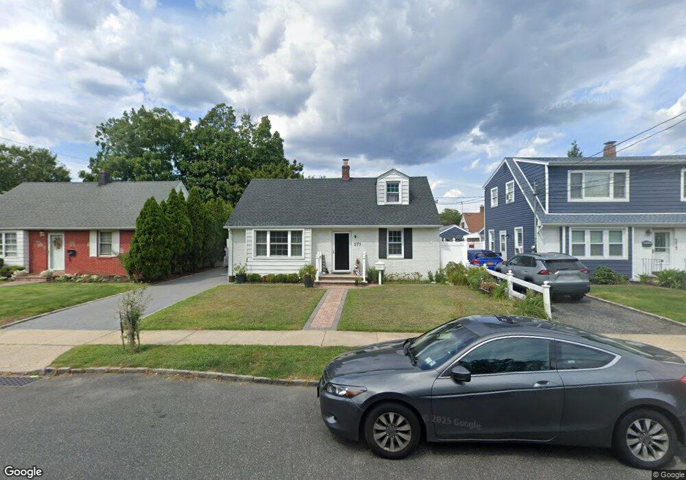
577 Whittier St Westbury, NY 11590
Estimated Value: $639,389 - $717,000
--
Bed
2
Baths
1,648
Sq Ft
$412/Sq Ft
Est. Value
About This Home
This home is located at 577 Whittier St, Westbury, NY 11590 and is currently estimated at $678,195, approximately $411 per square foot. 577 Whittier St is a home located in Nassau County with nearby schools including Westbury Middle School, Westbury High School, and St Brigid/Our Lady Of Hope Regional School.
Ownership History
Date
Name
Owned For
Owner Type
Purchase Details
Closed on
Jun 24, 2019
Sold by
Bonilla Williams and Bonilla Hector
Bought by
Bonilla Hector A
Current Estimated Value
Home Financials for this Owner
Home Financials are based on the most recent Mortgage that was taken out on this home.
Original Mortgage
$262,515
Outstanding Balance
$231,508
Interest Rate
4.25%
Mortgage Type
FHA
Estimated Equity
$446,687
Purchase Details
Closed on
Oct 10, 2000
Sold by
Castellanos Luis
Bought by
Bonilla Williams
Purchase Details
Closed on
Apr 21, 1998
Sold by
Kenny Patricia
Bought by
Castellanos Luis
Create a Home Valuation Report for This Property
The Home Valuation Report is an in-depth analysis detailing your home's value as well as a comparison with similar homes in the area
Home Values in the Area
Average Home Value in this Area
Purchase History
| Date | Buyer | Sale Price | Title Company |
|---|---|---|---|
| Bonilla Hector A | $95,000 | None Available | |
| Bonilla Williams | $185,000 | David Mejias | |
| Castellanos Luis | $153,000 | -- |
Source: Public Records
Mortgage History
| Date | Status | Borrower | Loan Amount |
|---|---|---|---|
| Open | Bonilla Hector A | $262,515 |
Source: Public Records
Tax History Compared to Growth
Tax History
| Year | Tax Paid | Tax Assessment Tax Assessment Total Assessment is a certain percentage of the fair market value that is determined by local assessors to be the total taxable value of land and additions on the property. | Land | Improvement |
|---|---|---|---|---|
| 2025 | $11,973 | $382 | $172 | $210 |
| 2024 | $3,281 | $382 | $172 | $210 |
| 2023 | $12,862 | $382 | $172 | $210 |
| 2022 | $12,862 | $382 | $172 | $210 |
| 2021 | $13,417 | $367 | $165 | $202 |
| 2020 | $14,295 | $701 | $507 | $194 |
| 2019 | $12,835 | $701 | $507 | $194 |
| 2018 | $12,835 | $701 | $0 | $0 |
| 2017 | $9,629 | $701 | $507 | $194 |
| 2016 | $12,434 | $701 | $507 | $194 |
| 2015 | $2,691 | $701 | $507 | $194 |
| 2014 | $2,691 | $701 | $507 | $194 |
| 2013 | $2,525 | $701 | $507 | $194 |
Source: Public Records
Map
Nearby Homes
- 20 Longfellow Ave
- 646 Whittier St
- 544 Dryden St
- 54 School St Unit 315
- 671 Whittier St
- 2001 Wellington Ct
- 906 Bromton Dr
- 2040 Wellington Ct
- 1982 Stratford Dr
- 806 Oliver Ave
- 1148 Howard Dr
- 130 Post Ave Unit 202
- 130 Post Ave Unit 303
- 130 Post Ave Unit 322
- 130 Post Ave Unit 316
- 9 Grayston St
- 537 Church St
- 330 Maple Ave Unit 25
- 254 Brook St
- 474 Newton St
- 573 Whittier St
- 581 Whittier St
- 569 Whittier St
- 576 Irving St
- 585 Whittier St
- 572 Irving St
- 582 Irving St
- 568 Irving St
- 565 Whittier St
- 578 Whittier St
- 572 Whittier St
- 588 Irving St
- 591 Whittier St
- 584 Whittier St
- 566 Whittier St
- 564 Irving St
- 590 Irving St
- 86 Longfellow Ave
- 590 Whittier St
- 92 Longfellow Ave