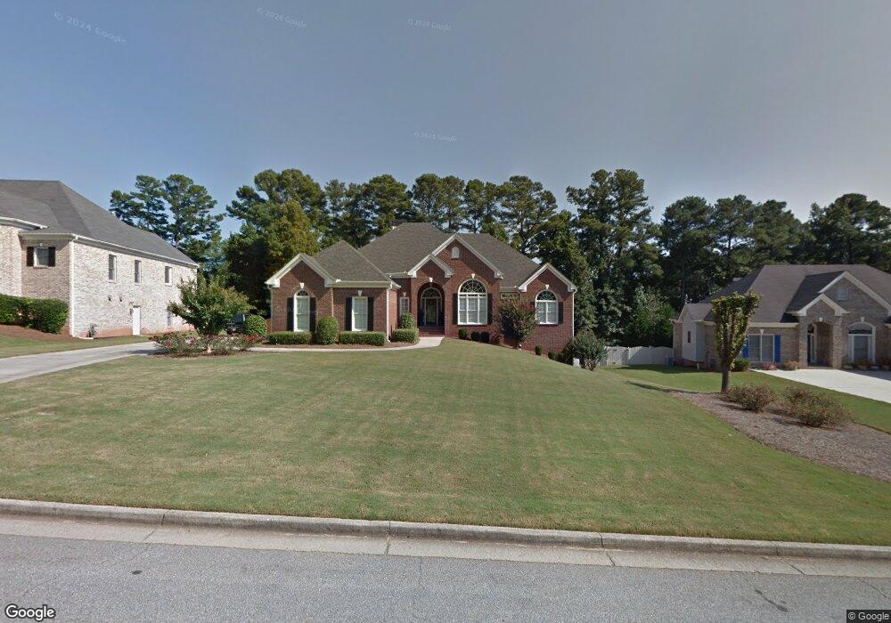
5770 Nash Commons Dr Stone Mountain, GA 30087
Estimated Value: $690,000 - $778,934
4
Beds
4
Baths
2,568
Sq Ft
$284/Sq Ft
Est. Value
About This Home
This home is located at 5770 Nash Commons Dr, Stone Mountain, GA 30087 and is currently estimated at $729,978, approximately $284 per square foot. 5770 Nash Commons Dr is a home located in Gwinnett County with nearby schools including Camp Creek Elementary School, Trickum Middle School, and Parkview High School.
Ownership History
Date
Name
Owned For
Owner Type
Purchase Details
Closed on
Oct 27, 2016
Sold by
Debbie S
Bought by
Kingston Jane W
Current Estimated Value
Home Financials for this Owner
Home Financials are based on the most recent Mortgage that was taken out on this home.
Original Mortgage
$195,000
Outstanding Balance
$156,551
Interest Rate
3.42%
Estimated Equity
$573,427
Purchase Details
Closed on
Oct 26, 2001
Sold by
Nash Properties
Bought by
Dailey Debbie S
Home Financials for this Owner
Home Financials are based on the most recent Mortgage that was taken out on this home.
Original Mortgage
$315,400
Interest Rate
6.6%
Create a Home Valuation Report for This Property
The Home Valuation Report is an in-depth analysis detailing your home's value as well as a comparison with similar homes in the area
Home Values in the Area
Average Home Value in this Area
Purchase History
| Date | Buyer | Sale Price | Title Company |
|---|---|---|---|
| Kingston Jane W | -- | -- | |
| Dailey Debbie S | $394,300 | -- |
Source: Public Records
Mortgage History
| Date | Status | Borrower | Loan Amount |
|---|---|---|---|
| Open | Kingston Jane W | $195,000 | |
| Previous Owner | Dailey Debbie S | $315,400 |
Source: Public Records
Tax History Compared to Growth
Tax History
| Year | Tax Paid | Tax Assessment Tax Assessment Total Assessment is a certain percentage of the fair market value that is determined by local assessors to be the total taxable value of land and additions on the property. | Land | Improvement |
|---|---|---|---|---|
| 2024 | $9,074 | $306,040 | $36,000 | $270,040 |
| 2023 | $9,074 | $228,080 | $31,600 | $196,480 |
| 2022 | $7,439 | $228,080 | $31,600 | $196,480 |
| 2021 | $6,285 | $167,800 | $31,600 | $136,200 |
| 2020 | $6,547 | $167,800 | $31,600 | $136,200 |
| 2019 | $6,306 | $167,800 | $31,600 | $136,200 |
| 2018 | $6,319 | $167,800 | $31,600 | $136,200 |
| 2016 | $5,470 | $149,040 | $23,200 | $125,840 |
| 2015 | $5,530 | $149,040 | $23,200 | $125,840 |
| 2014 | $5,560 | $149,040 | $23,200 | $125,840 |
Source: Public Records
Map
Nearby Homes
- 5632 Stillwater Ct
- 5774 Vantage Ct
- 737 Lioness Ct
- 923 Tall Pine Ct SW
- 2119 Gunstock Dr
- 5607 Mountainbrooke Ct
- 5798 Musket Ln
- 507 Castlearie Dr
- 507 Castleaire Dr Unit 1
- 771 Mountainbrooke Cir SW
- 483 Rollingwood Dr
- 1019 Crestwood Ln
- 851 Rockbridge Rd SW
- 5523 Bahia Mar Cir
- 717 Oxford Ct SW
- 5936 Millstone Ln
- 1959 Trotters Ln
- 5578 Four Winds Dr SW Unit 3
- 5760 Nash Commons Dr
- 5780 Nash Commons Dr Unit 4
- 5780 Nash Commons Dr
- 773 Denise Ct
- 772 Denise Ct
- 5795 Nash Commons Dr
- 5750 Nash Commons Dr
- 745 Old Tucker Rd
- 765 Old Tucker Rd Unit 2
- 5790 Nash Commons Dr
- 5785 Nash Commons Dr
- 783 Denise Ct
- 783 Denise Ct SW
- 5797 Lorraine Dr
- 5787 Lorraine Dr
- 775 Old Tucker Rd
- 793 Denise Ct
- 779 Old Tucker Rd
- 5790 Carlton Way
- 725 Old Tucker Rd