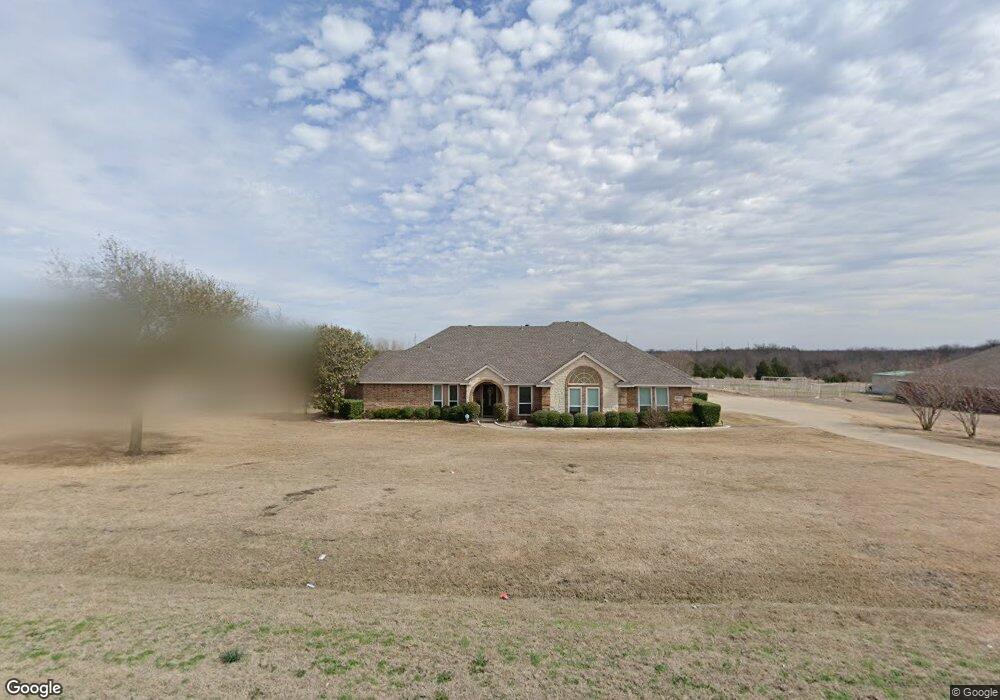
5773 S Fm 548 Royse City, TX 75189
Estimated Value: $472,263 - $566,000
3
Beds
2
Baths
2,237
Sq Ft
$229/Sq Ft
Est. Value
About This Home
This home is located at 5773 S Fm 548, Royse City, TX 75189 and is currently estimated at $511,816, approximately $228 per square foot. 5773 S Fm 548 is a home located in Rockwall County with nearby schools including Ruth Cherry Elementary School, Ouida Bailey Middle School, and Royse City High School.
Ownership History
Date
Name
Owned For
Owner Type
Purchase Details
Closed on
Mar 20, 2025
Sold by
Sewell Douglas J and Sewell Dora A
Bought by
Binder Robert and Binder Shannon
Current Estimated Value
Home Financials for this Owner
Home Financials are based on the most recent Mortgage that was taken out on this home.
Original Mortgage
$1,200,000
Outstanding Balance
$1,097,686
Interest Rate
6.89%
Mortgage Type
New Conventional
Estimated Equity
-$585,870
Purchase Details
Closed on
Jun 29, 2006
Sold by
Lgi Land Llc
Bought by
Weiss Jay C and Weiss Dayna V
Home Financials for this Owner
Home Financials are based on the most recent Mortgage that was taken out on this home.
Original Mortgage
$108,000
Interest Rate
6.63%
Mortgage Type
Purchase Money Mortgage
Create a Home Valuation Report for This Property
The Home Valuation Report is an in-depth analysis detailing your home's value as well as a comparison with similar homes in the area
Home Values in the Area
Average Home Value in this Area
Purchase History
| Date | Buyer | Sale Price | Title Company |
|---|---|---|---|
| Binder Robert | -- | None Listed On Document | |
| Weiss Jay C | -- | None Available |
Source: Public Records
Mortgage History
| Date | Status | Borrower | Loan Amount |
|---|---|---|---|
| Open | Binder Robert | $1,200,000 | |
| Previous Owner | Weiss Jay C | $108,000 |
Source: Public Records
Tax History Compared to Growth
Tax History
| Year | Tax Paid | Tax Assessment Tax Assessment Total Assessment is a certain percentage of the fair market value that is determined by local assessors to be the total taxable value of land and additions on the property. | Land | Improvement |
|---|---|---|---|---|
| 2025 | $4,532 | $421,587 | -- | -- |
| 2023 | $4,532 | $348,419 | $0 | $0 |
| 2022 | $5,497 | $316,745 | $0 | $0 |
| 2021 | $5,119 | $287,950 | $94,880 | $193,070 |
| 2020 | $5,336 | $281,820 | $92,170 | $189,650 |
| 2019 | $5,536 | $279,350 | $90,360 | $188,990 |
| 2018 | $5,086 | $281,390 | $90,360 | $191,030 |
| 2017 | $4,684 | $284,450 | $90,360 | $194,090 |
| 2016 | $4,258 | $208,120 | $30,120 | $178,000 |
| 2015 | $4,107 | $210,930 | $30,120 | $180,810 |
| 2014 | $4,107 | $210,930 | $30,120 | $180,810 |
Source: Public Records
Map
Nearby Homes
- 5760 S Fm 548
- 3109 Patrinia St
- 798B N Munson Rd
- 5512 Huffines Blvd
- 5314 Huffines Blvd
- 2550 Brookside Dr
- TBD N Munson Rd
- 2021 Bayfront Dr
- 1160 Waterscape Blvd
- 2526 Brookside Dr
- 3031 Concourse Dr
- 396 Alexander Ln
- 9045 Palafox St
- 2050 Clearmist Way
- 1222 Falls Rush Way
- 1018 Pompano Way
- 3038 Genevieve Ln
- 301 Reagan Ct
- 3250 Summerland Dr
- 5058 Huffines Blvd
- 5745 S Fm 548
- 5809 S Fm 548
- 5843 S Fm 548
- 5701 S Fm 548
- 5770 S Fm 548 Unit 548
- 5770 S Fm 548 Unit 548
- 5700 S Fm 548 Unit 548
- 6003 S Fm 548
- 124 N Munson Rd
- 000 N Munson Rd
- 00 N Munson Rd
- 164 N Munson Rd
- 212 N Munson Rd
- 244 N Munson Rd
- 252 N Munson Rd
- 209 N Munson Rd
- 310 N Munson Rd
- 161 N Munson Rd
- 368 N Munson Rd
- 265 N Munson Rd