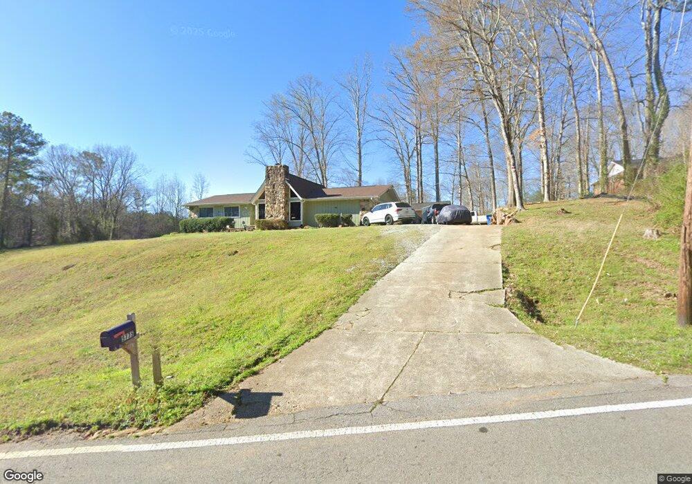
5775 Koweta Rd Atlanta, GA 30349
Estimated Value: $269,000 - $347,000
3
Beds
2
Baths
1,876
Sq Ft
$157/Sq Ft
Est. Value
About This Home
This home is located at 5775 Koweta Rd, Atlanta, GA 30349 and is currently estimated at $294,743, approximately $157 per square foot. 5775 Koweta Rd is a home located in Fulton County with nearby schools including Liberty Point Elementary School, Renaissance Middle School, and Langston Hughes High School.
Ownership History
Date
Name
Owned For
Owner Type
Purchase Details
Closed on
Sep 30, 2009
Sold by
Morequity Inc
Bought by
Brown Erma
Current Estimated Value
Purchase Details
Closed on
Jun 2, 2009
Sold by
Johnson Tolbert
Bought by
Morequity Inc
Purchase Details
Closed on
Aug 9, 2001
Sold by
Eason Theron L and Eason Mattie L
Bought by
Johnson Tolbert
Home Financials for this Owner
Home Financials are based on the most recent Mortgage that was taken out on this home.
Original Mortgage
$152,600
Interest Rate
7.19%
Mortgage Type
New Conventional
Create a Home Valuation Report for This Property
The Home Valuation Report is an in-depth analysis detailing your home's value as well as a comparison with similar homes in the area
Home Values in the Area
Average Home Value in this Area
Purchase History
| Date | Buyer | Sale Price | Title Company |
|---|---|---|---|
| Brown Erma | $47,000 | -- | |
| Morequity Inc | $100,000 | -- | |
| Johnson Tolbert | $155,000 | -- |
Source: Public Records
Mortgage History
| Date | Status | Borrower | Loan Amount |
|---|---|---|---|
| Previous Owner | Johnson Tolbert | $152,600 |
Source: Public Records
Tax History Compared to Growth
Tax History
| Year | Tax Paid | Tax Assessment Tax Assessment Total Assessment is a certain percentage of the fair market value that is determined by local assessors to be the total taxable value of land and additions on the property. | Land | Improvement |
|---|---|---|---|---|
| 2025 | $5,351 | $94,680 | $17,280 | $77,400 |
| 2023 | $2,792 | $98,920 | $15,840 | $83,080 |
| 2022 | $2,381 | $60,720 | $7,200 | $53,520 |
| 2021 | $2,360 | $58,960 | $7,000 | $51,960 |
| 2020 | $2,227 | $54,720 | $3,920 | $50,800 |
| 2019 | $2,123 | $53,760 | $3,840 | $49,920 |
| 2018 | $2,091 | $52,520 | $3,760 | $48,760 |
| 2017 | $1,389 | $34,080 | $8,480 | $25,600 |
| 2016 | $1,389 | $34,080 | $8,480 | $25,600 |
| 2015 | $1,393 | $34,080 | $8,480 | $25,600 |
| 2014 | $1,190 | $27,600 | $8,920 | $18,680 |
Source: Public Records
Map
Nearby Homes
- 5150 Derrick Rd
- 5760 Koweta Rd
- 5765 Koweta Rd
- 5175 Derrick Rd
- 5810 Raventree Ct
- 5140 Derrick Rd
- 5750 Koweta Rd
- 5820 Raventree Ct
- 5755 Koweta Rd
- 5795 Raventree Ct
- 5830 Raventree Ct
- 5194 Amberland Square
- 5840 Raventree Ct
- 5805 Raventree Ct
- 5190 Amberland Square
- 5202 Amberland Square
- 5186 Amberland Square
- 5815 Raventree Ct
- 5850 Raventree Ct
- 5198 Amberland Square