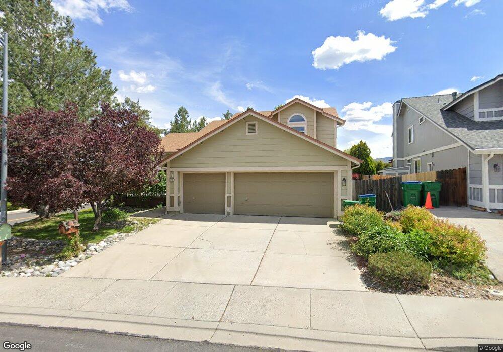
5778 Simons Dr Reno, NV 89523
Mae Anne Avenue NeighborhoodEstimated Value: $682,901 - $786,000
3
Beds
3
Baths
2,544
Sq Ft
$286/Sq Ft
Est. Value
About This Home
This home is located at 5778 Simons Dr, Reno, NV 89523 and is currently estimated at $727,725, approximately $286 per square foot. 5778 Simons Dr is a home located in Washoe County with nearby schools including Sarah Winnemucca Elementary School, B D Billinghurst Middle School, and Robert McQueen High School.
Ownership History
Date
Name
Owned For
Owner Type
Purchase Details
Closed on
Aug 5, 1994
Sold by
Hull Steven Laurence and Hull Marian S
Bought by
Nichols Thomas S and Nichols Jean E
Current Estimated Value
Home Financials for this Owner
Home Financials are based on the most recent Mortgage that was taken out on this home.
Original Mortgage
$158,400
Interest Rate
5.5%
Create a Home Valuation Report for This Property
The Home Valuation Report is an in-depth analysis detailing your home's value as well as a comparison with similar homes in the area
Home Values in the Area
Average Home Value in this Area
Purchase History
| Date | Buyer | Sale Price | Title Company |
|---|---|---|---|
| Nichols Thomas S | $198,000 | Western Title Company Inc |
Source: Public Records
Mortgage History
| Date | Status | Borrower | Loan Amount |
|---|---|---|---|
| Closed | Nichols Thomas S | $158,400 |
Source: Public Records
Tax History
| Year | Tax Paid | Tax Assessment Tax Assessment Total Assessment is a certain percentage of the fair market value that is determined by local assessors to be the total taxable value of land and additions on the property. | Land | Improvement |
|---|---|---|---|---|
| 2026 | $2,417 | $116,812 | $46,445 | $70,368 |
| 2024 | $3,044 | $114,804 | $41,300 | $73,504 |
| 2023 | $3,044 | $113,902 | $43,855 | $70,047 |
| 2022 | $2,956 | $94,864 | $36,120 | $58,744 |
| 2021 | $2,870 | $83,562 | $24,675 | $58,887 |
| 2020 | $2,738 | $82,040 | $25,795 | $56,245 |
| 2019 | $2,659 | $78,306 | $23,590 | $54,716 |
| 2018 | $2,584 | $71,073 | $17,220 | $53,853 |
| 2017 | $2,512 | $70,365 | $16,065 | $54,300 |
| 2016 | $2,444 | $71,375 | $15,680 | $55,695 |
| 2015 | $2,439 | $69,622 | $13,685 | $55,937 |
| 2014 | $2,368 | $65,381 | $11,060 | $54,321 |
| 2013 | -- | $62,683 | $9,065 | $53,618 |
Source: Public Records
Map
Nearby Homes
- 1586 Grazer Way
- 5865 Mitra Way
- 1596 Grazer Way
- 1598 Grazer Way
- 5833 Altitude St
- 0 Simons Dr
- 5857 Morgan Horse St
- 1091 Crown View Dr
- 5861 Morgan Horse St
- 5330 Windwood Ln
- 1473 Hogadon Way
- 6052 Bankside Way
- 5875 Walnut Creek Rd
- 5846 Walnut Creek Rd
- 1820 Terrace Heights Ln
- 5540 Daybreak Dr
- 1927 Tuolumne Dr Unit 70
- 5421 Daybreak Dr
- 5764 Golden Eagle Dr
- 5722 Golden Eagle Dr
- 5788 Simons Dr
- 1549 Lindsay Dr
- 5758 Simons Dr
- 1556 Lindsay Dr
- 1498 Backer Way
- 1550 Lindsay Dr
- 5781 Simons Dr
- 1488 Backer Way
- 1540 Lindsay Dr
- 5748 Simons Dr
- 1579 Shadow Park Dr
- 1539 Lindsay Dr
- 1478 Backer Way
- 1508 Backer Way
- 1468 Backer Way
- 1530 Lindsay Dr
- 1589 Shadow Park Dr
- 1518 Backer Way
- 1529 Lindsay Dr
- 5738 Simons Dr Unit 9B
Your Personal Tour Guide
Ask me questions while you tour the home.