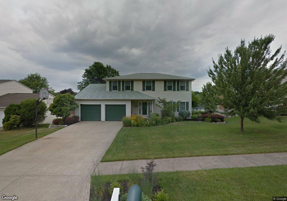
578 Dirlam Ln Mansfield, OH 44904
Estimated Value: $283,000 - $328,000
4
Beds
3
Baths
2,226
Sq Ft
$135/Sq Ft
Est. Value
About This Home
This home is located at 578 Dirlam Ln, Mansfield, OH 44904 and is currently estimated at $300,893, approximately $135 per square foot. 578 Dirlam Ln is a home located in Richland County with nearby schools including Lexington High School, Mansfield Christian School, and Discovery School.
Ownership History
Date
Name
Owned For
Owner Type
Purchase Details
Closed on
Apr 10, 2025
Sold by
Spenard Henry A and Spenard Terri L
Bought by
Spenard Preservation Trust and Stumbaugh
Current Estimated Value
Purchase Details
Closed on
Nov 21, 2000
Sold by
Mcbride James S
Bought by
Spenard Henry and Spenard Terri
Home Financials for this Owner
Home Financials are based on the most recent Mortgage that was taken out on this home.
Original Mortgage
$147,200
Interest Rate
7.87%
Mortgage Type
New Conventional
Purchase Details
Closed on
Feb 18, 2000
Sold by
Seidel Jan E
Bought by
Mcbride James S and Mcbride Linda L
Purchase Details
Closed on
Jul 1, 1989
Create a Home Valuation Report for This Property
The Home Valuation Report is an in-depth analysis detailing your home's value as well as a comparison with similar homes in the area
Home Values in the Area
Average Home Value in this Area
Purchase History
| Date | Buyer | Sale Price | Title Company |
|---|---|---|---|
| Spenard Preservation Trust | -- | None Listed On Document | |
| Spenard Henry | $155,000 | -- | |
| Mcbride James S | $121,690 | -- | |
| -- | $106,900 | -- |
Source: Public Records
Mortgage History
| Date | Status | Borrower | Loan Amount |
|---|---|---|---|
| Previous Owner | Spenard Henry | $147,200 |
Source: Public Records
Tax History
| Year | Tax Paid | Tax Assessment Tax Assessment Total Assessment is a certain percentage of the fair market value that is determined by local assessors to be the total taxable value of land and additions on the property. | Land | Improvement |
|---|---|---|---|---|
| 2024 | $3,341 | $80,320 | $13,650 | $66,670 |
| 2023 | $3,449 | $80,320 | $13,650 | $66,670 |
| 2022 | $3,284 | $57,810 | $10,310 | $47,500 |
| 2021 | $3,295 | $57,810 | $10,310 | $47,500 |
| 2020 | $3,298 | $57,810 | $10,310 | $47,500 |
| 2019 | $3,030 | $48,990 | $8,740 | $40,250 |
| 2018 | $2,579 | $48,990 | $8,740 | $40,250 |
| 2017 | $2,599 | $48,990 | $8,740 | $40,250 |
| 2016 | $2,647 | $49,830 | $8,470 | $41,360 |
| 2015 | $2,644 | $49,830 | $8,470 | $41,360 |
| 2014 | $2,645 | $49,830 | $8,470 | $41,360 |
| 2012 | $1,285 | $51,370 | $8,740 | $42,630 |
Source: Public Records
Map
Nearby Homes
- 594 Dirlam Ln
- 540 Sherwood Dr
- 450 Marwood Dr
- 615 Bailey Dr
- 1949 Richwood Dr
- 635 Karlson Dr
- 1938 Richwood Dr
- 601 Karlson Dr
- 1521 Cape Cod Dr
- 1510 Cape Cod Dr Unit 1504
- 1702 Middle Bellville Rd
- 763 York St W
- 1689 Middle Bellville Rd
- 0 Rippling Brook Dr
- 2160 Haywood Dr
- 680 Weller Ave
- 670 Fuhrer Ave
- 1490 Hess Cir
- 0 Lot #23132 Hess Cir
- 0 Lot #23127 Hess Cir
Your Personal Tour Guide
Ask me questions while you tour the home.