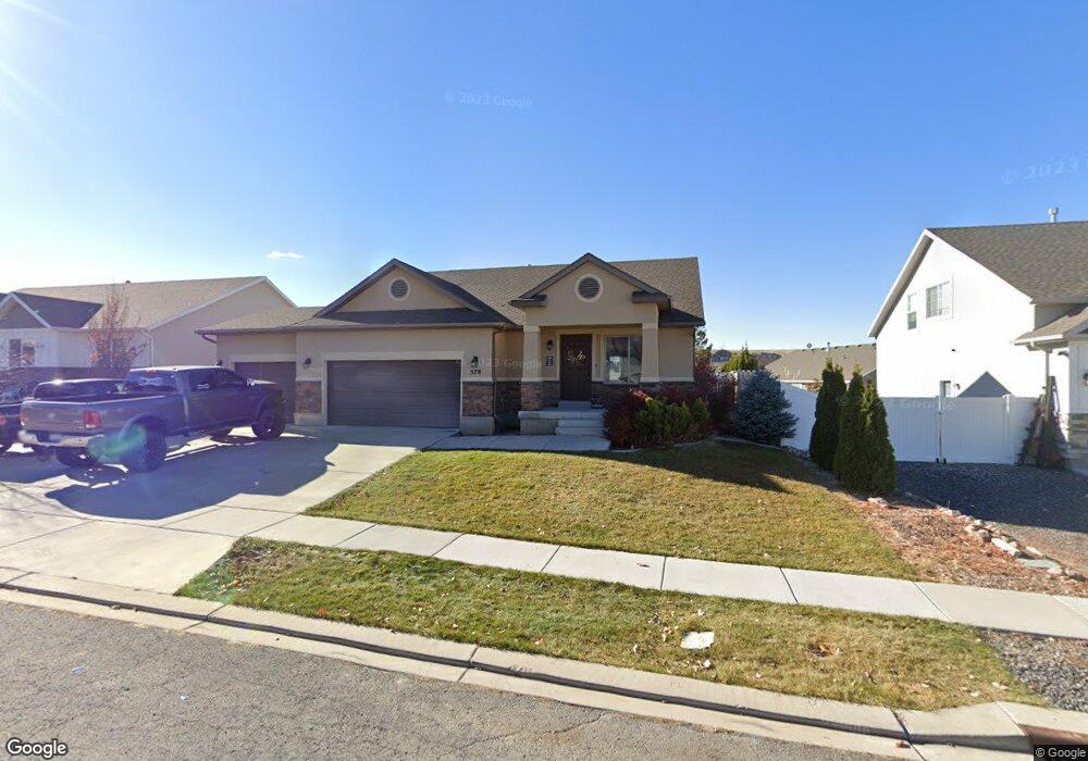
578 Little Rock Dr Santaquin, UT 84655
Estimated Value: $470,000 - $521,000
3
Beds
2
Baths
1,288
Sq Ft
$386/Sq Ft
Est. Value
About This Home
This home is located at 578 Little Rock Dr, Santaquin, UT 84655 and is currently estimated at $496,789, approximately $385 per square foot. 578 Little Rock Dr is a home located in Utah County with nearby schools including Santaquin Elementary School, Payson Junior High School, and Payson High School.
Ownership History
Date
Name
Owned For
Owner Type
Purchase Details
Closed on
Mar 1, 2018
Sold by
Salisbury Developers Inc
Bought by
Riding Siding Inc
Current Estimated Value
Purchase Details
Closed on
Feb 21, 2012
Sold by
Winnie Burke G
Bought by
Winnkle Burke
Home Financials for this Owner
Home Financials are based on the most recent Mortgage that was taken out on this home.
Original Mortgage
$194,840
Interest Rate
3.92%
Mortgage Type
New Conventional
Purchase Details
Closed on
Aug 27, 2009
Sold by
Ivory Homes Ltd
Bought by
Winnie Burke G
Home Financials for this Owner
Home Financials are based on the most recent Mortgage that was taken out on this home.
Original Mortgage
$198,390
Interest Rate
5.09%
Mortgage Type
New Conventional
Create a Home Valuation Report for This Property
The Home Valuation Report is an in-depth analysis detailing your home's value as well as a comparison with similar homes in the area
Home Values in the Area
Average Home Value in this Area
Purchase History
| Date | Buyer | Sale Price | Title Company |
|---|---|---|---|
| Riding Siding Inc | -- | Cottonwood Title | |
| Winnkle Burke | -- | None Available | |
| Winnie Burke G | -- | Cottonwodo Title Insurance |
Source: Public Records
Mortgage History
| Date | Status | Borrower | Loan Amount |
|---|---|---|---|
| Previous Owner | Winnkle Burke | $194,840 | |
| Previous Owner | Winnie Burke G | $198,390 | |
| Closed | Riding Siding Inc | $0 |
Source: Public Records
Tax History Compared to Growth
Tax History
| Year | Tax Paid | Tax Assessment Tax Assessment Total Assessment is a certain percentage of the fair market value that is determined by local assessors to be the total taxable value of land and additions on the property. | Land | Improvement |
|---|---|---|---|---|
| 2025 | $2,226 | $250,855 | $137,600 | $318,500 |
| 2024 | $2,226 | $221,650 | $0 | $0 |
| 2023 | $2,313 | $231,055 | $0 | $0 |
| 2022 | $2,300 | $236,995 | $0 | $0 |
| 2021 | $1,979 | $316,100 | $77,600 | $238,500 |
| 2020 | $1,899 | $294,000 | $64,700 | $229,300 |
| 2019 | $1,796 | $284,200 | $61,300 | $222,900 |
| 2018 | $1,663 | $251,000 | $54,500 | $196,500 |
| 2017 | $1,564 | $126,115 | $0 | $0 |
| 2016 | $1,439 | $113,685 | $0 | $0 |
| 2015 | $1,443 | $111,815 | $0 | $0 |
| 2014 | $1,293 | $99,990 | $0 | $0 |
Source: Public Records
Map
Nearby Homes
- 633 Little Rock Dr
- 583 Sunset Dr
- 402 Topaz Dr
- 926 S Tanner Rd
- 346 Red Rock Dr
- 1202 W Hidden Spring Dr
- 1022 Vista Ridge Dr Unit 149
- 1126 Valley View Dr
- 1245 Sageberry Dr
- 1186 S Vista Ridge Dr
- 1144 Crest Dale Ln
- 1287 Cedar Pass Dr Unit 113
- 1263 Crest Dale Ln
- 1858 W View Cove
- 1851 W View Cove
- 1276 W View Dr
- 1859 W View Cove
- 1375 Oakdale Dr
- 1302 W View Dr
- 1341 W View Dr
- 582 Little Rock Dr
- 582 Little Rock Dr Unit 102
- 572 Little Rock Dr Unit 104
- 572 Little Rock Dr
- 555 Little Rock Cir
- 573 Stone Way
- 566 Little Rock Dr Unit 105
- 585 Stone Way
- 577 Little Rock Dr Unit 53
- 577 Little Rock Dr Unit 49
- 581 Little Rock Dr
- 581 Little Rock Dr Unit 50
- 581 S Little Rock W Sh W Unit MORRIS
- 559 Little Rock Cir Unit 108
- 559 Little Rock Cir
- 569 Little Rock Dr Unit 48
- 569 S Little Rock W Sh W Unit MORRIS
- 565 Stone Way Unit 99
- 565 Stone Way
- 585 Little Rock Dr Unit 51