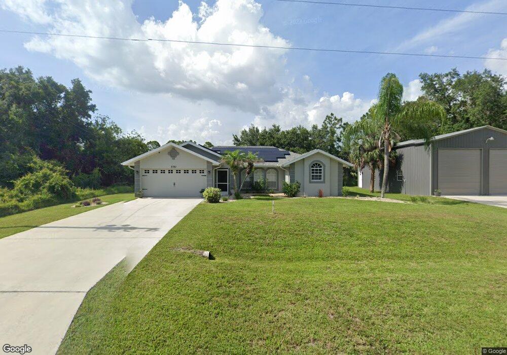
5780 E Hillsborough Blvd North Port, FL 34288
Estimated Value: $316,000 - $438,000
3
Beds
2
Baths
2,424
Sq Ft
$149/Sq Ft
Est. Value
About This Home
This home is located at 5780 E Hillsborough Blvd, North Port, FL 34288 and is currently estimated at $360,966, approximately $148 per square foot. 5780 E Hillsborough Blvd is a home located in Sarasota County with nearby schools including Atwater Elementary School, North Port High School, and Woodland Middle School.
Ownership History
Date
Name
Owned For
Owner Type
Purchase Details
Closed on
May 22, 2018
Sold by
Joseph Russell S and Joseph Elizabeth
Bought by
Joseph Russell S and Joseph Elizabeth
Current Estimated Value
Purchase Details
Closed on
Dec 22, 2015
Sold by
Megiel Patricia M
Bought by
Joseph Russell E
Home Financials for this Owner
Home Financials are based on the most recent Mortgage that was taken out on this home.
Original Mortgage
$152,000
Outstanding Balance
$120,605
Interest Rate
3.97%
Mortgage Type
New Conventional
Estimated Equity
$240,361
Purchase Details
Closed on
Jun 17, 1999
Sold by
Degross James
Bought by
Megiel Robert D and Megiel Patricia M
Purchase Details
Closed on
Jun 15, 1999
Sold by
Lepage Ethel
Bought by
Degross James
Create a Home Valuation Report for This Property
The Home Valuation Report is an in-depth analysis detailing your home's value as well as a comparison with similar homes in the area
Home Values in the Area
Average Home Value in this Area
Purchase History
| Date | Buyer | Sale Price | Title Company |
|---|---|---|---|
| Joseph Russell S | -- | None Available | |
| Joseph Russell E | $190,000 | North Port Title Llc | |
| Megiel Robert D | $6,200 | -- | |
| Degross James | $5,000 | -- |
Source: Public Records
Mortgage History
| Date | Status | Borrower | Loan Amount |
|---|---|---|---|
| Open | Joseph Russell E | $152,000 |
Source: Public Records
Tax History Compared to Growth
Tax History
| Year | Tax Paid | Tax Assessment Tax Assessment Total Assessment is a certain percentage of the fair market value that is determined by local assessors to be the total taxable value of land and additions on the property. | Land | Improvement |
|---|---|---|---|---|
| 2024 | $2,885 | $183,749 | -- | -- |
| 2023 | $2,885 | $178,397 | $0 | $0 |
| 2022 | $2,830 | $173,201 | $0 | $0 |
| 2021 | $2,764 | $168,156 | $0 | $0 |
| 2020 | $2,451 | $148,970 | $0 | $0 |
| 2019 | $2,385 | $145,621 | $0 | $0 |
| 2018 | $2,087 | $134,194 | $0 | $0 |
| 2017 | $2,012 | $129,769 | $0 | $0 |
| 2016 | $1,989 | $127,100 | $6,600 | $120,500 |
| 2015 | $1,535 | $104,600 | $7,000 | $97,600 |
| 2014 | $1,507 | $95,000 | $0 | $0 |
Source: Public Records
Map
Nearby Homes
- 21036 Dearman Ave
- 21060 Dearman Ave
- 21068 Dearman Ave
- 21084 Dearman Ave
- 10 Baldur Dr
- 79 Harvey St
- 0 E Hillsborough Blvd
- 0 E Hillsborough Blvd Unit MFRC7517768
- 74 Baldur Dr
- 195 Baldur Dr
- 48 Porter St
- LOT 13 Mattox Cir
- 120 Porter St
- 0 Dozier Terrace Unit MFRN6132350
- 0 Dozier Terrace Unit MFRC7498573
- 105 Ponoka St
- Lot 7 Mattox Cir
- Lot 11 Mattox Cir
- Lot 12 Mattox Cir
- Lot 14 Penny Cir
- Lot 9 E Hillsborough Blvd
- 21027 Hillsborough Blvd
- 5702 E Hillsborough Blvd
- 21059 Hillsborough Blvd
- 21028 Dearman Ave
- 21067 Hillsborough Blvd
- 21052 Dearman Ave
- 21020 Dearman Ave
- 5936 E Hillsborough Blvd
- 77 Gimli St
- 21076 Dearman Ave
- 21015 Dearman Ave
- 21092 Dearman Ave
- 55 Harvey St
- 70 Harvey St
- 21083 Hillsborough Blvd
- 20996 Dearman Ave
- 46 Harvey St
- 20988 Dearman Ave
- 56 & 64 Ponoka St