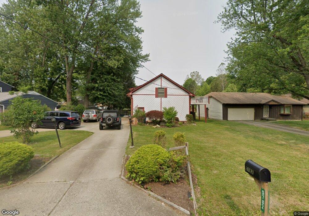
5782 Bradley Rd North Olmsted, OH 44070
Estimated Value: $333,000 - $358,000
4
Beds
3
Baths
2,007
Sq Ft
$171/Sq Ft
Est. Value
About This Home
This home is located at 5782 Bradley Rd, North Olmsted, OH 44070 and is currently estimated at $343,027, approximately $170 per square foot. 5782 Bradley Rd is a home located in Cuyahoga County with nearby schools including Chestnut Intermediate Elementary School, Pine Intermediate School, and North Olmsted Middle School.
Ownership History
Date
Name
Owned For
Owner Type
Purchase Details
Closed on
Apr 8, 1998
Sold by
Glasgow John E
Bought by
Hamdeh Fihmi A and Hamdeh Aberdella
Current Estimated Value
Home Financials for this Owner
Home Financials are based on the most recent Mortgage that was taken out on this home.
Original Mortgage
$130,500
Interest Rate
7.26%
Purchase Details
Closed on
Jul 8, 1987
Sold by
Wells Charles R
Bought by
Glasgow John E
Purchase Details
Closed on
Jan 1, 1984
Bought by
Wells Charles R
Create a Home Valuation Report for This Property
The Home Valuation Report is an in-depth analysis detailing your home's value as well as a comparison with similar homes in the area
Home Values in the Area
Average Home Value in this Area
Purchase History
| Date | Buyer | Sale Price | Title Company |
|---|---|---|---|
| Hamdeh Fihmi A | $163,000 | Chicago Title Insurance Comp | |
| Glasgow John E | $93,800 | -- | |
| Wells Charles R | -- | -- |
Source: Public Records
Mortgage History
| Date | Status | Borrower | Loan Amount |
|---|---|---|---|
| Previous Owner | Hamdeh Fihmi A | $130,500 |
Source: Public Records
Tax History Compared to Growth
Tax History
| Year | Tax Paid | Tax Assessment Tax Assessment Total Assessment is a certain percentage of the fair market value that is determined by local assessors to be the total taxable value of land and additions on the property. | Land | Improvement |
|---|---|---|---|---|
| 2024 | $6,479 | $104,335 | $5,215 | $99,120 |
| 2023 | $6,046 | $83,200 | $12,570 | $70,630 |
| 2022 | $6,048 | $83,200 | $12,570 | $70,630 |
| 2021 | $5,474 | $83,200 | $12,570 | $70,630 |
| 2020 | $4,890 | $67,660 | $10,220 | $57,440 |
| 2019 | $4,759 | $193,300 | $29,200 | $164,100 |
| 2018 | $4,826 | $67,660 | $10,220 | $57,440 |
| 2017 | $4,757 | $62,200 | $9,800 | $52,400 |
| 2016 | $4,715 | $62,200 | $9,800 | $52,400 |
| 2015 | $4,581 | $62,200 | $9,800 | $52,400 |
| 2014 | $4,581 | $60,380 | $9,520 | $50,860 |
Source: Public Records
Map
Nearby Homes
- 5608 Barton Rd
- 5560 Barton Rd Unit 511
- 30630 Lorain Rd
- 5950 Bayberry Cir
- 5366 Barton Rd
- 31134 Lorain Rd
- 5652 Rock Point Cir
- 6580 Barton Rd
- 5721 Hickory Trail
- 32583 Center Ridge Rd
- 6281 Christman Dr
- 29408 Stewart Dr
- 6617 Sutton Dr
- 5828 Tree Moss Ln
- 5461 Wellesley Ave
- 32567 Oakhurst Dr
- v/l Broxbourne Rd
- 29590 Broxbourne Rd
- 0 Stearns Rd
- 30651 Jasmine Ct Unit 58B
- 5794 Bradley Rd
- 5770 Bradley Rd
- 5760 Bradley Rd
- 5799 Barton Rd
- 5777 Barton Rd
- 5819 Barton Rd
- 5787 Bradley Rd
- 5757 Barton Rd
- 5775 Bradley Rd
- 5750 Bradley Rd
- 5763 Bradley Rd
- V/L Bradley Rd
- 5851 Barton Rd
- 5747 Barton Rd
- 5751 Bradley Rd
- 5740 Bradley Rd
- 5873 Barton Rd
- 30374 Bradley Rd
- 5806 Barton Rd
- 5820 Barton Rd